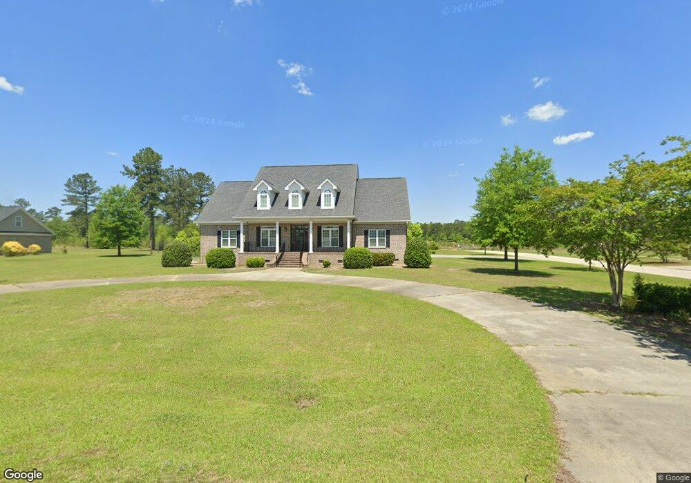
1016 Pheasant Rd Alcolu, SC 29001
Estimated Value: $553,000 - $648,000
--
Bed
--
Bath
4,510
Sq Ft
$137/Sq Ft
Est. Value
About This Home
This home is located at 1016 Pheasant Rd, Alcolu, SC 29001 and is currently estimated at $618,484, approximately $137 per square foot. 1016 Pheasant Rd is a home with nearby schools including Manning Early Childhood Center, Manning Primary School, and Manning Elementary School.
Ownership History
Date
Name
Owned For
Owner Type
Purchase Details
Closed on
Sep 22, 2021
Sold by
Dubose Steven L and Dubose Hallie M
Bought by
Abel William A
Current Estimated Value
Purchase Details
Closed on
Jun 23, 2011
Sold by
Trinity Heights Llc
Bought by
Dubose Steven L and Dubose Hallie M
Create a Home Valuation Report for This Property
The Home Valuation Report is an in-depth analysis detailing your home's value as well as a comparison with similar homes in the area
Home Values in the Area
Average Home Value in this Area
Purchase History
| Date | Buyer | Sale Price | Title Company |
|---|---|---|---|
| Abel William A | $539,900 | Cooperative Title Llc | |
| Dubose Steven L | $25,000 | None Available |
Source: Public Records
Tax History Compared to Growth
Tax History
| Year | Tax Paid | Tax Assessment Tax Assessment Total Assessment is a certain percentage of the fair market value that is determined by local assessors to be the total taxable value of land and additions on the property. | Land | Improvement |
|---|---|---|---|---|
| 2024 | $12,732 | $32,394 | $1,410 | $30,984 |
| 2023 | $12,395 | $21,596 | $940 | $20,656 |
| 2022 | $12,272 | $21,596 | $940 | $20,656 |
| 2021 | $2,650 | $13,892 | $920 | $12,972 |
| 2020 | $2,650 | $13,892 | $0 | $0 |
| 2019 | $2,454 | $13,892 | $0 | $0 |
| 2018 | $2,306 | $13,892 | $0 | $0 |
| 2017 | $2,307 | $13,892 | $0 | $0 |
| 2016 | $2,087 | $12,980 | $0 | $0 |
| 2015 | $2,175 | $13,344 | $1,120 | $12,224 |
| 2014 | $2,141 | $13,344 | $1,120 | $12,224 |
| 2013 | -- | $13,344 | $1,120 | $12,224 |
Source: Public Records
Map
Nearby Homes
- 1111 Foxbrook Ln
- 416 Thames St
- 406 Thames St
- TBD Old Georgetown Rd @ I95
- 101 Sumter St
- 107 Sumter St
- 40 W Rigby St
- 5301 Cypress Pointe #D301
- 202 E Huggins St
- 200 W Boyce St
- 409 W Boyce St
- 1000 Carolina Way
- 138 Nelson Cir
- 250 Dyson St
- 404 S Church St
- 204 Drayton St
- 387 Drayton St
- W Huggins St
- 2695 Paxville Hwy
- 408 Toccoa Dr
- 1193 Blue Jay Ave
- 1030 Pheasant Ct
- 1192 Blue Jay Ave
- 1019 Humming Bird Trail
- 1044 Pheasant Rd
- 1148 Blue Jay Ave
- 1037 Humming Bird Trail
- 1045 Pheasant Rd
- 1048 Humming Bird Trail
- 1127 Blue Jay Ave
- 1053 Pheasant Rd
- 1068 Pheasant Rd
- 1066 Humming Bird Trail
- 12 Blue Jay Ave
- 1057 Hummingbird Trail
- 1057 Humming Bird Trail
- 1035 Connor Rd
- 1035 Canary Ct
- 1080 Blue Jay Ave
- 1081 Blue Jay Ave