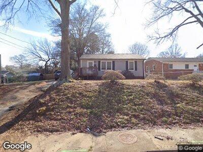
1016 Sturgis St Rock Hill, SC 29730
Estimated Value: $109,853 - $172,000
--
Bed
--
Bath
768
Sq Ft
$184/Sq Ft
Est. Value
About This Home
This home is located at 1016 Sturgis St, Rock Hill, SC 29730 and is currently estimated at $141,463, approximately $184 per square foot. 1016 Sturgis St is a home located in York County with nearby schools including Castle Heights Middle School, Northwestern High School, and St. Anne Catholic School.
Ownership History
Date
Name
Owned For
Owner Type
Purchase Details
Closed on
Dec 8, 2010
Sold by
Gunter Michael Nelson and Gunter Misty Diane
Bought by
Gunter Patricia D
Current Estimated Value
Purchase Details
Closed on
Nov 9, 2010
Sold by
Estate Of Meyer Nelson Gunter
Bought by
Gunter Patricia D and Gunter Michael Nelson
Purchase Details
Closed on
Aug 28, 2009
Sold by
Williams David A and Blackwell Edward Lee
Bought by
Gunter Patricia Diane and Gunter Meyer Nelson
Purchase Details
Closed on
Sep 25, 2000
Sold by
Williams David A
Bought by
Blackwell Edward
Purchase Details
Closed on
Mar 17, 2000
Sold by
Davis Kathye W
Bought by
Williams David A
Create a Home Valuation Report for This Property
The Home Valuation Report is an in-depth analysis detailing your home's value as well as a comparison with similar homes in the area
Home Values in the Area
Average Home Value in this Area
Purchase History
| Date | Buyer | Sale Price | Title Company |
|---|---|---|---|
| Gunter Patricia D | -- | -- | |
| Gunter Patricia D | -- | -- | |
| Gunter Patricia Diane | $32,600 | -- | |
| Williams David A | -- | -- | |
| Blackwell Edward | $6,822 | -- | |
| Williams David A | $29,382 | -- |
Source: Public Records
Tax History Compared to Growth
Tax History
| Year | Tax Paid | Tax Assessment Tax Assessment Total Assessment is a certain percentage of the fair market value that is determined by local assessors to be the total taxable value of land and additions on the property. | Land | Improvement |
|---|---|---|---|---|
| 2024 | $436 | $1,987 | $600 | $1,387 |
| 2023 | $437 | $1,987 | $600 | $1,387 |
| 2022 | $440 | $1,987 | $600 | $1,387 |
| 2021 | -- | $1,987 | $600 | $1,387 |
| 2020 | $441 | $1,987 | $0 | $0 |
| 2019 | $417 | $1,820 | $0 | $0 |
| 2018 | $416 | $1,820 | $0 | $0 |
| 2017 | $401 | $1,820 | $0 | $0 |
| 2016 | $397 | $1,820 | $0 | $0 |
| 2014 | $379 | $1,820 | $600 | $1,220 |
| 2013 | $379 | $1,820 | $520 | $1,300 |
Source: Public Records
Map
Nearby Homes
- 438 Stoneycreek Ln
- 441 Willowspring Ln
- 970 Willowbrook Ave
- 430 Stoneycreek Ln
- 441 Kimbrook Ct
- 229 N Jones Ave
- 843 Spring St
- 906 Eastwood Dr
- 620 3rd St
- 862 Eastwood Dr
- 621 Cauthen St
- 317 Annafrel St
- 647 E Black St
- 234 Marshall St
- 924 Flint Street Extension
- 642 E Black St
- 603 E Main St
- 306 S Jones Ave
- 1005 Clarkson St
- 621 Flint St
- 1016 Sturgis St
- 1012 Sturgis St Unit 30
- 1006 Sturgis St
- 339 Cummings St
- 343 Cummings St
- 340 High St
- 335 Cummings St
- 1015 Sturgis St
- 331 Cummings St
- 334 High St
- 1007 Sturgis St
- 325 Cummings St
- 328 High St
- 411 Cummings St
- 1003 Sturgis St
- 335 High St
- 339 High St
- 459 Willowspring Ln
- 329 High St
- 319 Cummings St