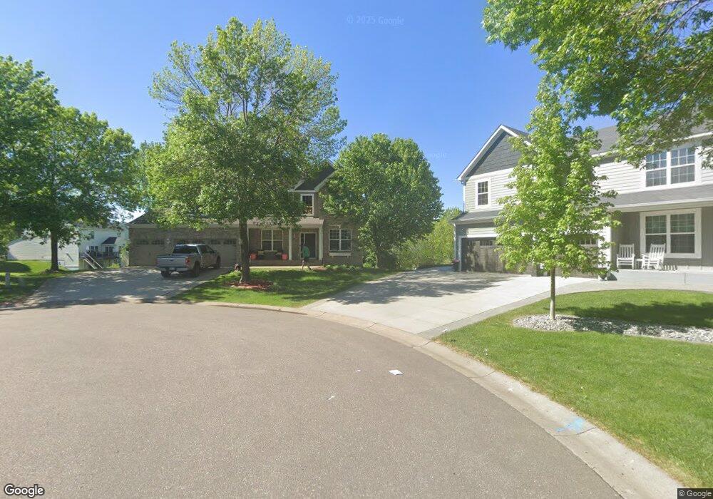
10165 44th Ct NE Saint Michael, MN 55376
Estimated Value: $560,000 - $625,000
5
Beds
4
Baths
3,925
Sq Ft
$149/Sq Ft
Est. Value
About This Home
This home is located at 10165 44th Ct NE, Saint Michael, MN 55376 and is currently estimated at $586,073, approximately $149 per square foot. 10165 44th Ct NE is a home located in Wright County with nearby schools including St. Michael Elementary School, Albertville Primary School, and Middle School East.
Ownership History
Date
Name
Owned For
Owner Type
Purchase Details
Closed on
Mar 23, 2020
Sold by
Monsrud Michael P and Monsrud Margaret
Bought by
Saari Matthew
Current Estimated Value
Home Financials for this Owner
Home Financials are based on the most recent Mortgage that was taken out on this home.
Original Mortgage
$344,000
Outstanding Balance
$304,080
Interest Rate
3.4%
Mortgage Type
New Conventional
Estimated Equity
$281,993
Purchase Details
Closed on
Jun 18, 2003
Sold by
The Ryland Group Inc
Bought by
Monsrud Michael P and Monsrud Margaret M
Create a Home Valuation Report for This Property
The Home Valuation Report is an in-depth analysis detailing your home's value as well as a comparison with similar homes in the area
Home Values in the Area
Average Home Value in this Area
Purchase History
| Date | Buyer | Sale Price | Title Company |
|---|---|---|---|
| Saari Matthew | $430,000 | Minnesota Title | |
| Monsrud Michael P | $345,327 | -- |
Source: Public Records
Mortgage History
| Date | Status | Borrower | Loan Amount |
|---|---|---|---|
| Open | Saari Matthew | $344,000 |
Source: Public Records
Tax History Compared to Growth
Tax History
| Year | Tax Paid | Tax Assessment Tax Assessment Total Assessment is a certain percentage of the fair market value that is determined by local assessors to be the total taxable value of land and additions on the property. | Land | Improvement |
|---|---|---|---|---|
| 2025 | $6,114 | $548,900 | $84,000 | $464,900 |
| 2024 | $5,982 | $526,900 | $80,000 | $446,900 |
| 2023 | $5,792 | $553,000 | $83,200 | $469,800 |
| 2022 | $5,692 | $504,900 | $77,000 | $427,900 |
| 2021 | $5,840 | $421,300 | $55,000 | $366,300 |
| 2020 | $5,812 | $417,800 | $55,000 | $362,800 |
| 2019 | $5,786 | $405,900 | $0 | $0 |
| 2018 | $5,282 | $396,900 | $0 | $0 |
| 2017 | $4,968 | $372,100 | $0 | $0 |
| 2016 | $4,714 | $0 | $0 | $0 |
| 2015 | $4,646 | $0 | $0 | $0 |
| 2014 | -- | $0 | $0 | $0 |
Source: Public Records
Map
Nearby Homes
- 10140 42nd St NE
- 4220 Kady Ave NE
- 305 Maple Knoll Way NW
- 10209 41st Place NE
- 10101 41st Place NE
- 4156 Jansen Ave NE
- 9935 41st St NE
- 409 5th St NW
- 520 Heights Rd NW
- 9720 42nd St NE
- 4946 Jansen Ave NE
- The Harmony Plan at Anton Village
- Whitney Plan at Anton Village
- Wesley Plan at Anton Village
- St. Croix Plan at Anton Village
- Birchwood Plan at Anton Village
- Regent Plan at Anton Village
- Somerset Plan at Anton Village
- Woodbridge Plan at Anton Village
- The Jordan Plan at Anton Village
- 10145 44th Ct NE
- 10182 44th Ct NE
- 10170 44th Ct NE
- 10125 44th Ct NE
- 4365 Kaelin Cir NE
- 10126 43rd Ct NE
- 4370 Kaelin Cir NE
- 4400 Kady Ave NE
- 10114 43rd Ct NE
- 10168 44th Ct NE
- 4380 Kady Ave NE
- 4420 Kady Ave NE
- 4355 Kaelin Cir NE
- 10100 43rd Ct NE
- 10146 44th Ct NE
- 4360 Kaelin Cir NE
- 10105 44th Ct NE
- 4350 Kaelin Cir NE
- 10142 43rd Ct NE
- 4345 Kaelin Cir NE