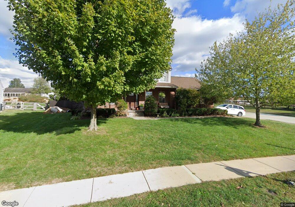
10165 Falcon Ridge Dr Independence, KY 41051
Estimated Value: $342,451 - $358,000
3
Beds
3
Baths
1,924
Sq Ft
$180/Sq Ft
Est. Value
About This Home
This home is located at 10165 Falcon Ridge Dr, Independence, KY 41051 and is currently estimated at $347,113, approximately $180 per square foot. 10165 Falcon Ridge Dr is a home located in Kenton County with nearby schools including Kenton Elementary School, Simon Kenton High School, and St. Cecilia Catholic School.
Ownership History
Date
Name
Owned For
Owner Type
Purchase Details
Closed on
Jun 27, 2019
Sold by
Brewster Jared and Brewster Jennifer
Bought by
Roseberry Grant William Omar and Roseberry Bethany
Current Estimated Value
Home Financials for this Owner
Home Financials are based on the most recent Mortgage that was taken out on this home.
Original Mortgage
$229,900
Outstanding Balance
$202,152
Interest Rate
4%
Mortgage Type
VA
Estimated Equity
$144,961
Purchase Details
Closed on
May 5, 2017
Bought by
Brewster Jared
Home Financials for this Owner
Home Financials are based on the most recent Mortgage that was taken out on this home.
Original Mortgage
$176,605
Interest Rate
4.02%
Purchase Details
Closed on
Nov 16, 2012
Sold by
Hunt Eric and Hunt Paula
Bought by
Hunt Eric and Hunt Paula
Purchase Details
Closed on
Apr 3, 2007
Sold by
Coppage Robert and Coppage Maria
Bought by
Coppage Robert and Coppage Maria
Purchase Details
Closed on
Jan 24, 2007
Sold by
Wells Fargo Bank Minnesota Na
Bought by
Coppage Robert
Purchase Details
Closed on
Nov 27, 2006
Sold by
Bohn Patricia M and Bohn Todd
Bought by
Wells Fargo Bank Minnesota Na
Purchase Details
Closed on
Oct 1, 2002
Sold by
Conrad Stephen B
Bought by
Bohn Patricia M
Home Financials for this Owner
Home Financials are based on the most recent Mortgage that was taken out on this home.
Original Mortgage
$120,000
Interest Rate
7.37%
Mortgage Type
New Conventional
Purchase Details
Closed on
Jul 1, 1999
Sold by
Shelton Wallace D
Bought by
Conrad Stephen B and Conrad Nancy L
Home Financials for this Owner
Home Financials are based on the most recent Mortgage that was taken out on this home.
Original Mortgage
$117,520
Interest Rate
7.27%
Mortgage Type
New Conventional
Purchase Details
Closed on
May 8, 1996
Sold by
H & L Builder Inc
Bought by
Shelton Wallace D and Shelton Tracie
Purchase Details
Closed on
Apr 29, 1996
Sold by
Falcon Ridge Dev
Bought by
H & L Builder Inc
Create a Home Valuation Report for This Property
The Home Valuation Report is an in-depth analysis detailing your home's value as well as a comparison with similar homes in the area
Home Values in the Area
Average Home Value in this Area
Purchase History
| Date | Buyer | Sale Price | Title Company |
|---|---|---|---|
| Roseberry Grant William Omar | $229,900 | Kentucky Land Title Agency | |
| Brewster Jared | -- | -- | |
| Hunt Eric | -- | None Available | |
| Hunt Eric | $104,000 | None Available | |
| Coppage Robert | -- | None Available | |
| Coppage Robert | $140,000 | Multiple | |
| Wells Fargo Bank Minnesota Na | $141,000 | None Available | |
| Bohn Patricia M | $150,000 | -- | |
| Conrad Stephen B | $146,900 | -- | |
| Shelton Wallace D | $24,000 | -- | |
| H & L Builder Inc | $22,000 | -- |
Source: Public Records
Mortgage History
| Date | Status | Borrower | Loan Amount |
|---|---|---|---|
| Open | Roseberry Grant William Omar | $229,900 | |
| Previous Owner | Brewster Jared | $176,605 | |
| Previous Owner | Brewster Jared | -- | |
| Previous Owner | Bohn Patricia M | $120,000 | |
| Previous Owner | Conrad Stephen B | $117,520 |
Source: Public Records
Tax History Compared to Growth
Tax History
| Year | Tax Paid | Tax Assessment Tax Assessment Total Assessment is a certain percentage of the fair market value that is determined by local assessors to be the total taxable value of land and additions on the property. | Land | Improvement |
|---|---|---|---|---|
| 2024 | $2,248 | $229,900 | $30,000 | $199,900 |
| 2023 | $2,316 | $229,900 | $30,000 | $199,900 |
| 2022 | $2,451 | $229,900 | $30,000 | $199,900 |
| 2021 | $2,487 | $229,900 | $30,000 | $199,900 |
| 2020 | $3,066 | $229,900 | $30,000 | $199,900 |
| 2019 | $2,500 | $185,900 | $30,000 | $155,900 |
| 2018 | $2,514 | $185,900 | $30,000 | $155,900 |
| 2017 | $1,796 | $135,000 | $30,000 | $105,000 |
| 2015 | $1,355 | $104,000 | $30,000 | $74,000 |
| 2014 | $1,336 | $104,000 | $30,000 | $74,000 |
Source: Public Records
Map
Nearby Homes
- 570 Old Bristow Rd
- 10311 Emancipation Place
- 1095 Audas Ct
- 1119 Brigade Rd
- 10452 Calvary Rd
- 10690 Melbury Ct Unit 305GL
- 10694 Melbury Ct Unit 306GL
- The Westchester Plan at The Greens of Glenhurst
- The Ella Marie Plan at The Greens of Glenhurst
- The Jefferson Plan at The Greens of Glenhurst
- The Leighann Plan at The Greens of Glenhurst
- The Waterson Plan at The Greens of Glenhurst
- The Lancaster Plan at The Greens of Glenhurst
- The Austin Plan at The Greens of Glenhurst
- The Morgan Plan at The Greens of Glenhurst
- The Marietta Plan at The Greens of Glenhurst
- The Camden Plan at The Greens of Glenhurst
- The Lincoln Plan at The Greens of Glenhurst
- The Bristol Plan at The Greens of Glenhurst
- The Livingston Plan at The Greens of Glenhurst
- 10161 Falcon Ridge Dr
- 5 Falcon Ridge Dr
- 3 Falcon Ridge Dr
- 10169 Falcon Ridge Dr
- 10166 Hiddenknoll Dr
- 10162 Hiddenknoll Dr
- 10157 Falcon Ridge Dr
- 10162 Falcon Ridge Dr
- 10170 Hiddenknoll Dr
- 10166 Falcon Ridge Dr
- 10158 Hiddenknoll Dr
- 10173 Falcon Ridge Dr
- 10156 Falcon Ridge Dr
- 10170 Falcon Ridge Dr
- 10153 Falcon Ridge Dr
- 83 Hiddenknoll Dr
- 10154 Hiddenknoll Dr
- 10148 Hiddenknoll Dr
- 10174 Hiddenknoll Dr
- 10142 Hiddenknoll Dr