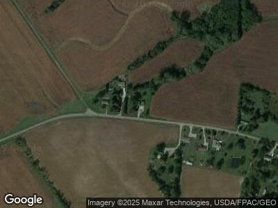
10166 Mccarty Rd Woodstock, OH 43084
Estimated Value: $203,000 - $266,000
3
Beds
2
Baths
1,484
Sq Ft
$164/Sq Ft
Est. Value
About This Home
This home is located at 10166 Mccarty Rd, Woodstock, OH 43084 and is currently estimated at $243,269, approximately $163 per square foot. 10166 Mccarty Rd is a home located in Champaign County with nearby schools including Triad Elementary School, Triad Middle School, and Triad High School.
Ownership History
Date
Name
Owned For
Owner Type
Purchase Details
Closed on
Apr 26, 2007
Sold by
Cowgill Ralph and Estate Of Margaret L Cowgill
Bought by
Fry Dana L and Fry Perry L
Current Estimated Value
Home Financials for this Owner
Home Financials are based on the most recent Mortgage that was taken out on this home.
Original Mortgage
$79,500
Interest Rate
6.2%
Mortgage Type
Purchase Money Mortgage
Create a Home Valuation Report for This Property
The Home Valuation Report is an in-depth analysis detailing your home's value as well as a comparison with similar homes in the area
Home Values in the Area
Average Home Value in this Area
Purchase History
| Date | Buyer | Sale Price | Title Company |
|---|---|---|---|
| Fry Dana L | $79,500 | The Talon Group |
Source: Public Records
Mortgage History
| Date | Status | Borrower | Loan Amount |
|---|---|---|---|
| Open | Fry Dana L | $75,450 | |
| Closed | Fry Dana L | $79,500 |
Source: Public Records
Tax History Compared to Growth
Tax History
| Year | Tax Paid | Tax Assessment Tax Assessment Total Assessment is a certain percentage of the fair market value that is determined by local assessors to be the total taxable value of land and additions on the property. | Land | Improvement |
|---|---|---|---|---|
| 2024 | $2,074 | $54,730 | $7,440 | $47,290 |
| 2023 | $2,074 | $54,730 | $7,440 | $47,290 |
| 2022 | $2,072 | $54,730 | $7,440 | $47,290 |
| 2021 | $1,781 | $43,780 | $5,950 | $37,830 |
| 2020 | $1,782 | $43,780 | $5,950 | $37,830 |
| 2019 | $1,753 | $43,780 | $5,950 | $37,830 |
| 2018 | $1,570 | $40,030 | $5,600 | $34,430 |
| 2017 | $1,535 | $40,030 | $5,600 | $34,430 |
| 2016 | $1,526 | $40,030 | $5,600 | $34,430 |
| 2015 | $1,396 | $36,900 | $5,600 | $31,300 |
| 2014 | $1,377 | $36,900 | $5,600 | $31,300 |
| 2013 | $1,366 | $36,900 | $5,600 | $31,300 |
Source: Public Records
Map
Nearby Homes
- 0 Mccarty Rd Unit 225013774
- 215 N Main St
- 2349 Park Rd
- 254 E Bennett St
- 258 E Bennett St
- 0 Berton Rd Unit 5081133
- 0 Urbana Woodstock Unit Lot 11 899909
- 0 Urbana Woodstock Unit 223037403
- 0 Urbana Woodstock Unit 1028849
- 701 Mill St Unit Lot 49
- 701 Mill St Unit Lot 12
- 701 Mill St Unit 90
- 701 Mill St Unit Lot 129
- 701 Mill St Unit Lot 78
- 701 Mill St Unit Lot 48
- 701 Mill St Unit Lot 88
- 701 Mill St Unit Lot 170
- 701 Mill St Unit Lot 106
- 701 Mill St Unit 5
- 20 Lloyd Dr
- 10166 Mccarty Rd
- 10134 Mccarty Rd
- 10118 Mccarty Rd
- 10209 Mccarty Rd
- 10259 Mccarty Rd
- 10281 Mccarty Rd
- 10305 Mccarty Rd
- 10415 Mccarty Rd
- 10578 Mccarty Rd
- 10621 Mccarty Rd
- 10681 Mccarty Rd
- 9685 Mccarty Rd
- 10704 Mccarty Rd
- 10701 Mccarty Rd
- 3116 Burton Rd
- 10800 Mccarty Rd
- 10276 Urbana Woodstock Pike
- 10390 Urbana Woodstock Pike
- 3229 Burton Rd
- 10462 Urbana Woodstock Pike