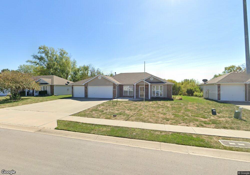
1017 Bristol Dr Raymore, MO 64083
Estimated Value: $293,000 - $309,000
3
Beds
2
Baths
1,330
Sq Ft
$225/Sq Ft
Est. Value
About This Home
This home is located at 1017 Bristol Dr, Raymore, MO 64083 and is currently estimated at $299,800, approximately $225 per square foot. 1017 Bristol Dr is a home located in Cass County with nearby schools including Stonegate Elementary School, Raymore-Peculiar South Middle School, and Raymore-Peculiar Senior High School.
Ownership History
Date
Name
Owned For
Owner Type
Purchase Details
Closed on
Nov 25, 2024
Sold by
Mohler Laura C and Mohler John M
Bought by
Brady Connor James
Current Estimated Value
Home Financials for this Owner
Home Financials are based on the most recent Mortgage that was taken out on this home.
Original Mortgage
$208,800
Outstanding Balance
$206,683
Interest Rate
6.54%
Mortgage Type
New Conventional
Estimated Equity
$93,117
Create a Home Valuation Report for This Property
The Home Valuation Report is an in-depth analysis detailing your home's value as well as a comparison with similar homes in the area
Home Values in the Area
Average Home Value in this Area
Purchase History
| Date | Buyer | Sale Price | Title Company |
|---|---|---|---|
| Brady Connor James | -- | Stewart Title |
Source: Public Records
Mortgage History
| Date | Status | Borrower | Loan Amount |
|---|---|---|---|
| Open | Brady Connor James | $208,800 |
Source: Public Records
Tax History Compared to Growth
Tax History
| Year | Tax Paid | Tax Assessment Tax Assessment Total Assessment is a certain percentage of the fair market value that is determined by local assessors to be the total taxable value of land and additions on the property. | Land | Improvement |
|---|---|---|---|---|
| 2025 | $2,512 | $34,860 | $7,080 | $27,780 |
| 2024 | $2,512 | $30,870 | $6,430 | $24,440 |
| 2023 | $2,509 | $30,870 | $6,430 | $24,440 |
| 2022 | $2,258 | $27,600 | $6,430 | $21,170 |
| 2021 | $2,258 | $27,600 | $6,430 | $21,170 |
| 2020 | $2,258 | $27,110 | $6,430 | $20,680 |
| 2019 | $2,180 | $27,110 | $6,430 | $20,680 |
| 2018 | $1,998 | $23,990 | $5,360 | $18,630 |
| 2017 | $1,835 | $23,990 | $5,360 | $18,630 |
| 2016 | $1,835 | $22,870 | $5,360 | $17,510 |
| 2015 | $1,836 | $22,870 | $5,360 | $17,510 |
| 2014 | $1,756 | $21,870 | $5,360 | $16,510 |
| 2013 | -- | $21,870 | $5,360 | $16,510 |
Source: Public Records
Map
Nearby Homes
- 1112 Carlisle Dr
- 808 Clancy Ct
- 901 W Lucy Webb Rd
- 1108 Yokley Dr
- 1509 Saddlebrook Rd
- 610 Roanke Dr
- 1222 Larkspur Place
- 1519 Colt Cir
- 1220 Larkspur Place
- 1225 Larkspur Place
- 1508 Bridlewood Ln
- 1228 Larkspur Place
- 1301 Larkspur Place
- 1511 Fox Run Ln
- 1312 Verbena Place
- 1515 Fox Run Ln
- 411 Eagle Glen Dr
- 117 S Westglen Dr
- 108 Rainbow Cir
- 603 Old Paint Rd
- 1015 Bristol Dr
- 1019 Bristol Dr
- 1013 Bristol Dr
- 1021 Bristol Dr
- 1016 Bristol Dr
- 1018 Bristol Dr
- 1014 Bristol Dr
- 1020 Bristol Dr
- 1023 Bristol Dr
- 737 Bristol Dr
- 1022 Bristol Dr
- 1148 W Linda Ln
- 1017 Carlisle Dr
- 1019 Carlisle Dr
- 1015 Carlisle Dr
- 1101 Bristol Dr
- 1024 Bristol Dr
- 1021 Carlisle Dr
- 735 Bristol Dr
- 1013 Carlisle Dr