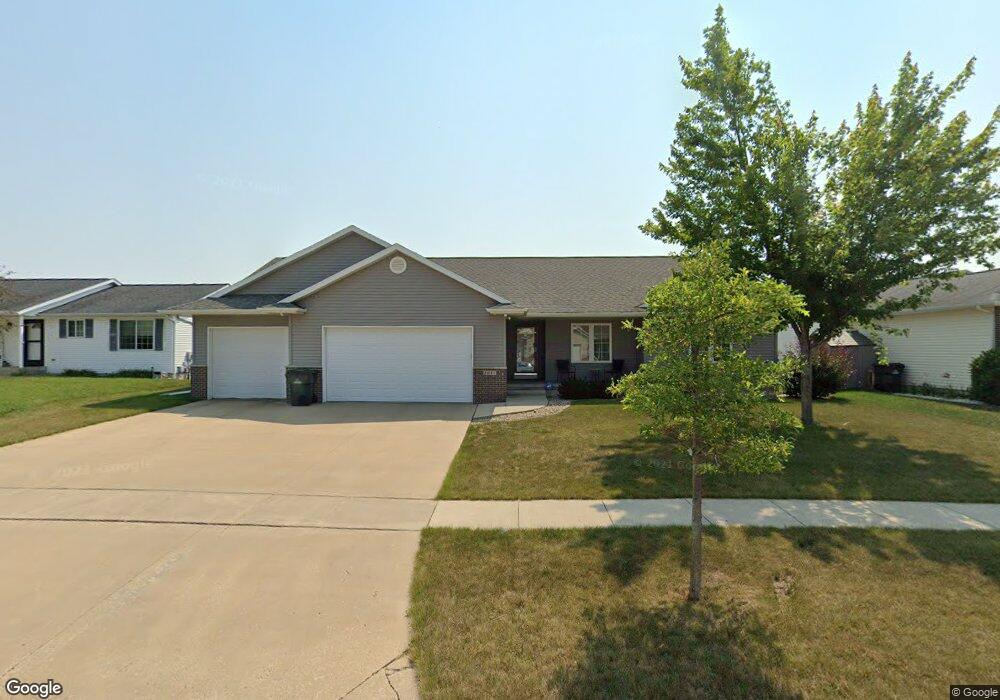
1017 Koudsi Blvd NW Cedar Rapids, IA 52405
Estimated Value: $241,000 - $353,000
4
Beds
4
Baths
1,512
Sq Ft
$211/Sq Ft
Est. Value
About This Home
This home is located at 1017 Koudsi Blvd NW, Cedar Rapids, IA 52405 and is currently estimated at $318,568, approximately $210 per square foot. 1017 Koudsi Blvd NW is a home located in Linn County with nearby schools including Maple Grove Elementary School, North Middletown Elementary School, and Ponderosa Elementary School.
Ownership History
Date
Name
Owned For
Owner Type
Purchase Details
Closed on
Jan 31, 2018
Sold by
Gruchow Tracy J
Bought by
Gruchow Tracy J and Hull Shelly R
Current Estimated Value
Purchase Details
Closed on
Sep 14, 2005
Sold by
Steenhoek/Kaiser Llc
Bought by
Gruchow Tracy J
Create a Home Valuation Report for This Property
The Home Valuation Report is an in-depth analysis detailing your home's value as well as a comparison with similar homes in the area
Home Values in the Area
Average Home Value in this Area
Purchase History
| Date | Buyer | Sale Price | Title Company |
|---|---|---|---|
| Gruchow Tracy J | -- | None Available | |
| Gruchow Tracy J | $41,500 | -- |
Source: Public Records
Tax History Compared to Growth
Tax History
| Year | Tax Paid | Tax Assessment Tax Assessment Total Assessment is a certain percentage of the fair market value that is determined by local assessors to be the total taxable value of land and additions on the property. | Land | Improvement |
|---|---|---|---|---|
| 2025 | $5,372 | $341,900 | $61,600 | $280,300 |
| 2024 | $5,448 | $314,000 | $58,100 | $255,900 |
| 2023 | $5,448 | $314,000 | $58,100 | $255,900 |
| 2022 | $5,204 | $267,200 | $51,000 | $216,200 |
| 2021 | $5,326 | $260,200 | $44,000 | $216,200 |
| 2020 | $5,326 | $250,000 | $44,000 | $206,000 |
| 2019 | $4,724 | $227,700 | $35,200 | $192,500 |
| 2018 | $4,590 | $227,700 | $35,200 | $192,500 |
| 2017 | $4,733 | $224,600 | $35,200 | $189,400 |
| 2016 | $4,733 | $222,700 | $35,200 | $187,500 |
| 2015 | $4,663 | $219,122 | $35,203 | $183,919 |
| 2014 | $4,478 | $219,122 | $35,203 | $183,919 |
| 2013 | $4,378 | $219,122 | $35,203 | $183,919 |
Source: Public Records
Map
Nearby Homes
- 4819 Fruitwood Ln NW
- 1722 Gardner Dr NW
- 1608 Morris Ave NW
- 272 Peace Ave NW
- 281 Jacolyn Dr NW
- 4819 Ford Ave NW
- 3802 Richland Dr NW
- 208 Lenora Dr NW
- 4975 Kesler Rd NW
- 229 Jacolyn Dr NW
- 3313 Crestwood Dr NW
- 5127 Holly Ave NW
- 200 Cherry Park Dr NW
- 4910 Gordon Ave NW
- 3507 E Ave NW Unit F
- 3509 E Ave NW Unit D
- 3312 G Ave NW
- 327* Edgewood Rd NW
- 0 501 Unit 2509749
- 3600 Midway Dr NW
- 1023 Koudsi Blvd NW
- 1011 Koudsi Blvd NW
- 1008 Wolf Dr NW
- 1029 Koudsi Blvd NW
- 1005 Koudsi Blvd NW
- 1016 Wolf Dr NW
- 1022 Wolf Dr NW
- 1022 Koudsi Blvd NW
- 902 Moose Dr NW
- 1010 Koudsi Blvd NW
- 1101 Koudsi Blvd NW
- 908 Moose Dr NW
- 822 Moose Dr NW
- 1028 Koudsi Blvd NW
- 1028 Wolf Dr NW
- 804 Moose Dr NW
- 814 Moose Dr NW
- 1000 Koudsi Blvd NW
- 1102 Koudsi Blvd NW
- 1107 Koudsi Blvd NW