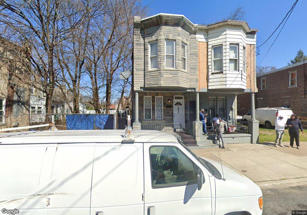
1017 Liberty St Camden, NJ 08104
Gateway NeighborhoodEstimated Value: $139,000 - $171,000
--
Bed
--
Bath
1,247
Sq Ft
$122/Sq Ft
Est. Value
About This Home
This home is located at 1017 Liberty St, Camden, NJ 08104 and is currently estimated at $152,000, approximately $121 per square foot. 1017 Liberty St is a home located in Camden County with nearby schools including Camden High School and Freedom Prep Charter School.
Ownership History
Date
Name
Owned For
Owner Type
Purchase Details
Closed on
Dec 13, 2023
Sold by
Rosario Family Properties Llc
Bought by
Rosario Family Properties Llc
Current Estimated Value
Home Financials for this Owner
Home Financials are based on the most recent Mortgage that was taken out on this home.
Original Mortgage
$518,700
Interest Rate
7.44%
Mortgage Type
New Conventional
Purchase Details
Closed on
Nov 17, 2021
Sold by
Sheriff / The County / Camden
Bought by
Rosario Family Properties Llc and State Of New Jersey
Create a Home Valuation Report for This Property
The Home Valuation Report is an in-depth analysis detailing your home's value as well as a comparison with similar homes in the area
Home Values in the Area
Average Home Value in this Area
Purchase History
| Date | Buyer | Sale Price | Title Company |
|---|---|---|---|
| Rosario Family Properties Llc | -- | Brennan Title Abstract | |
| Rosario Family Properties Llc | $35,000 | Brennan Title Abstract |
Source: Public Records
Mortgage History
| Date | Status | Borrower | Loan Amount |
|---|---|---|---|
| Previous Owner | Rosario Family Properties Llc | $518,700 |
Source: Public Records
Tax History Compared to Growth
Tax History
| Year | Tax Paid | Tax Assessment Tax Assessment Total Assessment is a certain percentage of the fair market value that is determined by local assessors to be the total taxable value of land and additions on the property. | Land | Improvement |
|---|---|---|---|---|
| 2025 | $1,733 | $48,900 | $6,100 | $42,800 |
| 2024 | $1,675 | $48,900 | $6,100 | $42,800 |
| 2023 | $1,675 | $48,900 | $6,100 | $42,800 |
| 2022 | $1,644 | $48,900 | $6,100 | $42,800 |
| 2021 | $1,638 | $48,900 | $6,100 | $42,800 |
| 2020 | $1,555 | $48,900 | $6,100 | $42,800 |
| 2019 | $1,489 | $48,900 | $6,100 | $42,800 |
| 2018 | $1,481 | $48,900 | $6,100 | $42,800 |
| 2017 | $1,445 | $48,900 | $6,100 | $42,800 |
| 2016 | $1,399 | $48,900 | $6,100 | $42,800 |
| 2015 | $1,347 | $48,900 | $6,100 | $42,800 |
| 2014 | $1,314 | $48,900 | $6,100 | $42,800 |
Source: Public Records
Map
Nearby Homes
- 936 Mechanic St
- 910 Mechanic St
- 1140 Kaighn Ave
- 1137 Sycamore St
- 764 Mount Vernon St
- 1224 Chestnut St
- 1476 Mount Ephraim Ave Unit 3
- 1165 Lansdowne Ave
- 1167 Lansdowne Ave
- 1169 Lansdowne Ave
- 918 Mount Ephraim Ave
- 1522 S 10th St
- 917 S 8th St
- 1218 1/2 Atlantic Ave
- 1036 Princess Ave
- 1097 Morton St
- 940 Morton St
- 724 Spruce St
- 1165 Morton St
- 718 Spruce St
- 1019 Liberty St
- 1023 Liberty St
- 1220 S 10th St
- 1218 S 10th St
- 1222 S 10th St
- 1224 S 10th St
- 1216 S 10th St
- 1025 Liberty St
- 1214 S 10th St
- 1027 Liberty St
- 1029 Liberty St
- 1031 Liberty St
- 1033 Liberty St
- 1223 #1 S 10th St
- 1035 Liberty St
- 1022 Kaighns Ave
- 1221 S 10th St
- 1219 S 10th St
- 1215 S 10th St
- 1223 S 10th St Unit 1