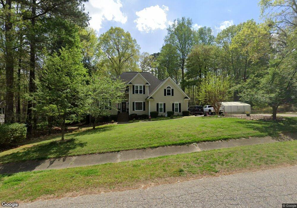
1017 Luminary Ln Willow Spring, NC 27592
Estimated Value: $528,000 - $577,000
3
Beds
3
Baths
2,654
Sq Ft
$209/Sq Ft
Est. Value
About This Home
This home is located at 1017 Luminary Ln, Willow Spring, NC 27592 and is currently estimated at $555,887, approximately $209 per square foot. 1017 Luminary Ln is a home located in Wake County with nearby schools including Vance Elementary School and West Lake Middle.
Ownership History
Date
Name
Owned For
Owner Type
Purchase Details
Closed on
Sep 28, 2012
Sold by
Nellis Donna B and Nellis Gary A
Bought by
Nellis Donna B
Current Estimated Value
Home Financials for this Owner
Home Financials are based on the most recent Mortgage that was taken out on this home.
Original Mortgage
$236,000
Outstanding Balance
$164,954
Interest Rate
3.71%
Mortgage Type
New Conventional
Estimated Equity
$390,933
Purchase Details
Closed on
May 25, 2001
Sold by
Scarboro Ronald L
Bought by
Nellis Gary A and Nellis Donna
Home Financials for this Owner
Home Financials are based on the most recent Mortgage that was taken out on this home.
Original Mortgage
$235,250
Interest Rate
7.11%
Mortgage Type
VA
Create a Home Valuation Report for This Property
The Home Valuation Report is an in-depth analysis detailing your home's value as well as a comparison with similar homes in the area
Home Values in the Area
Average Home Value in this Area
Purchase History
| Date | Buyer | Sale Price | Title Company |
|---|---|---|---|
| Nellis Donna B | -- | None Available | |
| Nellis Gary A | $246,000 | -- |
Source: Public Records
Mortgage History
| Date | Status | Borrower | Loan Amount |
|---|---|---|---|
| Open | Nellis Donna B | $236,000 | |
| Previous Owner | Nellis Gary A | $235,250 |
Source: Public Records
Tax History
| Year | Tax Paid | Tax Assessment Tax Assessment Total Assessment is a certain percentage of the fair market value that is determined by local assessors to be the total taxable value of land and additions on the property. | Land | Improvement |
|---|---|---|---|---|
| 2025 | -- | $496,707 | $100,000 | $396,707 |
| 2024 | $3,105 | $496,707 | $100,000 | $396,707 |
Source: Public Records
Map
Nearby Homes
- 3917 N Carolina 42
- 6952 Ogburn Farms Dr
- 1117 Aquadale Dr
- 2409 Water Front Dr
- 1024 Jarrett Bay Rd
- 4104 Rockside Hills Dr
- 7218 Cabernet Franc Dr
- 6512 Cablewood Dr
- 1005 Tyler Farms Dr
- 6801 Rock Service Station Rd
- 6501 Rock Service Station Rd
- 7308 Messenger Dr
- 2109 Saunders Farm Dr
- 2113 Saunders Farm Way
- 1140 Polo Dr
- 1145 Taos Trail
- 1132 Southern Meadows Dr
- 1153 Polo Dr
- 5215 Red Crimson Dr
- 6313 Southern Charm Ln
- 1009 Luminary Ln
- 1012 Luminary Ln
- 1021 Luminary Ln
- 1001 Luminary Ln
- 1020 Luminary Ln
- 1004 Luminary Ln
- 1100 Hammerman Dr
- 108 Hammerman Dr
- 1025 Luminary Ln
- 1024 Luminary Ln
- 6624 Jays Bridge Dr
- 6625 Jays Bridge Dr
- 1101 Hammerman Dr
- 1101 Hammerman Dr Unit Lot 25
- 1108 Hammerman Dr
- 6813 Landingham Dr
- LOT 38 Luminary Ln
- 1001 Kay Falls Ln
- 1028 Luminary Ln
- 6828 Landingham Dr