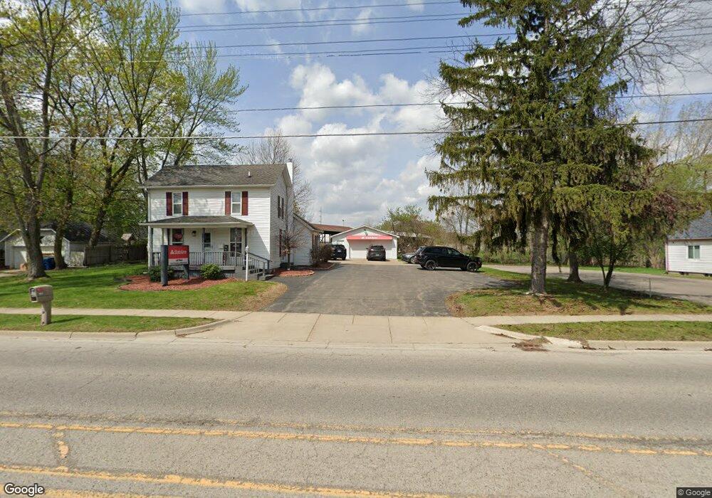
1017 N Bridge St Linden, MI 48451
Estimated Value: $208,000 - $278,000
3
Beds
2
Baths
1,454
Sq Ft
$172/Sq Ft
Est. Value
About This Home
This home is located at 1017 N Bridge St, Linden, MI 48451 and is currently estimated at $250,002, approximately $171 per square foot. 1017 N Bridge St is a home located in Genesee County with nearby schools including Linden Elementary School, Linden Middle School, and Linden High School.
Ownership History
Date
Name
Owned For
Owner Type
Purchase Details
Closed on
Jul 3, 2018
Sold by
Sutika John Douglas and Sutika Elizabeth A
Bought by
Scott Girls Llc
Current Estimated Value
Purchase Details
Closed on
May 7, 2012
Sold by
The State Bank
Bought by
Sutika John Douglas and Sutika Elizabeth A
Purchase Details
Closed on
Jun 25, 2010
Sold by
Josh Williams Construction Inc
Bought by
The State Bank
Purchase Details
Closed on
Jul 31, 2003
Sold by
Josh Williams Construction Inc
Bought by
Sutika John Douglas and Sutika Elizabeth A
Purchase Details
Closed on
Jul 6, 2001
Sold by
Whitten Gerald P and Whitten Ann S
Bought by
Josh Williams Construction Inc
Create a Home Valuation Report for This Property
The Home Valuation Report is an in-depth analysis detailing your home's value as well as a comparison with similar homes in the area
Home Values in the Area
Average Home Value in this Area
Purchase History
| Date | Buyer | Sale Price | Title Company |
|---|---|---|---|
| Scott Girls Llc | $118,000 | Select Title Co | |
| Sutika John Douglas | $58,000 | None Available | |
| The State Bank | -- | Cislo Title Co | |
| Sutika John Douglas | -- | Lawyers Title | |
| Josh Williams Construction Inc | $119,000 | Guaranty Title Company |
Source: Public Records
Tax History Compared to Growth
Tax History
| Year | Tax Paid | Tax Assessment Tax Assessment Total Assessment is a certain percentage of the fair market value that is determined by local assessors to be the total taxable value of land and additions on the property. | Land | Improvement |
|---|---|---|---|---|
| 2025 | $4,452 | $97,100 | $0 | $0 |
| 2024 | $2,523 | $91,900 | $0 | $0 |
| 2023 | $2,533 | $81,500 | $0 | $0 |
| 2022 | $4,059 | $66,100 | $0 | $0 |
| 2021 | $3,644 | $60,200 | $0 | $0 |
| 2020 | $2,324 | $61,000 | $0 | $0 |
| 2019 | $2,315 | $52,300 | $0 | $0 |
| 2018 | $2,333 | $52,300 | $0 | $0 |
| 2017 | $2,734 | $50,000 | $0 | $0 |
| 2016 | $2,756 | $52,500 | $0 | $0 |
| 2015 | $2,754 | $49,800 | $0 | $0 |
| 2012 | -- | $40,846 | $40,846 | $0 |
Source: Public Records
Map
Nearby Homes
- 110 Kathy Cir Unit 20
- 902 N Bridge St
- 240 E Rolston Rd
- 331 Andrea Ave Unit 63
- 5512 Hidden Oaks Cir Unit 52
- 417 E Rolston Rd
- 13339 Whispering Pines Ct
- 5442 Hidden Ridge Trail Unit 4
- 185 Laura Ln Unit 26
- 1565 W Rolston Rd
- 1590 W Rolston Rd
- 628 Riverside Dr
- Springmill Plan at The Fairways
- Riverwalk Plan at The Fairways
- Embry Hills Plan at The Fairways
- Cedar Creek Plan at The Fairways
- Brookfield Plan at The Fairways
- Hepbirn Plan at The Fairways
- Shoal Creek Plan at The Fairways
- Quali Ridge Plan at The Fairways
- 1013 N Bridge St
- 1013 N Bridge St Unit 2
- 1021 N Bridge St
- 1014 N Bridge St
- 1097 N Bridge St
- 0 E Rolston Rd Unit 210013610
- 0 E Rolston Rd
- 0 E Rolston Rd Unit G20327878
- 0 E Rolston Rd Unit G20386436
- 0 E Rolston Rd Unit G20386437
- 0 E Rolston Rd Unit R219023744
- 0 E Rolston Rd Unit R219023733
- 0 E Rolston Rd Unit R219023719
- 0 E Rolston Rd Unit R2200075019
- 0 E Rolston Rd Unit R2200075017
- 0 E Rolston Rd Unit R2200075013
- 0 E Rolston Rd Unit 2200060318
- 0 E Rolston Rd Unit 30002169
- 0 E Rolston Rd Unit 30006454
- 0 E Rolston Rd Unit 30013214