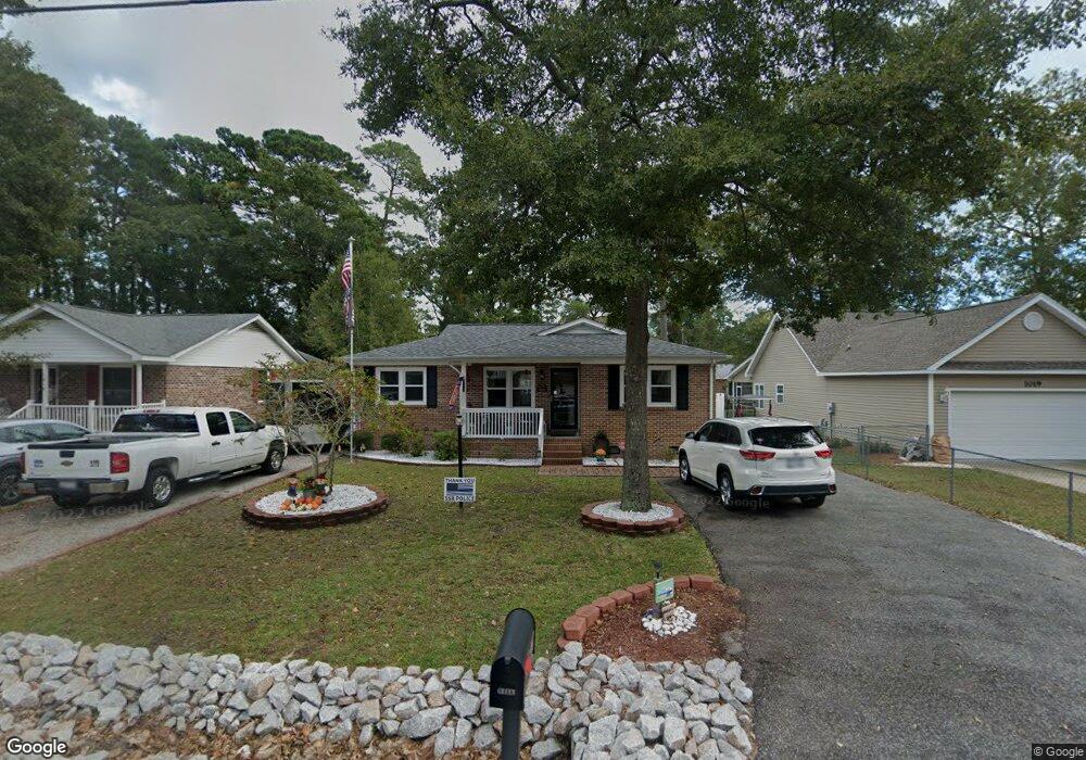
1017 S Poplar Dr Unit 1017 S. Poplar Drive Surfside Beach, SC 29575
Estimated Value: $391,000 - $466,000
3
Beds
2
Baths
1,320
Sq Ft
$320/Sq Ft
Est. Value
About This Home
This home is located at 1017 S Poplar Dr Unit 1017 S. Poplar Drive, Surfside Beach, SC 29575 and is currently estimated at $422,908, approximately $320 per square foot. 1017 S Poplar Dr Unit 1017 S. Poplar Drive is a home located in Horry County with nearby schools including Seaside Elementary, St. James Intermediate, and St. James Middle School.
Ownership History
Date
Name
Owned For
Owner Type
Purchase Details
Closed on
May 6, 2025
Sold by
Dunham Elizabeth D
Bought by
Sharp Jason C and Sharp Rebekah Elizabeth
Current Estimated Value
Home Financials for this Owner
Home Financials are based on the most recent Mortgage that was taken out on this home.
Original Mortgage
$382,936
Outstanding Balance
$381,572
Interest Rate
6.62%
Mortgage Type
FHA
Estimated Equity
$41,336
Purchase Details
Closed on
Nov 27, 2023
Sold by
Dunham Michael Francis
Bought by
Dunham Elizabeth D
Purchase Details
Closed on
Aug 2, 2015
Sold by
Meyers Holding Llc
Bought by
Green Michael Zeb and Green Sandra G
Purchase Details
Closed on
Jan 5, 2005
Sold by
Rabon William E
Bought by
Rabon Kelly C
Create a Home Valuation Report for This Property
The Home Valuation Report is an in-depth analysis detailing your home's value as well as a comparison with similar homes in the area
Home Values in the Area
Average Home Value in this Area
Purchase History
| Date | Buyer | Sale Price | Title Company |
|---|---|---|---|
| Sharp Jason C | -- | -- | |
| Sharp Jason C | $390,000 | -- | |
| Dunham Elizabeth D | -- | -- | |
| Green Michael Zeb | $178,000 | -- | |
| Rabon Kelly C | -- | -- | |
| Rabon William E | -- | -- |
Source: Public Records
Mortgage History
| Date | Status | Borrower | Loan Amount |
|---|---|---|---|
| Open | Sharp Jason C | $382,936 |
Source: Public Records
Tax History Compared to Growth
Tax History
| Year | Tax Paid | Tax Assessment Tax Assessment Total Assessment is a certain percentage of the fair market value that is determined by local assessors to be the total taxable value of land and additions on the property. | Land | Improvement |
|---|---|---|---|---|
| 2024 | $775 | $22,595 | $15,000 | $7,595 |
| 2023 | $775 | $7,472 | $3,536 | $3,936 |
| 2021 | $663 | $13,939 | $8,035 | $5,904 |
| 2020 | $649 | $13,939 | $8,035 | $5,904 |
| 2019 | $649 | $13,939 | $8,035 | $5,904 |
| 2018 | $0 | $9,746 | $4,160 | $5,586 |
| 2017 | $489 | $9,746 | $4,160 | $5,586 |
| 2016 | -- | $9,746 | $4,160 | $5,586 |
| 2015 | $489 | $9,747 | $4,161 | $5,586 |
| 2014 | $456 | $9,747 | $4,161 | $5,586 |
Source: Public Records
Map
Nearby Homes
- 1014 Bay Dr
- 811 10th Ave S
- 1013 Sabal Palm Way
- 723 10th Ave S Unit Lot 8
- TBD Poplar Dr S
- 633 Sparrow Dr Unit B
- 617 13th Ave S Unit 116
- 614 14th Ave S Unit 132
- 620 15th Ave S Unit 89
- 613 14th Ave S Unit 34
- 611 13th Ave S Unit 173
- 910 U S 17 Business
- 610 14th Ave S Unit 181
- 614 15th Ave S Unit 41
- 1511 S Hollywood Dr Unit SB
- 215 Melody Gardens Dr
- TBD Maple Dr
- 120-A 16th Ave S
- 482 Meadowlark
- 618 Cypress Dr Unit SB
- 1017 S Poplar Dr
- 1013 S Poplar Dr
- 1019 S Poplar Dr Unit B
- 1012 Bay Dr Unit MB
- 1012 Bay Dr Unit WALKING DISTANCE TO
- 1016 Bay Dr
- 1011 S Poplar Dr
- 1012 S Poplar Dr
- 1014A S Poplar Dr
- 1014 B S Poplar Dr
- 1016 S Poplar Dr
- 1016 S Poplar Dr
- 1016A S Poplar Dr Unit A unit
- 1016 S Poplar Dr Unit B
- 1016 S Poplar Dr Unit A
- 1014 S Poplar Dr
- 1021 S Poplar Dr Unit SR
- 1021 S Poplar Dr Unit 1021 Poplar Dr. S
- 1021 S Poplar Dr Unit 1021 S Poplar Drive
- 1018 Bay Dr Unit SB