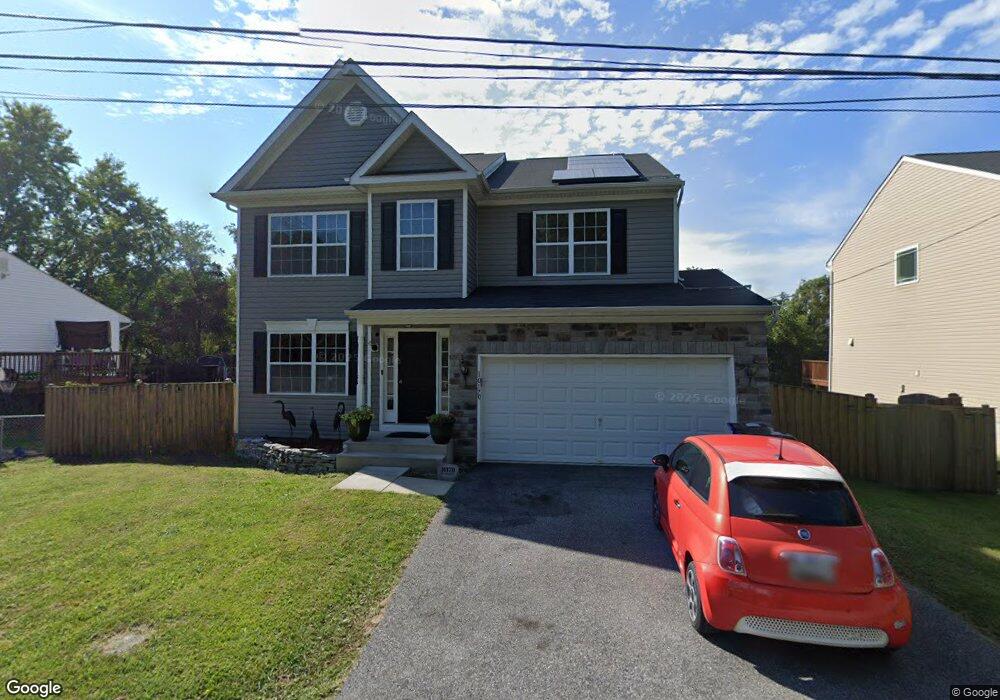
10170 High Ridge Rd Laurel, MD 20723
North Laurel NeighborhoodEstimated Value: $680,000 - $778,000
Studio
1
Bath
2,272
Sq Ft
$328/Sq Ft
Est. Value
About This Home
This home is located at 10170 High Ridge Rd, Laurel, MD 20723 and is currently estimated at $745,833, approximately $328 per square foot. 10170 High Ridge Rd is a home located in Howard County with nearby schools including Gorman Crossing Elementary School, Hammond Middle School, and Reservoir High School.
Ownership History
Date
Name
Owned For
Owner Type
Purchase Details
Closed on
Oct 30, 2013
Sold by
Harmony Builders Inc
Bought by
Debisette Michael Colin
Current Estimated Value
Home Financials for this Owner
Home Financials are based on the most recent Mortgage that was taken out on this home.
Original Mortgage
$408,497
Outstanding Balance
$300,073
Interest Rate
4.24%
Mortgage Type
VA
Estimated Equity
$445,761
Create a Home Valuation Report for This Property
The Home Valuation Report is an in-depth analysis detailing your home's value as well as a comparison with similar homes in the area
Home Values in the Area
Average Home Value in this Area
Purchase History
| Date | Buyer | Sale Price | Title Company |
|---|---|---|---|
| Debisette Michael Colin | $399,900 | First American Title Ins Co |
Source: Public Records
Mortgage History
| Date | Status | Borrower | Loan Amount |
|---|---|---|---|
| Open | Debisette Michael Colin | $408,497 |
Source: Public Records
Tax History
| Year | Tax Paid | Tax Assessment Tax Assessment Total Assessment is a certain percentage of the fair market value that is determined by local assessors to be the total taxable value of land and additions on the property. | Land | Improvement |
|---|---|---|---|---|
| 2025 | $9,338 | $635,500 | $183,100 | $452,400 |
| 2024 | $9,338 | $607,033 | $0 | $0 |
| 2023 | $8,769 | $578,567 | $0 | $0 |
| 2022 | $8,320 | $550,100 | $188,100 | $362,000 |
| 2021 | $7,885 | $519,833 | $0 | $0 |
| 2020 | $6,107 | $489,567 | $0 | $0 |
| 2019 | $6,623 | $459,300 | $114,600 | $344,700 |
| 2018 | $6,445 | $445,167 | $0 | $0 |
| 2017 | $6,055 | $459,300 | $0 | $0 |
| 2016 | -- | $416,900 | $0 | $0 |
| 2015 | -- | $408,567 | $0 | $0 |
| 2014 | -- | $400,233 | $0 | $0 |
Source: Public Records
Map
Nearby Homes
- 9437 Fairview Ave
- 9425 Fairview Ave
- 1103 Montgomery St
- 9401 Riverbrink Ct
- 1211 Snowden Place
- 7209 Brooklyn Bridge Rd
- 1116 Westview Terrace
- 7106 Donston Dr
- 8040 Sandy Spring Rd
- 910 Montgomery St Unit A
- 1016 Phillip Powers Dr
- 9711 Whiskey Run
- 16140 Kenny Rd
- 15743 Millbrook Ln
- 916 Philip Powers Dr
- 9342 Canterbury Riding
- 15706 Dorset Rd Unit 102
- 15708 Dorset Rd Unit 202
- 9695 Hitching Post Ln Unit H
- 9175 Hitching Post Ln Unit F
- 10172 High Ridge Rd
- 10168 High Ridge Rd
- 10178 High Ridge Rd
- 10171 High Ridge Rd
- 10175 High Ridge Rd
- 10180 High Ridge Rd
- 9080 Riverhill Rd
- 10160 High Ridge Rd
- 10169 High Ridge Rd
- 10179 High Ridge Rd
- 10154 High Ridge Rd
- 10181 High Ridge Rd
- 10182 High Ridge Rd
- 9090 Riverhill Rd
- 10150 High Ridge Rd
- 10129 Stansfield Rd
- 10167 High Ridge Rd
- 10165 High Ridge Rd
- 10165 High Ridge Rd
- 10165 High Ridge Rd
Your Personal Tour Guide
Ask me questions while you tour the home.