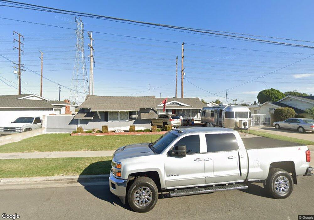
10172 Macduff St Stanton, CA 90680
West Anaheim NeighborhoodEstimated Value: $855,000 - $921,000
3
Beds
2
Baths
1,390
Sq Ft
$646/Sq Ft
Est. Value
About This Home
This home is located at 10172 Macduff St, Stanton, CA 90680 and is currently estimated at $898,499, approximately $646 per square foot. 10172 Macduff St is a home located in Orange County with nearby schools including Robert M. Pyles Elementary School, Dale Jr High School, and Magnolia High.
Ownership History
Date
Name
Owned For
Owner Type
Purchase Details
Closed on
Jan 13, 2005
Sold by
Bayr Arnold and Bayr Trudy
Bought by
Ontiveros Adam A and Ontiveros Angelica M
Current Estimated Value
Home Financials for this Owner
Home Financials are based on the most recent Mortgage that was taken out on this home.
Original Mortgage
$359,650
Outstanding Balance
$182,302
Interest Rate
5.81%
Mortgage Type
Purchase Money Mortgage
Estimated Equity
$716,197
Purchase Details
Closed on
Jan 18, 1996
Sold by
Bayr Arnold and Bayr Trudy
Bought by
Bayr Arnold and Bayr Trudy
Create a Home Valuation Report for This Property
The Home Valuation Report is an in-depth analysis detailing your home's value as well as a comparison with similar homes in the area
Home Values in the Area
Average Home Value in this Area
Purchase History
| Date | Buyer | Sale Price | Title Company |
|---|---|---|---|
| Ontiveros Adam A | $450,000 | -- | |
| Bayr Arnold | -- | -- |
Source: Public Records
Mortgage History
| Date | Status | Borrower | Loan Amount |
|---|---|---|---|
| Open | Ontiveros Adam A | $359,650 | |
| Closed | Ontiveros Adam A | $67,850 |
Source: Public Records
Tax History
| Year | Tax Paid | Tax Assessment Tax Assessment Total Assessment is a certain percentage of the fair market value that is determined by local assessors to be the total taxable value of land and additions on the property. | Land | Improvement |
|---|---|---|---|---|
| 2025 | $7,078 | $627,251 | $539,015 | $88,236 |
| 2024 | $7,078 | $614,952 | $528,446 | $86,506 |
| 2023 | $6,898 | $602,895 | $518,085 | $84,810 |
| 2022 | $6,834 | $591,074 | $507,926 | $83,148 |
| 2021 | $6,753 | $579,485 | $497,967 | $81,518 |
| 2020 | $6,564 | $559,980 | $492,798 | $67,182 |
| 2019 | $6,398 | $549,000 | $483,135 | $65,865 |
| 2018 | $6,051 | $514,000 | $448,135 | $65,865 |
| 2017 | $5,945 | $514,000 | $448,135 | $65,865 |
| 2016 | $5,456 | $462,000 | $396,135 | $65,865 |
| 2015 | $4,981 | $417,000 | $351,135 | $65,865 |
| 2014 | $4,823 | $417,000 | $351,135 | $65,865 |
Source: Public Records
Map
Nearby Homes
- 10471 Magnolia Ave
- 2906 W Ravenswood Dr
- 1226 S Gaymont St
- 10800 Dale Ave Unit 129
- 10800 Dale Ave Unit 415
- 2834 W Keys Ln
- 10802 Mac St
- 2869 W Stonybrook Dr
- 10773 Magnolia Ave Unit 102
- 9155 Pacific Ave Unit 265
- 10891 Scottsbluff Dr
- 2917 W Rome Ave
- 2960 W Rome Ave
- 8681 Katella Ave
- 8681 Katella Ave Unit SPC 810
- 8681 Katella Ave Unit 897
- 8681 Katella Ave Unit 914
- 8681 Katella Ave Unit 861
- 8681 Katella Ave Unit 159
- 8681 Katella Ave Unit 812
- 8682 Lola Ave
- 10192 Macduff St
- 1298 S Macduff St
- 10202 Macduff St
- 10171 Macduff St
- 10181 Macduff St
- 8652 Lola Ave
- 1294 S Macduff St
- 10201 Macduff St
- 10222 Macduff St
- 8681 Lola Ave
- 10141 Macduff St
- 10232 Macduff St
- 10221 Macduff St
- 10172 Wasco Rd
- 10182 Wasco Rd
- 10162 Wasco Rd
- 8641 Lola Ave
- 10202 Wasco Rd
- 10212 Wasco Rd
Your Personal Tour Guide
Ask me questions while you tour the home.