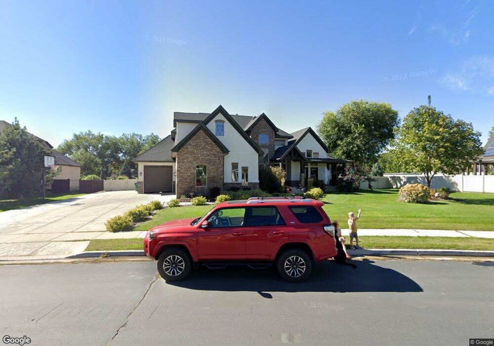
10179 N 6650 W Highland, UT 84003
Estimated Value: $1,338,000 - $1,515,000
4
Beds
4
Baths
6,182
Sq Ft
$231/Sq Ft
Est. Value
About This Home
This home is located at 10179 N 6650 W, Highland, UT 84003 and is currently estimated at $1,431,098, approximately $231 per square foot. 10179 N 6650 W is a home located in Utah County with nearby schools including Freedom Elementary School, Mountain Ridge Junior High School, and American Fork High School.
Ownership History
Date
Name
Owned For
Owner Type
Purchase Details
Closed on
Feb 24, 2022
Sold by
Peterson Tyson J
Bought by
Peterson Tyson J and Peterson Mikail
Current Estimated Value
Purchase Details
Closed on
Jun 2, 2021
Sold by
Bennett Michael
Bought by
Peterson Tyson J
Home Financials for this Owner
Home Financials are based on the most recent Mortgage that was taken out on this home.
Original Mortgage
$248,250
Interest Rate
2.9%
Mortgage Type
New Conventional
Purchase Details
Closed on
Jun 25, 2007
Sold by
Maycock Larry and Maycock Carolyn E
Bought by
Halafuka Vili Sunia and Halafuka Angela
Purchase Details
Closed on
Mar 20, 2007
Sold by
Maycock Larry
Bought by
Maycock Larry and Maycock Carolyn E
Purchase Details
Closed on
Apr 28, 2006
Sold by
Shumway Paul H
Bought by
Maycock Larry
Home Financials for this Owner
Home Financials are based on the most recent Mortgage that was taken out on this home.
Original Mortgage
$736,000
Interest Rate
6.29%
Mortgage Type
Purchase Money Mortgage
Purchase Details
Closed on
Feb 23, 2006
Sold by
Platinum Development & Construction Inc
Bought by
Shumway Paul H
Create a Home Valuation Report for This Property
The Home Valuation Report is an in-depth analysis detailing your home's value as well as a comparison with similar homes in the area
Home Values in the Area
Average Home Value in this Area
Purchase History
| Date | Buyer | Sale Price | Title Company |
|---|---|---|---|
| Peterson Tyson J | -- | Inwest Title | |
| Peterson Tyson J | -- | Inwest Title | |
| Halafuka Vili Sunia | -- | Equity Title Insurance Agen | |
| Maycock Larry | -- | Surety Title | |
| Maycock Larry | -- | Merrill Title Company | |
| Shumway Paul H | -- | Surety Title |
Source: Public Records
Mortgage History
| Date | Status | Borrower | Loan Amount |
|---|---|---|---|
| Previous Owner | Peterson Tyson J | $248,250 | |
| Previous Owner | Maycock Larry | $736,000 |
Source: Public Records
Tax History Compared to Growth
Tax History
| Year | Tax Paid | Tax Assessment Tax Assessment Total Assessment is a certain percentage of the fair market value that is determined by local assessors to be the total taxable value of land and additions on the property. | Land | Improvement |
|---|---|---|---|---|
| 2025 | $5,458 | $729,190 | $658,500 | $667,300 |
| 2024 | $5,070 | $674,135 | $0 | $0 |
| 2023 | $5,070 | $675,565 | $0 | $0 |
| 2022 | $4,846 | $626,065 | $0 | $0 |
| 2021 | $4,396 | $846,000 | $426,800 | $419,200 |
| 2020 | $4,123 | $778,100 | $371,100 | $407,000 |
| 2019 | $3,672 | $891,800 | $371,100 | $520,700 |
| 2018 | $4,320 | $810,500 | $357,700 | $452,800 |
| 2017 | $3,832 | $383,735 | $0 | $0 |
| 2016 | $3,595 | $336,490 | $0 | $0 |
| 2015 | $3,487 | $309,320 | $0 | $0 |
| 2014 | $3,128 | $318,065 | $0 | $0 |
Source: Public Records
Map
Nearby Homes
- 9967 N 6670 W
- 9924 N 6630 W Unit 9
- 6399 W 10150 N
- 10434 N 6400 W
- 6372 W 10400 N
- 6692 W 9770 N
- 6373 W 10500 N
- 6190 W 10050 N
- 975 E 2125 N
- 1602 E Center Pointe Dr
- 1602 E Center Pointe Dr Unit 1
- 1610 E Center Pointe Dr
- 859 E 2125 N
- 2208 N 825 E
- 975 E 2850 N
- 6271 W 10830 St N
- 11337 N 5950 W Unit 7
- 1438 N 400 W
- 9435 N Aspen Hollow Cir
- 5973 W 9960 N
- 10239 N 6650 W
- 10211 N 6650 W
- 10149 N 6650 W
- 6742 W 10205 N
- 10233 N 6650 W
- 6752 W 10205 N
- 10274 N 6650 W Unit 5
- 10274 N 6650 W
- 10190 N 6650 W
- 10154 N 6650 W
- 10133 N Westwood Ln
- 10133 N 6650 W
- 6749 W 10205 N
- 6749 W 10205 N Unit 5
- 10136 N 6650 W
- 6768 W 10205 N
- 6649 W 10250 N
- 10257 N 6680 W
- 10257 N 6680 W Unit 237
- 10257 N 6650 W Unit 4