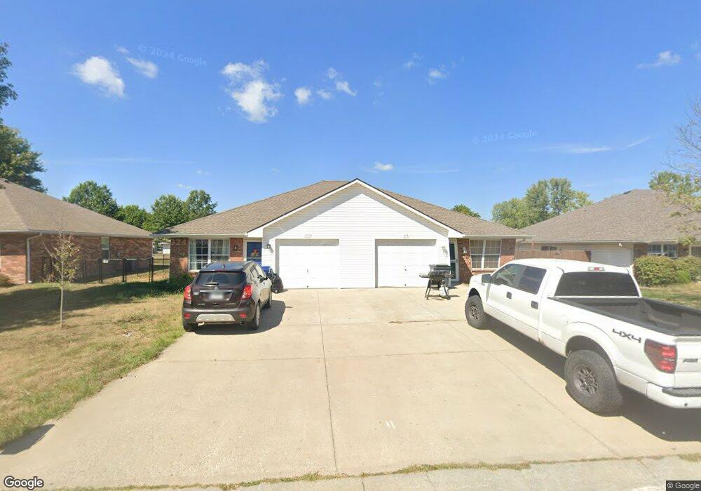
1018 Christie Ln Grain Valley, MO 64029
Estimated Value: $181,000 - $196,000
3
Beds
2
Baths
1,048
Sq Ft
$182/Sq Ft
Est. Value
About This Home
This home is located at 1018 Christie Ln, Grain Valley, MO 64029 and is currently estimated at $190,724, approximately $181 per square foot. 1018 Christie Ln is a home located in Jackson County with nearby schools including Grain Valley High School.
Ownership History
Date
Name
Owned For
Owner Type
Purchase Details
Closed on
Oct 12, 2000
Sold by
David L Arnold Construction Inc
Bought by
Brown Michael L
Current Estimated Value
Home Financials for this Owner
Home Financials are based on the most recent Mortgage that was taken out on this home.
Original Mortgage
$71,900
Outstanding Balance
$26,277
Interest Rate
7.95%
Mortgage Type
Purchase Money Mortgage
Estimated Equity
$164,447
Create a Home Valuation Report for This Property
The Home Valuation Report is an in-depth analysis detailing your home's value as well as a comparison with similar homes in the area
Home Values in the Area
Average Home Value in this Area
Purchase History
| Date | Buyer | Sale Price | Title Company |
|---|---|---|---|
| Brown Michael L | -- | Security Land Title Company |
Source: Public Records
Mortgage History
| Date | Status | Borrower | Loan Amount |
|---|---|---|---|
| Open | Brown Michael L | $71,900 |
Source: Public Records
Tax History Compared to Growth
Tax History
| Year | Tax Paid | Tax Assessment Tax Assessment Total Assessment is a certain percentage of the fair market value that is determined by local assessors to be the total taxable value of land and additions on the property. | Land | Improvement |
|---|---|---|---|---|
| 2025 | $2,007 | $24,374 | $4,604 | $19,770 |
| 2024 | $1,932 | $24,366 | $2,424 | $21,942 |
| 2023 | $1,932 | $24,365 | $3,473 | $20,892 |
| 2022 | $1,671 | $18,430 | $2,119 | $16,311 |
| 2021 | $1,632 | $18,430 | $2,119 | $16,311 |
| 2020 | $1,452 | $16,176 | $2,119 | $14,057 |
| 2019 | $1,422 | $16,176 | $2,119 | $14,057 |
| 2018 | $1,319 | $14,012 | $1,776 | $12,236 |
| 2017 | $1,285 | $14,012 | $1,776 | $12,236 |
| 2016 | $1,285 | $13,661 | $2,052 | $11,609 |
| 2014 | $1,190 | $12,559 | $2,054 | $10,505 |
Source: Public Records
Map
Nearby Homes
- 1024 Christie Ln
- 200 Cross Creek Ln
- 209 SW Cross Creek Dr
- 207 Pebblebrook St
- 509 SW Joseph Ct
- 636 SW Lakeview Dr
- 1418 SW Blue Branch Dr
- 725 SW Tisha Ln
- 401 S Minter Rd
- 1215 SW Lone Star Ct
- 640 SW Crestview Dr
- 714 SW Brome Dr
- 1214 SW Windcrest Ct
- 506 SW Meadowood Dr
- 1219 SW Windcrest Ct
- 518 South St
- 1235 NW Ashley Ln
- 719 S Minter Rd
- 1309 SW Graystone Cir
- 621 SW Tisha Ln
- 1016 Christie Ln
- 1020 Christie Ln
- 1022 Christie Ln
- 1010 Christie Ln
- 1026 Christie Ln
- 1021 Christie Ln
- 1101 SW Ephraim Dr
- 1017 Christie Ln
- 1041 SW Ephraim Dr
- 1013 Christie Ln
- 1019 Christie Ln
- 1028 Christie Ln
- 1039 SW Ephraim Dr
- 1105 SW Ephraim Dr
- 1035 SW Ephraim Dr
- 1035 SW Ephraim Dr
- 1009 Christie Ln
- 1025 Christie Ln
- 1006 Christie Ln
- 1037 Ephraim Dr