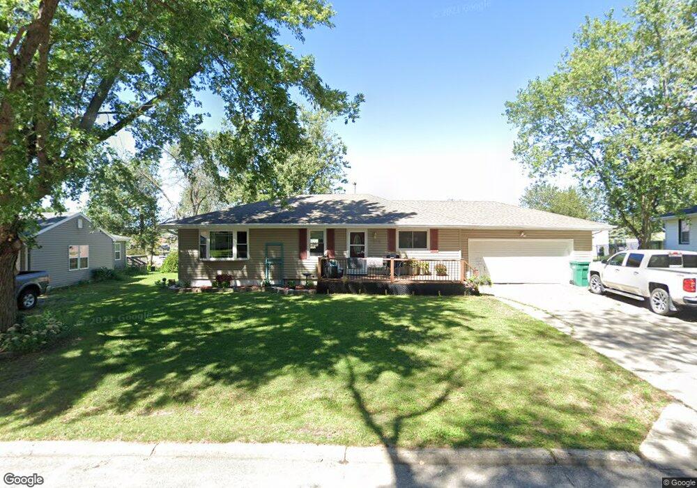
1018 Crest Dr Creston, IA 50801
Estimated Value: $210,283 - $245,000
3
Beds
2
Baths
1,520
Sq Ft
$150/Sq Ft
Est. Value
About This Home
This home is located at 1018 Crest Dr, Creston, IA 50801 and is currently estimated at $228,571, approximately $150 per square foot. 1018 Crest Dr is a home located in Union County with nearby schools including Creston Early Childhood Center, Creston Elementary School, and Creston Middle School.
Ownership History
Date
Name
Owned For
Owner Type
Purchase Details
Closed on
Feb 4, 2008
Sold by
Carter Shelley Lynn
Bought by
Hanson Rick L and Hanson Tara L
Current Estimated Value
Home Financials for this Owner
Home Financials are based on the most recent Mortgage that was taken out on this home.
Original Mortgage
$85,500
Interest Rate
6.2%
Mortgage Type
Purchase Money Mortgage
Create a Home Valuation Report for This Property
The Home Valuation Report is an in-depth analysis detailing your home's value as well as a comparison with similar homes in the area
Home Values in the Area
Average Home Value in this Area
Purchase History
| Date | Buyer | Sale Price | Title Company |
|---|---|---|---|
| Hanson Rick L | $95,000 | None Available |
Source: Public Records
Mortgage History
| Date | Status | Borrower | Loan Amount |
|---|---|---|---|
| Previous Owner | Hanson Rick L | $85,500 |
Source: Public Records
Tax History
| Year | Tax Paid | Tax Assessment Tax Assessment Total Assessment is a certain percentage of the fair market value that is determined by local assessors to be the total taxable value of land and additions on the property. | Land | Improvement |
|---|---|---|---|---|
| 2025 | $3,486 | $219,070 | $23,560 | $195,510 |
| 2024 | $3,486 | $197,420 | $23,560 | $173,860 |
| 2023 | $3,914 | $200,530 | $28,010 | $172,520 |
| 2022 | $3,876 | $170,990 | $28,010 | $142,980 |
| 2021 | $3,876 | $159,810 | $26,180 | $133,630 |
| 2020 | $3,376 | $145,090 | $21,680 | $123,410 |
| 2019 | $3,450 | $145,090 | $0 | $0 |
| 2018 | $3,288 | $145,090 | $0 | $0 |
| 2017 | $3,332 | $145,090 | $0 | $0 |
| 2016 | $3,276 | $145,090 | $0 | $0 |
| 2015 | $3,276 | $133,110 | $0 | $0 |
| 2014 | $3,070 | $133,110 | $0 | $0 |
Source: Public Records
Map
Nearby Homes
- 1011 Crest Dr
- 3 SW Corner of Townline St & N Su Unit Lots
- 1000 N Spruce St
- 509 W Buckeye St
- 703 W Devoe St
- 1107 W Prairie St
- 1007 N Maple St
- 500 Levy St
- 1202 N Walnut St
- 601 W Irving St
- 614 N Maple St
- 609 N Maple St
- 507 W Howard St
- 500 N Elm St
- 619 N Walnut St
- 700 W Howard St
- 1100 N Vine St
- 707 N Birch St
- 901 W Adair St
- 601 N Pine St
- 1025 Crest Dr
- 1020 Crest Dr
- 1016 Crest Dr
- 1027 Crest Dr
- 1014 Crest Dr
- 1021 Crest Dr
- 1023 Crest Dr
- 1012 Crest Dr
- 1024 Crest Dr
- 1018 N Spruce St
- 1019 Crest Dr
- 1100 N Spruce St
- 1016 N Spruce St
- 1010 1/2 Crest Dr
- 1014 N Spruce St
- 1017 Crest Dr
- 1015 Crest Dr
- 1010 N Spruce St
- 1012 N Spruce St
- 1010 Crest Dr