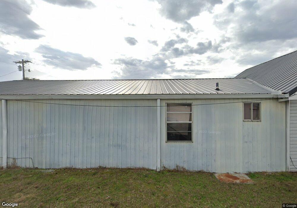
1018 Dinah Shore Blvd Winchester, TN 37398
Estimated Value: $129,570 - $253,000
--
Bed
1
Bath
756
Sq Ft
$271/Sq Ft
Est. Value
About This Home
This home is located at 1018 Dinah Shore Blvd, Winchester, TN 37398 and is currently estimated at $204,893, approximately $271 per square foot. 1018 Dinah Shore Blvd is a home located in Franklin County with nearby schools including North Middle School, Franklin County High School, and Winchester Christian Academy.
Ownership History
Date
Name
Owned For
Owner Type
Purchase Details
Closed on
May 1, 2023
Sold by
Kimbrough Lois F
Bought by
Kimbrough Lois F
Current Estimated Value
Purchase Details
Closed on
Jan 30, 2018
Sold by
Kimbrough Lois F and Mabry Lois F
Bought by
Partin Melinda and Edwards Martha
Purchase Details
Closed on
Jan 31, 1983
Bought by
Mabry Lois F
Purchase Details
Closed on
Apr 28, 1982
Purchase Details
Closed on
Apr 7, 1977
Purchase Details
Closed on
Jan 4, 1900
Create a Home Valuation Report for This Property
The Home Valuation Report is an in-depth analysis detailing your home's value as well as a comparison with similar homes in the area
Home Values in the Area
Average Home Value in this Area
Purchase History
| Date | Buyer | Sale Price | Title Company |
|---|---|---|---|
| Kimbrough Lois F | -- | Sovereign Title | |
| Partin Melinda | -- | Sovereign T&E Llc | |
| Mabry Lois F | $18,500 | -- | |
| -- | $10,500 | -- | |
| -- | -- | -- | |
| -- | -- | -- |
Source: Public Records
Tax History Compared to Growth
Tax History
| Year | Tax Paid | Tax Assessment Tax Assessment Total Assessment is a certain percentage of the fair market value that is determined by local assessors to be the total taxable value of land and additions on the property. | Land | Improvement |
|---|---|---|---|---|
| 2024 | $1,465 | $56,960 | $27,000 | $29,960 |
| 2023 | $1,465 | $56,960 | $27,000 | $29,960 |
| 2022 | $1,436 | $56,960 | $27,000 | $29,960 |
| 2021 | $993 | $56,960 | $27,000 | $29,960 |
| 2020 | $1,370 | $38,760 | $20,000 | $18,760 |
| 2019 | $1,370 | $38,760 | $20,000 | $18,760 |
| 2018 | $1,290 | $38,760 | $20,000 | $18,760 |
| 2017 | $1,290 | $38,760 | $20,000 | $18,760 |
| 2016 | $1,179 | $35,400 | $18,000 | $17,400 |
| 2015 | $1,157 | $35,400 | $18,000 | $17,400 |
| 2014 | $1,157 | $35,387 | $0 | $0 |
Source: Public Records
Map
Nearby Homes
- 132 Highland Dr
- 120 Dogwood Ln
- 209 Franklin Park
- 136 Bel Aire Dr
- 103 Lisa Cir
- 108 Allen Dr
- 114 Allen Dr
- 0 Spring Hill Dr
- 713 Hunt St
- 709 Hunt St
- 0 Old Cowan Rd Unit RTC2970796
- 238 Jills Landing
- 105 Lakeview Dr
- 0 N Porter St
- 211 S Porter St
- 213 S Porter St
- 215 S Porter St
- 1019 Old Cowan Rd
- 303 N Porter St
- 203 3rd Ave NE
- 101 Mountain View Dr
- 107 Mountain View Dr
- 109 Mountain View Dr
- 100 Swann Ave
- 102 Mountain View Dr
- 111 Mountain View Dr
- 104 Mountain View Dr
- 104 Swann Ave
- 106 Mountain View Dr
- 1057 Dinah Shore Blvd
- 113 Mountain View Dr
- 0 Decherd Blvd Unit 1934653
- 0 Decherd Blvd Unit 1914966
- 0 Decherd Blvd Unit 1860023
- 0 Decherd Blvd Unit 2149565
- 0 Decherd Blvd Unit 2111827
- 1059 Dinah Shore Blvd Unit 1059
- 1059 Dinah Shore Blvd
- 108 Mountain View Dr
- 1101 Dinah Shore Blvd