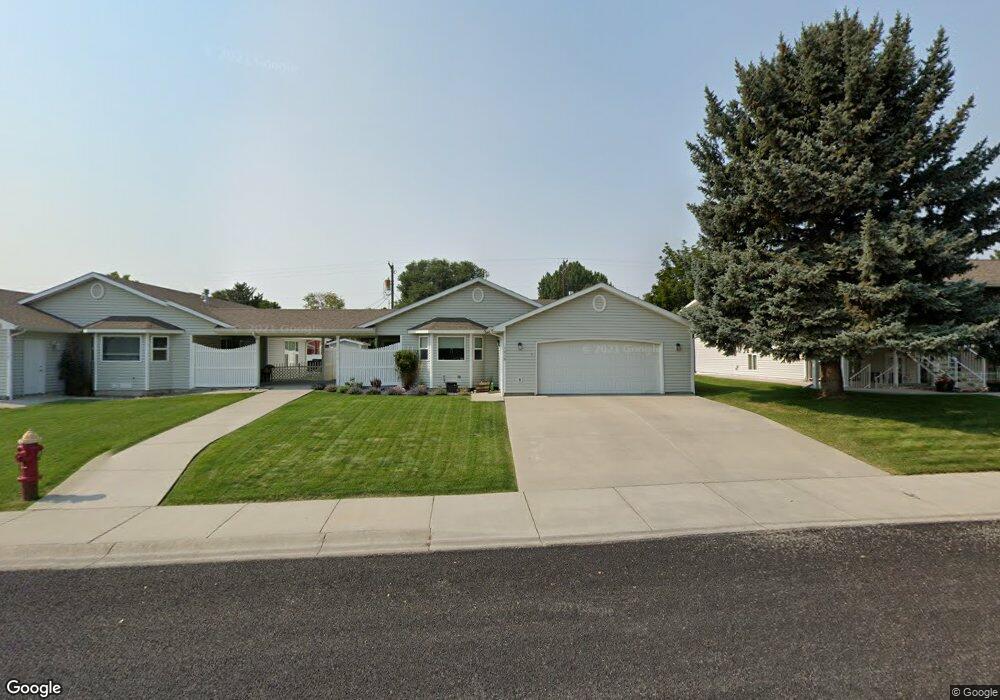
1018 Montana Ave Laurel, MT 59044
Estimated Value: $272,000 - $311,000
2
Beds
2
Baths
1,216
Sq Ft
$241/Sq Ft
Est. Value
About This Home
This home is located at 1018 Montana Ave, Laurel, MT 59044 and is currently estimated at $293,002, approximately $240 per square foot. 1018 Montana Ave is a home located in Yellowstone County with nearby schools including Fred W. Graff School, West School, and Laurel Middle School.
Ownership History
Date
Name
Owned For
Owner Type
Purchase Details
Closed on
Oct 9, 2009
Sold by
Hergett Vic and Hergett Evelyn
Bought by
Sands Terrence and Sands Carol Ann
Current Estimated Value
Home Financials for this Owner
Home Financials are based on the most recent Mortgage that was taken out on this home.
Original Mortgage
$118,450
Interest Rate
5.02%
Mortgage Type
New Conventional
Purchase Details
Closed on
Sep 25, 2009
Sold by
Horning Cheryl L and Kenyon Vicki Y
Bought by
Hergett Vic and Hergett Evelyn
Home Financials for this Owner
Home Financials are based on the most recent Mortgage that was taken out on this home.
Original Mortgage
$118,450
Interest Rate
5.02%
Mortgage Type
New Conventional
Purchase Details
Closed on
Dec 17, 2004
Sold by
Hergett Vic and Hergett Evelyn
Bought by
Hergett Vic and Hergett Evelyn
Create a Home Valuation Report for This Property
The Home Valuation Report is an in-depth analysis detailing your home's value as well as a comparison with similar homes in the area
Home Values in the Area
Average Home Value in this Area
Purchase History
| Date | Buyer | Sale Price | Title Company |
|---|---|---|---|
| Sands Terrence | -- | None Available | |
| Hergett Vic | -- | None Available | |
| Hergett Vic | -- | None Available |
Source: Public Records
Mortgage History
| Date | Status | Borrower | Loan Amount |
|---|---|---|---|
| Previous Owner | Sands Terrence | $118,450 |
Source: Public Records
Tax History Compared to Growth
Tax History
| Year | Tax Paid | Tax Assessment Tax Assessment Total Assessment is a certain percentage of the fair market value that is determined by local assessors to be the total taxable value of land and additions on the property. | Land | Improvement |
|---|---|---|---|---|
| 2025 | $692 | $294,300 | $39,624 | $254,676 |
| 2024 | $692 | $298,770 | $66,540 | $232,230 |
| 2023 | $1,068 | $265,500 | $33,270 | $232,230 |
| 2022 | $1,125 | $207,800 | $0 | $0 |
| 2021 | $1,134 | $207,800 | $0 | $0 |
| 2020 | $984 | $177,400 | $0 | $0 |
| 2019 | $999 | $177,400 | $0 | $0 |
| 2018 | $994 | $179,300 | $0 | $0 |
| 2017 | $454 | $179,300 | $0 | $0 |
| 2016 | $1,130 | $166,100 | $0 | $0 |
| 2015 | $1,082 | $160,100 | $0 | $0 |
| 2014 | $1,195 | $94,923 | $0 | $0 |
Source: Public Records
Map
Nearby Homes
- 1003 Montana Ave
- 109 E 12th St
- 403 Grandview Blvd
- 516 Pennsylvania Ave
- 110 E 5th St
- 1336 Pennsylvania Ave
- 512 W 14th St
- 1036 9th Ave
- 717 E 5th, 506 Alder Ave
- 1109 10th Ave
- 1004 E 8th St
- 801 E 4th St
- 802-816 Date Ave
- 1006 Sunhaven Dr
- 1008 Sunhaven Dr
- 1013 W 12th St
- 116 4th Ave
- 810 Piper Loop
- 1106 W 12th St
- 1104 E 8th St
- 1016 Montana Ave
- 1006 Montana Ave
- 1017 Montana Ave
- 1015 1st Ave
- 1013 Montana Ave
- 1041 Montana Ave
- 1019 Montana Ave
- 1011 Montana Ave
- 1011 1st Ave
- 1043 Montana Ave
- 1015 Montana Ave
- 1007 1st Ave
- 1045 Montana Ave
- 1047 Montana Ave
- 115 E Maryland Ln
- 1009 Montana Ave
- 1049 Montana Ave
- 1051 Montana Ave
- 1053 Montana Ave
- 1055 Montana Ave