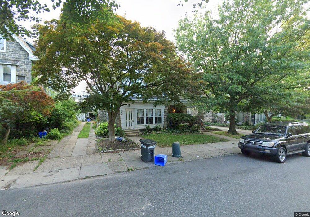
1018 N 64th St Philadelphia, PA 19151
Overbrook NeighborhoodEstimated Value: $330,000 - $370,000
--
Bed
--
Bath
2,147
Sq Ft
$165/Sq Ft
Est. Value
About This Home
This home is located at 1018 N 64th St, Philadelphia, PA 19151 and is currently estimated at $353,348, approximately $164 per square foot. 1018 N 64th St is a home located in Philadelphia County with nearby schools including Overbrook High School, Ad Prima Charter School, and Harambee Institute of Science and Techno.
Ownership History
Date
Name
Owned For
Owner Type
Purchase Details
Closed on
Aug 17, 2007
Sold by
Long Robin S and Mcdonald Gregory T
Bought by
Mcdonald Gregory T and Roundtree Mcdonald Janelle A
Current Estimated Value
Purchase Details
Closed on
Mar 21, 2007
Sold by
Long Robin S and Mcdonald Gregory T
Bought by
Long Robin S and Mcdonald Gregory T
Purchase Details
Closed on
Jan 2, 2007
Sold by
Long Robin S and Mcdonald Gurcina L
Bought by
Long Robin S and Mcdonald Gregory T
Purchase Details
Closed on
Aug 17, 2006
Sold by
Long Robin S
Bought by
Long Robin S and Mcdonald Gurcina L
Purchase Details
Closed on
Dec 22, 2000
Sold by
Roselli Angelina and Roselli Philip
Bought by
Long Robin S
Create a Home Valuation Report for This Property
The Home Valuation Report is an in-depth analysis detailing your home's value as well as a comparison with similar homes in the area
Home Values in the Area
Average Home Value in this Area
Purchase History
| Date | Buyer | Sale Price | Title Company |
|---|---|---|---|
| Mcdonald Gregory T | $38,240 | First American Title Insuran | |
| Long Robin S | -- | None Available | |
| Long Robin S | -- | None Available | |
| Long Robin S | -- | None Available | |
| Long Robin S | $98,000 | Security Search & Abstract C |
Source: Public Records
Tax History Compared to Growth
Tax History
| Year | Tax Paid | Tax Assessment Tax Assessment Total Assessment is a certain percentage of the fair market value that is determined by local assessors to be the total taxable value of land and additions on the property. | Land | Improvement |
|---|---|---|---|---|
| 2025 | $3,557 | $304,700 | $60,940 | $243,760 |
| 2024 | $3,557 | $304,700 | $60,940 | $243,760 |
| 2023 | $3,557 | $254,100 | $50,820 | $203,280 |
| 2022 | $1,947 | $209,100 | $50,820 | $158,280 |
| 2021 | $2,577 | $0 | $0 | $0 |
| 2020 | $2,577 | $0 | $0 | $0 |
| 2019 | $2,485 | $0 | $0 | $0 |
| 2018 | $2,839 | $0 | $0 | $0 |
| 2017 | $2,839 | $0 | $0 | $0 |
| 2016 | $2,419 | $0 | $0 | $0 |
| 2015 | $2,316 | $0 | $0 | $0 |
| 2014 | -- | $202,800 | $24,894 | $177,906 |
| 2012 | -- | $21,728 | $4,261 | $17,467 |
Source: Public Records
Map
Nearby Homes
- 6345 Lebanon Ave
- 925 Marlyn Rd
- 1200 N 64th St
- 6528 Lebanon Ave
- 1165 Atwood Rd
- 853 Wynnewood Rd
- 947 N 66th St
- 1210 Atwood Rd
- 1243 N 65th St
- 1258 N 64th St
- 924 N 66th St
- 1004 N 66th St
- 1122 26 N 63rd St
- 6146 W Columbia Ave
- 1746 N 62nd St
- 6136 W Oxford St
- 6618 Malvern Ave
- 6452 Lansdowne Ave
- 6137 W Jefferson St
- 6158 Lebanon Ave
- 1020 N 64th St
- 1016 N 64th St
- 1014 N 64th St
- 1014 N 64th St Unit 2
- 1014 N 64th St Unit 1
- 1022 N 64th St
- 1012 N 64th St
- 1025 Marlyn Rd
- 1027 Marlyn Rd
- 1029 Marlyn Rd
- 1010 N 64th St
- 1023 Marlyn Rd
- 1021 Marlyn Rd
- 1019 Marlyn Rd
- 1008 N 64th St
- 1017 Marlyn Rd
- 1015 Marlyn Rd
- 1006 N 64th St
- 1013 Marlyn Rd
- 1019 N 64th St