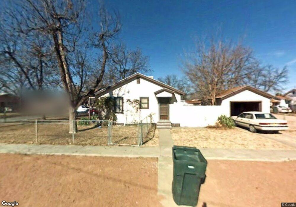
1018 N Main St Carlsbad, NM 88220
Estimated Value: $150,418 - $184,000
--
Bed
--
Bath
768
Sq Ft
$215/Sq Ft
Est. Value
About This Home
This home is located at 1018 N Main St, Carlsbad, NM 88220 and is currently estimated at $164,855, approximately $214 per square foot. 1018 N Main St is a home located in Eddy County with nearby schools including Sunset Elementary School, Carlsbad Intermediate School - PR Leyva Campus, and Carlsbad High School.
Ownership History
Date
Name
Owned For
Owner Type
Purchase Details
Closed on
Jan 27, 2020
Sold by
Mccormick Ronald D
Bought by
Sierra Ibed M and Echaverria David Roman
Current Estimated Value
Purchase Details
Closed on
Aug 13, 2018
Sold by
Mccormick Delbert N and Mccormick Carlene M
Bought by
Mccormick Ronald D
Purchase Details
Closed on
Nov 13, 2012
Sold by
Kaiser Stephen L
Bought by
Mccormick Delbert N and Mccormick Carlene
Home Financials for this Owner
Home Financials are based on the most recent Mortgage that was taken out on this home.
Original Mortgage
$72,000
Interest Rate
3.37%
Mortgage Type
New Conventional
Purchase Details
Closed on
Aug 3, 2009
Sold by
Philpott Annabelle
Bought by
Kaiser Stephen L
Home Financials for this Owner
Home Financials are based on the most recent Mortgage that was taken out on this home.
Original Mortgage
$63,500
Interest Rate
5.41%
Mortgage Type
New Conventional
Create a Home Valuation Report for This Property
The Home Valuation Report is an in-depth analysis detailing your home's value as well as a comparison with similar homes in the area
Home Values in the Area
Average Home Value in this Area
Purchase History
| Date | Buyer | Sale Price | Title Company |
|---|---|---|---|
| Sierra Ibed M | -- | None Available | |
| Mccormick Ronald D | -- | None Available | |
| Mccormick Delbert N | -- | Guaranty Title Co | |
| Kaiser Stephen L | -- | Guaranty Title Co |
Source: Public Records
Mortgage History
| Date | Status | Borrower | Loan Amount |
|---|---|---|---|
| Previous Owner | Mccormick Delbert N | $72,000 | |
| Previous Owner | Kaiser Stephen L | $63,500 |
Source: Public Records
Tax History Compared to Growth
Tax History
| Year | Tax Paid | Tax Assessment Tax Assessment Total Assessment is a certain percentage of the fair market value that is determined by local assessors to be the total taxable value of land and additions on the property. | Land | Improvement |
|---|---|---|---|---|
| 2025 | $703 | $28,605 | $2,708 | $25,897 |
| 2024 | $691 | $27,772 | $2,708 | $25,064 |
| 2023 | $691 | $28,121 | $2,708 | $25,413 |
| 2022 | $705 | $28,572 | $2,708 | $25,864 |
| 2021 | $682 | $27,740 | $2,708 | $25,032 |
| 2020 | $674 | $26,534 | $2,708 | $23,826 |
Source: Public Records
Map
Nearby Homes
- 208 Vine St
- 302 Glendale St
- 310 Glendale St
- 307 E Blodgett St
- 1105 N Main St
- 402 Rosedale St
- 919 N Alameda St
- 1108 N Guadalupe St
- 414 Mariposa St
- 405 Mariposa St
- 912 N Mesquite St
- 711 N Guadalupe St
- 1020 N Mesa St
- 809 Colonial Ct
- 613 N Mesquite St
- 1003 N Edwards St
- 1401 Glasier Dr
- 904 W Riverside Dr
- 1115 N Ural Dr
- 1313 Doepp Dr
- 1020 N Main St
- 1016 Sunset Cir
- 1006 N Main St
- 1022 N Main St
- 1022 N Francis St
- 101 W Francis St
- 1014 Sunset Cir
- 1012 Sunset Cir
- 1011 N Main St
- 1024 N Francis St
- 1010 Sunset Cir
- 1008 Sunset Cir
- 1004 N Main St
- 103 W Francis St
- 1005 N Main St
- 1026 N Francis St
- 1024 N Main St
- 105 W Francis St
- 1025 N Francis St
- 104 E Blodgett St