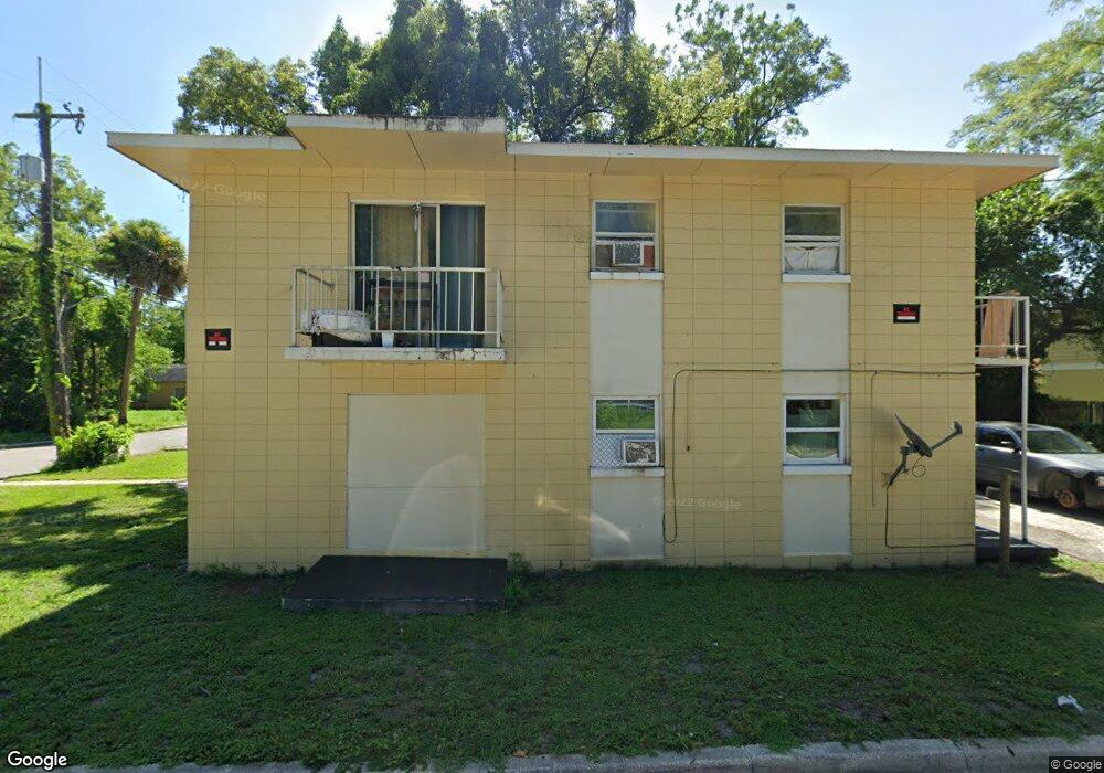
1018 Randall St Orlando, FL 32805
Parramore NeighborhoodEstimated Value: $246,000 - $269,000
4
Beds
2
Baths
1,746
Sq Ft
$149/Sq Ft
Est. Value
About This Home
This home is located at 1018 Randall St, Orlando, FL 32805 and is currently estimated at $259,576, approximately $148 per square foot. 1018 Randall St is a home located in Orange County with nearby schools including OCPS Academic Center for Excellence, Jones High School, and Harvest Baptist Christian Academy.
Ownership History
Date
Name
Owned For
Owner Type
Purchase Details
Closed on
Aug 16, 2016
Sold by
Randall St Land Trust 1018
Bought by
The Brothers Investment Llc
Current Estimated Value
Purchase Details
Closed on
Jun 10, 2016
Sold by
Bmack Investments Llc
Bought by
Randall St Land Trust and Martin Antonio G
Purchase Details
Closed on
Jun 1, 2016
Bought by
Brothers Investment Llc
Purchase Details
Closed on
Mar 21, 2005
Sold by
Spalding Brendon E
Bought by
Bmack Investments Llc
Purchase Details
Closed on
Feb 18, 2005
Sold by
Bmack Investments Inc
Bought by
Spalding Brendon E
Purchase Details
Closed on
Apr 30, 2004
Sold by
Spalding Brendon E
Bought by
Bmack Investments Llc
Purchase Details
Closed on
Jun 17, 2003
Sold by
Schneider Vernon A and Schneider Audrey J
Bought by
Seminole Housing Authority Llc
Create a Home Valuation Report for This Property
The Home Valuation Report is an in-depth analysis detailing your home's value as well as a comparison with similar homes in the area
Home Values in the Area
Average Home Value in this Area
Purchase History
| Date | Buyer | Sale Price | Title Company |
|---|---|---|---|
| The Brothers Investment Llc | $30,000 | Attorney | |
| Randall St Land Trust | -- | Attorney | |
| Brothers Investment Llc | $100 | -- | |
| Bmack Investments Llc | -- | -- | |
| Spalding Brendon E | -- | -- | |
| Bmack Investments Llc | -- | -- | |
| Seminole Housing Authority Llc | $125,000 | -- |
Source: Public Records
Tax History Compared to Growth
Tax History
| Year | Tax Paid | Tax Assessment Tax Assessment Total Assessment is a certain percentage of the fair market value that is determined by local assessors to be the total taxable value of land and additions on the property. | Land | Improvement |
|---|---|---|---|---|
| 2025 | $1,829 | $80,698 | -- | -- |
| 2024 | $1,568 | $80,698 | -- | -- |
| 2023 | $1,568 | $112,614 | $38,000 | $74,614 |
| 2022 | $1,427 | $100,726 | $38,000 | $62,726 |
| 2021 | $1,289 | $85,475 | $35,000 | $50,475 |
| 2020 | $1,198 | $86,519 | $35,000 | $51,519 |
| 2019 | $1,046 | $62,391 | $35,000 | $27,391 |
| 2018 | $931 | $51,607 | $26,000 | $25,607 |
| 2017 | $792 | $37,646 | $12,100 | $25,546 |
| 2016 | $691 | $34,157 | $9,500 | $24,657 |
| 2015 | $665 | $33,189 | $9,500 | $23,689 |
| 2014 | $665 | $35,591 | $18,000 | $17,591 |
Source: Public Records
Map
Nearby Homes
- 1017 Randall St
- 1013 Randall St
- 1025 Colyer St Unit A/B
- 1029 Colyer St
- 509 Grove Ave
- 811 Colyer St
- 433 S Lee Ave
- 0 Easy Ave
- 727 Quill Ave
- 440 Mcfall Ave
- 724 Grove Ave
- 1232 Conley St
- 1202 Cypress St
- 1023 W Gore St
- 1122 Dewitt Dr
- 544 Murphy St
- 107 Garden Ave
- 907 Columbia St
- 222 N Parramore Ave
- 1018 Mack Ave
- 440 Albany Ave
- 1016 Randall St
- 1021 W Anderson St
- 1019 W Anderson St
- 1025 W Anderson St
- 1026 W Anderson St
- 1021 Randall St
- 1015 W Anderson St
- 500 Albany Ave
- 1025 Randall St
- 1027 Randall St
- 1032 Randall St
- 1011 W Anderson St
- 1011 Randall St
- 1031 W Anderson St
- 1007 W Anderson St
- 1009 Randall St
- 1035 W Anderson St
- 1031 Randall St
- 1020 Colyer St