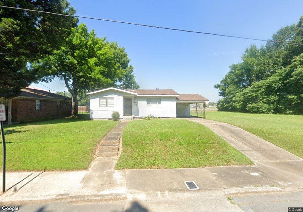
1018 S Missouri St Pine Bluff, AR 71601
Estimated Value: $37,000 - $60,000
Studio
1
Bath
722
Sq Ft
$66/Sq Ft
Est. Value
About This Home
This home is located at 1018 S Missouri St, Pine Bluff, AR 71601 and is currently estimated at $47,857, approximately $66 per square foot. 1018 S Missouri St is a home located in Jefferson County with nearby schools including Matthews Elementary School, Dollarway High School, and Hope Academy.
Ownership History
Date
Name
Owned For
Owner Type
Purchase Details
Closed on
Feb 21, 1989
Bought by
Goins John W and Goins Wf
Current Estimated Value
Purchase Details
Closed on
Nov 7, 1988
Bought by
Admin Of Veterans Affairs
Purchase Details
Closed on
Aug 18, 1988
Bought by
Simmons First National Bank
Purchase Details
Closed on
Apr 24, 1987
Bought by
Wilber Robert Earl
Purchase Details
Closed on
Jan 1, 1910
Bought by
Wilbur Robert Earl
Create a Home Valuation Report for This Property
The Home Valuation Report is an in-depth analysis detailing your home's value as well as a comparison with similar homes in the area
Purchase History
| Date | Buyer | Sale Price | Title Company |
|---|---|---|---|
| Goins John W | $5,500 | -- | |
| Admin Of Veterans Affairs | -- | -- | |
| Simmons First National Bank | -- | -- | |
| Wilber Robert Earl | -- | -- | |
| Wilbur Robert Earl | -- | -- |
Source: Public Records
Tax History
| Year | Tax Paid | Tax Assessment Tax Assessment Total Assessment is a certain percentage of the fair market value that is determined by local assessors to be the total taxable value of land and additions on the property. | Land | Improvement |
|---|---|---|---|---|
| 2025 | $231 | $4,250 | $660 | $3,590 |
| 2024 | $214 | $4,250 | $660 | $3,590 |
| 2023 | $197 | $4,250 | $660 | $3,590 |
| 2022 | $163 | $2,640 | $400 | $2,240 |
| 2021 | $161 | $2,640 | $400 | $2,240 |
| 2020 | $149 | $2,640 | $400 | $2,240 |
| 2019 | $138 | $2,640 | $400 | $2,240 |
| 2018 | $125 | $2,640 | $400 | $2,240 |
| 2017 | $116 | $1,860 | $400 | $1,460 |
| 2016 | $115 | $1,860 | $400 | $1,460 |
| 2015 | $110 | $1,860 | $400 | $1,460 |
| 2014 | -- | $1,860 | $400 | $1,460 |
Source: Public Records
Map
Nearby Homes
- 1120 E 8th Ave
- 812 S Nebraska St
- .18 Acre E 6th Ave
- 919 S Nebraska St
- 600 E 17th Ave
- 1200 S Walnut St Unit 1202
- 817 S Walnut St
- 1019 S Olive St
- 716 S Walnut St
- 1307 S Dakota St
- 1509 S Walnut St
- 1307 S Laurel St
- 1313 S Laurel St
- 917 E 2nd Ave
- 210 W 18th Ave
- 808 W 15th Ave
- 00 NE Corner Hwy 65 425-81
- 00
- 000 S 65 Hwy
- 1926 S Olive St
- 1014 S Missouri St
- 1020 S Missouri St
- 1024 S Missouri St
- 1011 S Missouri St
- 1009 S Missouri St
- 1004 S Missouri St
- 817 E 11th Ave Unit 819
- 1000 S Missouri St
- 1111 S Missouri St
- 1001 S Missouri St
- 1105 S Louisiana St
- 1006 S Virginia St
- 1100 S Louisiana St
- 1002 S Virginia St
- 812 E 10th Ave
- 1107 S Louisiana St
- 814 E 10th Ave
- 1102 S Louisiana St
- E E 11th Ave
- 1000 S Virginia St
Your Personal Tour Guide
Ask me questions while you tour the home.