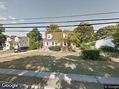
1018 Udall Rd West Islip, NY 11795
West Islip NeighborhoodEstimated Value: $545,273 - $579,000
--
Bed
--
Bath
--
Sq Ft
0.3
Acres
About This Home
This home is located at 1018 Udall Rd, West Islip, NY 11795 and is currently estimated at $562,137. 1018 Udall Rd is a home located in Suffolk County with nearby schools including Manetuck Elementary School, Udall Road Middle School, and West Islip Senior High School.
Ownership History
Date
Name
Owned For
Owner Type
Purchase Details
Closed on
Oct 31, 2007
Current Estimated Value
Purchase Details
Closed on
Apr 24, 2003
Sold by
Morra Thomas C and Schiavo Mary B
Bought by
Morra Thomas C and Morra Debbie
Home Financials for this Owner
Home Financials are based on the most recent Mortgage that was taken out on this home.
Original Mortgage
$207,000
Interest Rate
5.86%
Mortgage Type
Purchase Money Mortgage
Purchase Details
Closed on
Apr 13, 2000
Sold by
Boylan Daniel T
Bought by
Morra Thomas C and Schiavo Mary B
Home Financials for this Owner
Home Financials are based on the most recent Mortgage that was taken out on this home.
Original Mortgage
$166,250
Interest Rate
8.21%
Mortgage Type
Purchase Money Mortgage
Purchase Details
Closed on
Jan 24, 1994
Sold by
Boylan Daniel T and Boylan Patrick J
Bought by
Boylan Daniel T
Create a Home Valuation Report for This Property
The Home Valuation Report is an in-depth analysis detailing your home's value as well as a comparison with similar homes in the area
Home Values in the Area
Average Home Value in this Area
Purchase History
| Date | Buyer | Sale Price | Title Company |
|---|---|---|---|
| -- | -- | -- | |
| Morra Thomas C | -- | -- | |
| Morra Thomas C | $175,000 | -- |
Source: Public Records
Mortgage History
| Date | Status | Borrower | Loan Amount |
|---|---|---|---|
| Previous Owner | Morra Thomas C | $207,000 | |
| Previous Owner | Morra Thomas C | $166,250 |
Source: Public Records
Tax History Compared to Growth
Tax History
| Year | Tax Paid | Tax Assessment Tax Assessment Total Assessment is a certain percentage of the fair market value that is determined by local assessors to be the total taxable value of land and additions on the property. | Land | Improvement |
|---|---|---|---|---|
| 2023 | -- | $38,300 | $8,000 | $30,300 |
| 2022 | $9,004 | $38,300 | $8,000 | $30,300 |
| 2021 | $9,004 | $38,300 | $8,000 | $30,300 |
| 2020 | $9,534 | $38,300 | $8,000 | $30,300 |
| 2019 | $9,534 | $0 | $0 | $0 |
| 2018 | -- | $38,300 | $8,000 | $30,300 |
| 2017 | $8,991 | $38,300 | $8,000 | $30,300 |
| 2016 | $8,952 | $38,300 | $8,000 | $30,300 |
| 2015 | -- | $38,300 | $8,000 | $30,300 |
| 2014 | -- | $38,300 | $8,000 | $30,300 |
Source: Public Records
Map
Nearby Homes
- 1017 Fire Island Ave
- 498 Kime Ave
- 532 Bellmore St
- 1052 Bay Shore Ave
- 12 Stewart St
- 878 Udall Rd
- 900 Bay Shore Ave
- 871 Ocean Ave
- 1069 Reilly St
- 74 Webster Ave
- 96 Toomey Rd
- 553 Rockaway St
- 24 Haynes Ave
- 28 W Oakdale St
- 78 Leopold Ave
- 1063 Gridley St
- 75 Harvest Ln
- 1069 Brookdale Ave
- 30 W Belmont St
- 406 Howells Rd
- 1018 Udall Rd
- 158 Altmar Ave
- 1016 Udall Rd
- 154 Altmar Ave
- 1019 Udall Rd
- 150 Altmar Ave
- 1017 Udall Rd
- 157 Altmar Ave
- 1023 Udall Rd
- 153 Altmar Ave
- 146 Altmar Ave
- 570 Kime Ave
- 117 Watts Place
- 149 Altmar Ave
- 1028 Udall Rd
- 1011 Udall Rd
- 1020 Fire Island Ave
- 1018 Fire Island Ave
- 1022 Fire Island Ave
- 1026 Fire Island Ave