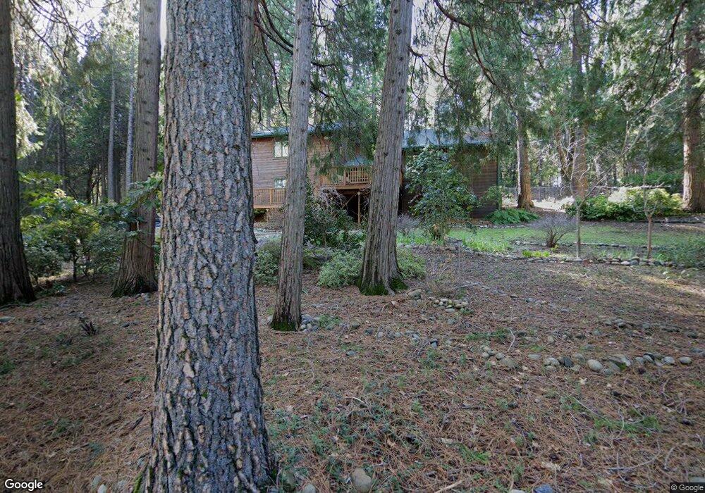
10185 Pittsburg Rd Nevada City, CA 95959
Estimated Value: $637,904 - $746,000
3
Beds
2
Baths
2,343
Sq Ft
$297/Sq Ft
Est. Value
About This Home
This home is located at 10185 Pittsburg Rd, Nevada City, CA 95959 and is currently estimated at $696,476, approximately $297 per square foot. 10185 Pittsburg Rd is a home located in Nevada County with nearby schools including Deer Creek Elementary School, Seven Hills Intermediate School, and Twin Ridges Home Study Charter School.
Ownership History
Date
Name
Owned For
Owner Type
Purchase Details
Closed on
Mar 13, 2015
Sold by
Label Norman and Label Donna
Bought by
Norman & Donna Faye Family 1985 Revocabl
Current Estimated Value
Home Financials for this Owner
Home Financials are based on the most recent Mortgage that was taken out on this home.
Original Mortgage
$337,500
Interest Rate
3.54%
Mortgage Type
New Conventional
Create a Home Valuation Report for This Property
The Home Valuation Report is an in-depth analysis detailing your home's value as well as a comparison with similar homes in the area
Home Values in the Area
Average Home Value in this Area
Purchase History
| Date | Buyer | Sale Price | Title Company |
|---|---|---|---|
| Norman & Donna Faye Family 1985 Revocabl | -- | Accommodation | |
| Label Norman | -- | First American Title Company |
Source: Public Records
Mortgage History
| Date | Status | Borrower | Loan Amount |
|---|---|---|---|
| Closed | Label Norman | $337,500 |
Source: Public Records
Tax History Compared to Growth
Tax History
| Year | Tax Paid | Tax Assessment Tax Assessment Total Assessment is a certain percentage of the fair market value that is determined by local assessors to be the total taxable value of land and additions on the property. | Land | Improvement |
|---|---|---|---|---|
| 2025 | $4,603 | $431,299 | $64,010 | $367,289 |
| 2024 | $4,511 | $422,843 | $62,755 | $360,088 |
| 2023 | $4,511 | $414,553 | $61,525 | $353,028 |
| 2022 | $4,417 | $406,425 | $60,319 | $346,106 |
| 2021 | $4,298 | $386,457 | $59,137 | $327,320 |
| 2020 | $4,161 | $382,495 | $58,531 | $323,964 |
| 2019 | $4,075 | $374,996 | $57,384 | $317,612 |
| 2018 | $3,994 | $367,644 | $56,259 | $311,385 |
| 2017 | $3,915 | $360,436 | $55,156 | $305,280 |
| 2016 | $3,772 | $353,370 | $54,075 | $299,295 |
| 2015 | $3,717 | $348,063 | $53,263 | $294,800 |
| 2014 | -- | $341,246 | $52,220 | $289,026 |
Source: Public Records
Map
Nearby Homes
- 12766 Nevada City Hwy
- 11021 Pittsburg Mine Rd
- 2300 Nevada City Hwy
- 306 Lone Jack Ct Unit 24
- 111 Lone Jack Ct
- 104 Perseverance Mine Ct
- 202 Gold Flat Rd
- 181 Bost Ave
- 607 Cold Spring Ct
- 506 Liberty Ct
- 614 Cold Spring Ct
- 606 Cold Spring Ct
- 611 Cold Spring Ct
- 605 Cold Spring Ct
- 136 Jackrabbit Rd
- 114 Jackrabbit Rd
- 118 Jackrabbit Rd
- 106 Jackrabbit Rd
- 110 Jackrabbit Rd
- 122 Jackrabbit Rd
- 10221 Pittsburg Rd
- 10161 Pittsburg Rd
- 10248 Banner Lava Cap Rd
- 10290 Pittsburg Rd
- 10103 Pittsburg Rd
- 10098 Pittsburg Rd
- 10304 Banner Lava Cap Rd
- 12528 Old French Rd
- 12466 Old French Rd
- 12481 Old French Rd
- 12530 Old French Rd
- 10259 Banner Lava Cap Rd
- 10340 Banner Lava Cap Rd
- 10193 Banner Lava Cap Rd
- 12081 Ore de Gold Ct