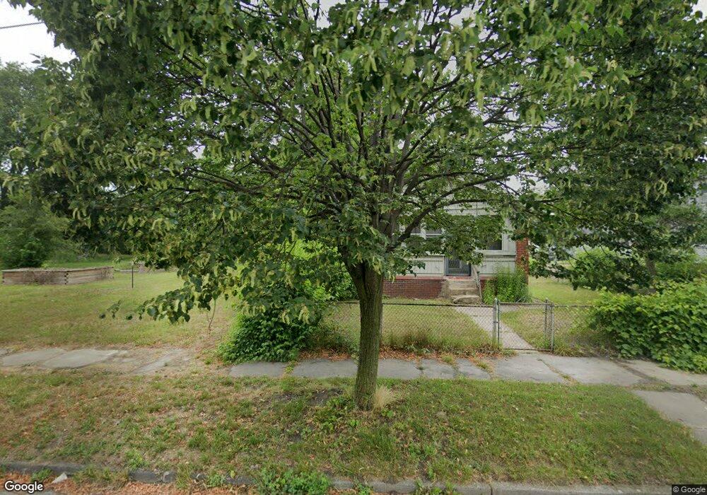
1019 Heston St Toledo, OH 43607
ONYX NeighborhoodEstimated Value: $94,000
--
Bed
--
Bath
--
Sq Ft
3,485
Sq Ft Lot
About This Home
This home is located at 1019 Heston St, Toledo, OH 43607 and is currently priced at $94,000. 1019 Heston St is a home located in Lucas County with nearby schools including Pickett Elementary School, Jesup W. Scott High School, and Explorers Academy.
Ownership History
Date
Name
Owned For
Owner Type
Purchase Details
Closed on
May 9, 2017
Sold by
Toledo City Of An Ohio Municipal Corpora
Bought by
Lucas County Land Reutilization Cor
Current Estimated Value
Purchase Details
Closed on
Jan 3, 2017
Sold by
The Lucas County Land Reutilization Corp
Bought by
City Of Toledo
Purchase Details
Closed on
Jan 26, 2015
Sold by
Secrest Properties
Bought by
Lucas County Land Reutilization Corp
Purchase Details
Closed on
Apr 16, 2013
Sold by
Rehner Andrew
Bought by
Secrest Properties Llc
Purchase Details
Closed on
Nov 17, 2004
Sold by
Hud
Bought by
Secrest Properties and Secrest Andrew Rehner
Purchase Details
Closed on
Jan 8, 1999
Sold by
Gertha Kyle
Bought by
Hud
Create a Home Valuation Report for This Property
The Home Valuation Report is an in-depth analysis detailing your home's value as well as a comparison with similar homes in the area
Home Values in the Area
Average Home Value in this Area
Purchase History
| Date | Buyer | Sale Price | Title Company |
|---|---|---|---|
| Lucas County Land Reutilization Cor | -- | -- | |
| City Of Toledo | -- | None Available | |
| Lucas County Land Reutilization Corp | -- | None Available | |
| Secrest Properties Llc | -- | None Available | |
| Secrest Properties | $600 | Lakeside Title & Escrow Agen | |
| Hud | -- | -- |
Source: Public Records
Tax History Compared to Growth
Tax History
| Year | Tax Paid | Tax Assessment Tax Assessment Total Assessment is a certain percentage of the fair market value that is determined by local assessors to be the total taxable value of land and additions on the property. | Land | Improvement |
|---|---|---|---|---|
| 2024 | -- | $140 | $140 | -- |
| 2023 | $0 | $140 | $140 | $0 |
| 2022 | $0 | $140 | $140 | $0 |
| 2021 | $0 | $140 | $140 | $0 |
| 2020 | $0 | $105 | $105 | $0 |
| 2019 | $8 | $105 | $105 | $0 |
| 2018 | $0 | $105 | $105 | $0 |
| 2017 | $0 | $105 | $105 | $0 |
| 2016 | $0 | $300 | $300 | $0 |
| 2015 | $128 | $300 | $300 | $0 |
| 2014 | $11 | $110 | $110 | $0 |
| 2013 | $7 | $110 | $110 | $0 |
Source: Public Records
Map
Nearby Homes
- 834 N Detroit Ave
- 901 N Detroit Ave
- 1267 Nebraska Ave
- 1255 Nebraska Ave
- 1434 Nebraska Ave
- 1133 Blum St
- 1422 Tecumseh St
- 1264 Fernwood Ave
- 635 N Detroit Ave
- 1123 Hamilton St
- 1627 Fernwood Ave
- 1063 Norwood Ave
- 910 Blum St
- 820 N Miller St
- 1222 Lincoln Ave
- 1401 Foster Ave
- 1510 Lincoln Ave
- 929 Norwood Ave
- 927 Norwood Ave
- 1211 Manila St
- 1007 Heston St
- 1001 Heston St
- 934 Heston St
- 930 Heston St
- 1008 Heston St
- 927 Heston St
- 926 Heston St
- 1010 Heston St
- 923 Heston St
- 1013 Heston St
- 919 Heston St
- 1314 Indiana Ave
- 1315 Indiana Ave
- 1017 Heston St
- 1259 Indiana Ave
- 1018 Heston St
- 916 Heston St
- 1318 Indiana Ave
- 1255 Indiana Ave
- 1020 Heston St