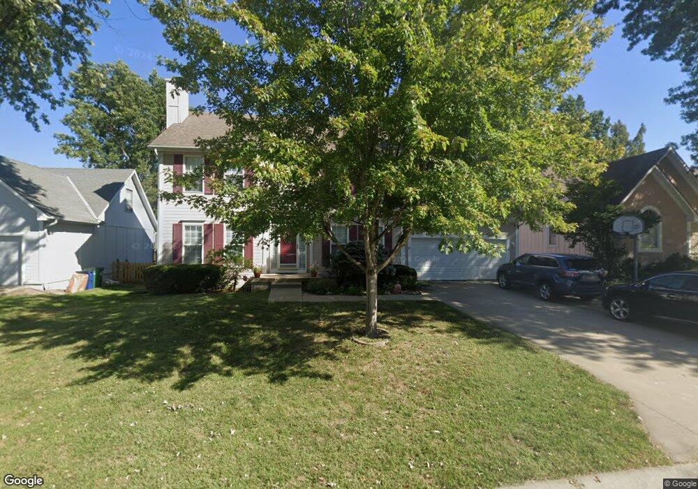
1019 SE Dover Dr Lees Summit, MO 64081
Estimated Value: $364,942 - $411,000
4
Beds
3
Baths
2,022
Sq Ft
$191/Sq Ft
Est. Value
About This Home
This home is located at 1019 SE Dover Dr, Lees Summit, MO 64081 and is currently estimated at $386,736, approximately $191 per square foot. 1019 SE Dover Dr is a home located in Jackson County with nearby schools including Sunset Valley Elementary School, Pleasant Lea Middle School, and Lee's Summit Senior High School.
Ownership History
Date
Name
Owned For
Owner Type
Purchase Details
Closed on
Dec 19, 2011
Sold by
Eubank Betty P
Bought by
Eubank David F and Eubank Josefina Q
Current Estimated Value
Home Financials for this Owner
Home Financials are based on the most recent Mortgage that was taken out on this home.
Original Mortgage
$150,000
Outstanding Balance
$102,709
Interest Rate
4.03%
Mortgage Type
Seller Take Back
Estimated Equity
$284,027
Purchase Details
Closed on
May 27, 2010
Sold by
Ford Ryan and Ford Julie
Bought by
Eubank Betty P and Eubank David F
Purchase Details
Closed on
Aug 28, 2001
Sold by
Brennan & Sons Inc
Bought by
Ford Ryan and Ford Julie
Home Financials for this Owner
Home Financials are based on the most recent Mortgage that was taken out on this home.
Original Mortgage
$116,490
Interest Rate
7.07%
Mortgage Type
Purchase Money Mortgage
Purchase Details
Closed on
May 11, 2001
Sold by
Ford Ryan J and Ford Julie L
Bought by
Brennan & Sons Inc
Purchase Details
Closed on
Feb 15, 2001
Sold by
Putnam Dennis E and Putnam Marilyn A
Bought by
Ford Ryan J and Ford Julie L
Create a Home Valuation Report for This Property
The Home Valuation Report is an in-depth analysis detailing your home's value as well as a comparison with similar homes in the area
Home Values in the Area
Average Home Value in this Area
Purchase History
| Date | Buyer | Sale Price | Title Company |
|---|---|---|---|
| Eubank David F | -- | None Available | |
| Eubank Betty P | -- | First American Title Ins Co | |
| Ford Ryan | -- | Chicago Title Co | |
| Brennan & Sons Inc | -- | Columbian National Title | |
| Ford Ryan J | -- | Coffelt Land Title |
Source: Public Records
Mortgage History
| Date | Status | Borrower | Loan Amount |
|---|---|---|---|
| Open | Eubank David F | $150,000 | |
| Previous Owner | Ford Ryan | $116,490 |
Source: Public Records
Tax History
| Year | Tax Paid | Tax Assessment Tax Assessment Total Assessment is a certain percentage of the fair market value that is determined by local assessors to be the total taxable value of land and additions on the property. | Land | Improvement |
|---|---|---|---|---|
| 2025 | $3,655 | $55,782 | $8,556 | $47,226 |
| 2024 | $3,628 | $50,618 | $7,458 | $43,160 |
| 2023 | $3,628 | $50,618 | $6,473 | $44,145 |
| 2022 | $3,405 | $42,180 | $7,686 | $34,494 |
| 2021 | $3,475 | $42,180 | $7,686 | $34,494 |
| 2020 | $3,335 | $40,085 | $7,686 | $32,399 |
| 2019 | $3,244 | $40,085 | $7,686 | $32,399 |
| 2018 | $2,932 | $33,617 | $3,053 | $30,564 |
| 2017 | $2,932 | $33,617 | $3,053 | $30,564 |
| 2016 | $2,690 | $30,533 | $3,192 | $27,341 |
Source: Public Records
Map
Nearby Homes
- 719 SE London Way
- 727 SE 10th St
- 704 SE 11th St
- 722 SE 13th St
- 1325 SE Lexington Ave Unit 134C
- 1322 SE Lexington Ave
- 1324 SE Norwood Dr
- 1023 SE Bordner Dr
- 1313 SE Broadway Cir Unit B
- 1302 SE Broadway Ct
- 1335 SE Broadway Cir
- 1412 SE Lexington Ave
- 729 SE Claremont St
- 613 SE Brentwood Dr
- 1220 SE 12th Terrace
- 1225 SE 12th St
- 1200 SE 7th St
- 1308 SE 7th St
- 1224 SE Windbreak Dr
- 1212 SE Windbreak Dr
- 1015 SE Dover Dr
- 1023 SE Dover Dr
- 1020 SE Dover Dr
- 1011 SE Dover Dr
- 1016 SE Dover Dr
- 1020 SE Cape Dr
- 824 SE 10th Terrace
- 1007 SE Dover Dr
- 1016 SE Cape Dr
- 1012 SE Dover Dr
- 817 SE 10th Terrace
- 1012 SE Cape Dr
- 821 SE 10th Terrace
- 813 SE 10th Terrace
- 809 SE 10th Terrace
- 825 SE 10th Terrace
- 1008 SE Dover Dr
- 1025 SE Cape Dr
- 1021 SE Cape Dr
- 1003 SE Dover Dr
Your Personal Tour Guide
Ask me questions while you tour the home.