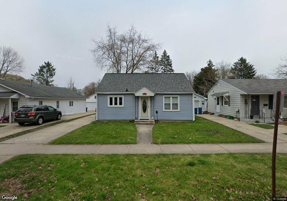
1019 Spruce St Aurora, IL 60506
Blackhawk NeighborhoodEstimated Value: $192,000 - $246,000
2
Beds
1
Bath
768
Sq Ft
$284/Sq Ft
Est. Value
About This Home
This home is located at 1019 Spruce St, Aurora, IL 60506 and is currently estimated at $218,012, approximately $283 per square foot. 1019 Spruce St is a home located in Kane County with nearby schools including Mccleery Elementary School, Jefferson Middle School, and West Aurora High School.
Ownership History
Date
Name
Owned For
Owner Type
Purchase Details
Closed on
Feb 28, 2005
Sold by
Paustian Rhonda L and Paustian Crispin
Bought by
Leifheit Dale A
Current Estimated Value
Home Financials for this Owner
Home Financials are based on the most recent Mortgage that was taken out on this home.
Original Mortgage
$110,650
Outstanding Balance
$53,816
Interest Rate
5%
Mortgage Type
Purchase Money Mortgage
Estimated Equity
$164,196
Purchase Details
Closed on
May 31, 2002
Sold by
Swanson Jeffrey K and Swanson Shirley A
Bought by
Paustian Rhonda and Paustian Crispin
Home Financials for this Owner
Home Financials are based on the most recent Mortgage that was taken out on this home.
Original Mortgage
$106,400
Interest Rate
6.79%
Create a Home Valuation Report for This Property
The Home Valuation Report is an in-depth analysis detailing your home's value as well as a comparison with similar homes in the area
Home Values in the Area
Average Home Value in this Area
Purchase History
| Date | Buyer | Sale Price | Title Company |
|---|---|---|---|
| Leifheit Dale A | $116,500 | -- | |
| Paustian Rhonda | $112,000 | -- |
Source: Public Records
Mortgage History
| Date | Status | Borrower | Loan Amount |
|---|---|---|---|
| Open | Leifheit Dale A | $110,650 | |
| Previous Owner | Paustian Rhonda | $106,400 |
Source: Public Records
Tax History
| Year | Tax Paid | Tax Assessment Tax Assessment Total Assessment is a certain percentage of the fair market value that is determined by local assessors to be the total taxable value of land and additions on the property. | Land | Improvement |
|---|---|---|---|---|
| 2024 | $4,762 | $60,147 | $7,070 | $53,077 |
| 2023 | $4,603 | $53,741 | $6,317 | $47,424 |
| 2022 | $4,340 | $49,034 | $5,764 | $43,270 |
| 2021 | $4,171 | $45,651 | $5,366 | $40,285 |
| 2020 | $3,970 | $42,403 | $4,984 | $37,419 |
| 2019 | $3,842 | $39,288 | $4,618 | $34,670 |
| 2018 | $3,405 | $34,105 | $4,272 | $29,833 |
| 2017 | $3,234 | $31,422 | $3,936 | $27,486 |
| 2016 | $2,308 | $27,729 | $3,374 | $24,355 |
| 2015 | -- | $24,035 | $2,901 | $21,134 |
| 2014 | -- | $22,992 | $2,666 | $20,326 |
| 2013 | -- | $24,055 | $2,682 | $21,373 |
Source: Public Records
Map
Nearby Homes
- 930 W New York St Unit 932
- 1039 S Pleasure Ct
- 1061 S Pleasure Ct
- 8 S Commonwealth Ave
- 424 N Lancaster Ave
- 810 W Galena Blvd
- 1344 W Galena Blvd
- 160 Ingleside Ave
- 732 N Fordham Ave
- 175 S Harrison Ave
- 659 W Downer Place
- 231 W Downer Place
- 833 Sheldon Ave
- 646-648 Hardin Ave
- 523 N Highland Ave
- 932 W New York St
- 837 Taylor Ave
- 847 Foran Ln
- 1358 Monomoy St Unit A
- 220 S Calumet Ave
- 1015 Spruce St
- 1023 Spruce St
- 1027 Spruce St
- 1011 Spruce St
- 1018 Charles St
- 1014 Charles St
- 1026 Charles St
- 1031 Spruce St
- 1007 Spruce St
- 1010 Charles St
- 1030 Charles St
- 212 N Elmwood Dr
- 202 N Elmwood Dr
- 1035 Spruce St
- 1018 Spruce St
- 1014 Spruce St
- 1022 Spruce St
- 1010 Spruce St
- 216 N Elmwood Dr
- 1026 Spruce St
Your Personal Tour Guide
Ask me questions while you tour the home.