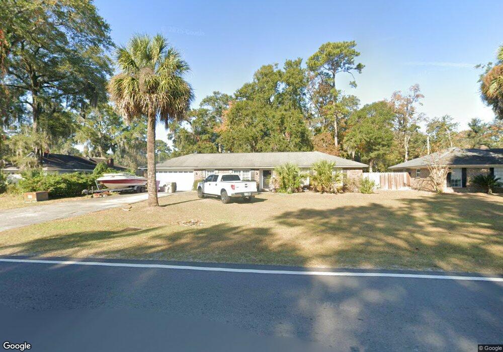
1019 Walthour Rd Savannah, GA 31410
Estimated Value: $492,534 - $536,000
3
Beds
2
Baths
2,132
Sq Ft
$238/Sq Ft
Est. Value
About This Home
This home is located at 1019 Walthour Rd, Savannah, GA 31410 and is currently estimated at $508,384, approximately $238 per square foot. 1019 Walthour Rd is a home located in Chatham County with nearby schools including Howard Elementary School, Coastal Middle School, and Islands High School.
Ownership History
Date
Name
Owned For
Owner Type
Purchase Details
Closed on
Jun 10, 2008
Sold by
Not Provided
Bought by
Youmans Natalie M
Current Estimated Value
Home Financials for this Owner
Home Financials are based on the most recent Mortgage that was taken out on this home.
Original Mortgage
$213,750
Outstanding Balance
$137,722
Interest Rate
6.13%
Mortgage Type
New Conventional
Estimated Equity
$370,662
Create a Home Valuation Report for This Property
The Home Valuation Report is an in-depth analysis detailing your home's value as well as a comparison with similar homes in the area
Home Values in the Area
Average Home Value in this Area
Purchase History
| Date | Buyer | Sale Price | Title Company |
|---|---|---|---|
| Youmans Natalie M | $225,000 | -- |
Source: Public Records
Mortgage History
| Date | Status | Borrower | Loan Amount |
|---|---|---|---|
| Open | Youmans Natalie M | $213,750 |
Source: Public Records
Tax History Compared to Growth
Tax History
| Year | Tax Paid | Tax Assessment Tax Assessment Total Assessment is a certain percentage of the fair market value that is determined by local assessors to be the total taxable value of land and additions on the property. | Land | Improvement |
|---|---|---|---|---|
| 2025 | $4,194 | $170,960 | $34,000 | $136,960 |
| 2024 | $4,194 | $155,240 | $30,000 | $125,240 |
| 2023 | $4,604 | $134,080 | $22,880 | $111,200 |
| 2022 | $3,742 | $123,720 | $22,880 | $100,840 |
| 2021 | $3,788 | $105,040 | $22,880 | $82,160 |
| 2020 | $3,833 | $105,040 | $22,880 | $82,160 |
| 2019 | $3,917 | $105,040 | $22,880 | $82,160 |
| 2018 | $3,000 | $93,600 | $22,880 | $70,720 |
| 2017 | $2,731 | $95,240 | $22,880 | $72,360 |
| 2016 | $2,774 | $82,000 | $22,880 | $59,120 |
| 2015 | $2,778 | $82,000 | $22,880 | $59,120 |
| 2014 | $4,076 | $82,000 | $0 | $0 |
Source: Public Records
Map
Nearby Homes
- 1022 Walthour Rd
- 1106 Oakleaf Dr
- 1024 Walthour Rd
- 24 Crisp St
- 903 Moss Dr
- 903 Sandpiper Rd
- 710 Leaning Oaks Dr
- 810 Walthour Rd
- 2 Brittlewood Ct
- 302 Gloucester Rd
- 908 Betz Creek Rd
- 127 Penn Station
- 104 Saint Andrews Way
- 7 Cedar Cove
- 119 Oemler Loop
- 509 Pointe North Dr
- 511 Pointe Dr N
- 515 Pointe North Dr
- 128 Mary Musgrove Dr
- 127 Druid Cir
- 1017 Walthour Rd
- 908 Woodridge Dr
- 2 Oakleaf Ct
- 3 Oakleaf Ct
- 1016 Walthour Rd
- 1015 Walthour Rd
- 2 Crisp St
- 12 Moss Ct
- 1014 Walthour Rd
- 1014 Walthour Rd Unit 2723
- 1013 Walthour Rd
- 907 Woodridge Dr
- 10 Moss Ct
- 20 East St
- 5 East St
- 1020 Walthour Rd
- 905 Woodridge Dr
- 4 Oakleaf Ct
- 0 Crisp St
- 1011 Walthour Rd