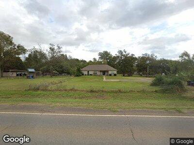
10191 Highway 71 Elm Grove, LA 71051
Elm Grove NeighborhoodEstimated Value: $298,656 - $327,000
4
Beds
3
Baths
2,120
Sq Ft
$145/Sq Ft
Est. Value
About This Home
This home is located at 10191 Highway 71, Elm Grove, LA 71051 and is currently estimated at $307,914, approximately $145 per square foot. 10191 Highway 71 is a home located in Bossier Parish with nearby schools including Elm Grove Elementary School, Elm Grove Middle School, and Parkway High School.
Ownership History
Date
Name
Owned For
Owner Type
Purchase Details
Closed on
Dec 30, 2020
Sold by
Wilton Wesley D and Wilton Susan R
Bought by
Bradford Bryant and Bradford Melissa
Current Estimated Value
Home Financials for this Owner
Home Financials are based on the most recent Mortgage that was taken out on this home.
Original Mortgage
$272,000
Outstanding Balance
$245,485
Interest Rate
2.7%
Mortgage Type
Purchase Money Mortgage
Estimated Equity
$62,429
Purchase Details
Closed on
Jan 21, 2010
Sold by
Mcgrath Builders Inc
Bought by
Wilton Wesley Donald and Wilton Susan Rene
Home Financials for this Owner
Home Financials are based on the most recent Mortgage that was taken out on this home.
Original Mortgage
$238,623
Interest Rate
5.08%
Mortgage Type
VA
Create a Home Valuation Report for This Property
The Home Valuation Report is an in-depth analysis detailing your home's value as well as a comparison with similar homes in the area
Home Values in the Area
Average Home Value in this Area
Purchase History
| Date | Buyer | Sale Price | Title Company |
|---|---|---|---|
| Bradford Bryant | $272,000 | None Available | |
| Wilton Wesley Donald | $232,000 | First Commerce Title Co |
Source: Public Records
Mortgage History
| Date | Status | Borrower | Loan Amount |
|---|---|---|---|
| Open | Bradford Bryant | $272,000 | |
| Previous Owner | Wilton Wesley D | $60,000 | |
| Previous Owner | Wilton Wesley Donald | $235,968 | |
| Previous Owner | Wilton Wesley Donald | $238,623 |
Source: Public Records
Tax History Compared to Growth
Tax History
| Year | Tax Paid | Tax Assessment Tax Assessment Total Assessment is a certain percentage of the fair market value that is determined by local assessors to be the total taxable value of land and additions on the property. | Land | Improvement |
|---|---|---|---|---|
| 2024 | $2,135 | $25,291 | $800 | $24,491 |
| 2023 | $1,791 | $21,469 | $800 | $20,669 |
| 2022 | $1,733 | $21,469 | $800 | $20,669 |
| 2021 | $2,644 | $21,469 | $800 | $20,669 |
| 2020 | $1,685 | $21,075 | $800 | $20,275 |
| 2019 | $1,748 | $21,500 | $800 | $20,700 |
| 2018 | $1,748 | $21,500 | $800 | $20,700 |
| 2017 | $1,705 | $21,500 | $800 | $20,700 |
| 2016 | $1,705 | $21,500 | $800 | $20,700 |
| 2015 | $1,587 | $21,350 | $800 | $20,550 |
| 2014 | $1,587 | $21,350 | $800 | $20,550 |
Source: Public Records
Map
Nearby Homes
- 0 U S Highway 71
- 0 Smith Rd
- 0 Captain Hm Shreve Blvd Unit 20787165
- 1144 Highway 527
- 220 Robinson Rd
- Lot 22 J T White Rd
- 664 Red Chute
- 290 Robinson Rd
- 0 Jt White Rd #26 Rd
- 5338 Bobbie Ln
- 204 Shadow Ridge Dr
- 0 Eagle Ridge Rd Unit 10
- Lot 28 Eagle Ridge Rd
- 3 Eagle Ridge Rd
- 34 Upland Ct
- 32 Upland Ct
- 30 Upland Ct
- 22 Upland Ct
- 20 Upland Ct
- 52 Copper Ct Unit 31