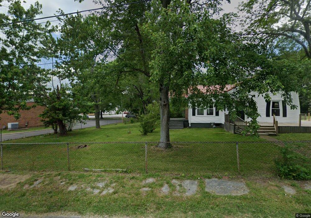
10196 Us Highway 70 E Mc Ewen, TN 37101
Estimated Value: $196,000 - $254,000
--
Bed
2
Baths
1,749
Sq Ft
$128/Sq Ft
Est. Value
About This Home
This home is located at 10196 Us Highway 70 E, Mc Ewen, TN 37101 and is currently estimated at $223,537, approximately $127 per square foot. 10196 Us Highway 70 E is a home located in Humphreys County with nearby schools including St. Patrick's School.
Ownership History
Date
Name
Owned For
Owner Type
Purchase Details
Closed on
Jul 11, 2014
Sold by
Abernathy William Ernest
Bought by
Parchment Patricia Holland
Current Estimated Value
Purchase Details
Closed on
Jun 10, 1992
Bought by
Abernathy William Ernest
Purchase Details
Closed on
Sep 21, 1955
Bought by
Abernathy Abernathy W and Abernathy Tommye W
Purchase Details
Closed on
Aug 5, 1953
Purchase Details
Closed on
Nov 2, 1951
Purchase Details
Closed on
May 1, 1945
Create a Home Valuation Report for This Property
The Home Valuation Report is an in-depth analysis detailing your home's value as well as a comparison with similar homes in the area
Home Values in the Area
Average Home Value in this Area
Purchase History
| Date | Buyer | Sale Price | Title Company |
|---|---|---|---|
| Parchment Patricia Holland | $63,000 | -- | |
| Proctor Billy W | $28,500 | -- | |
| Buckner Calvin | $40,000 | -- | |
| City Rentals Llc | $91,000 | -- | |
| Abernathy William Ernest | $54,800 | -- | |
| Abernathy Abernathy W | -- | -- | |
| -- | -- | -- | |
| -- | -- | -- | |
| -- | -- | -- |
Source: Public Records
Tax History Compared to Growth
Tax History
| Year | Tax Paid | Tax Assessment Tax Assessment Total Assessment is a certain percentage of the fair market value that is determined by local assessors to be the total taxable value of land and additions on the property. | Land | Improvement |
|---|---|---|---|---|
| 2024 | -- | $55,000 | $1,850 | $53,150 |
| 2023 | $1,154 | $55,000 | $1,850 | $53,150 |
| 2022 | $682 | $26,450 | $1,550 | $24,900 |
| 2021 | $682 | $26,450 | $1,550 | $24,900 |
| 2020 | $682 | $26,450 | $1,550 | $24,900 |
| 2019 | $571 | $21,450 | $1,525 | $19,925 |
| 2018 | $571 | $22,400 | $1,525 | $20,875 |
| 2017 | $572 | $22,400 | $1,525 | $20,875 |
| 2016 | $565 | $20,325 | $1,725 | $18,600 |
| 2015 | $565 | $20,325 | $1,725 | $18,600 |
| 2014 | $565 | $20,309 | $0 | $0 |
Source: Public Records
Map
Nearby Homes
- 0 Ridgewood Dr Unit RTC3001972
- 0 Ridgewood Dr Unit RTC2942955
- 0 Ridgewood Dr Unit RTC2818596
- 0 Ridgewood Dr Unit RTC2791892
- 0 Ridgewood Dr Unit RTC2765366
- 0 Ridgewood Dr Unit RTC2564240
- 596 High St E
- 126 Mike St
- 131 Bold Springs Rd
- 19 Brook St
- 372 Melrose St
- 65 Parrish Ln
- 0 Hilltop Dr
- 135 Main St
- 0 Curtis Chapel Rd
- 4407 Tennessee 231
- 1280 Bold Springs Rd
- 0 Trace Creek Rd
- 0 Hurt Loop
- 2800 N Hurricane Creek Rd
- 10198 Us Highway 70 E
- 10180 Us Highway 70 E
- 10152 Us Highway 70 E
- 10230 Us Highway 70 E
- 10230 10230 Highway 70 E
- 10230 Highway 70 E
- 10165 Highway 70 E
- 10136 Us Highway 70 E
- 10145 Us Highway 70 E
- 10114 Us Highway 70 E
- 10100 Us Highway 70 E
- 103 Lucy St
- 10038 Us Highway 70 E
- 102 Blair Blvd
- 48 Blair Blvd
- 9990 Us Highway 70 E
- 0 Ridgewood Dr Unit RTC2923654
- 0 Ridgewood Dr Unit RTC2805729
- 0 Ridgewood Dr Unit RTC2774859
- 0 Ridgewood Dr Unit RTC2685147