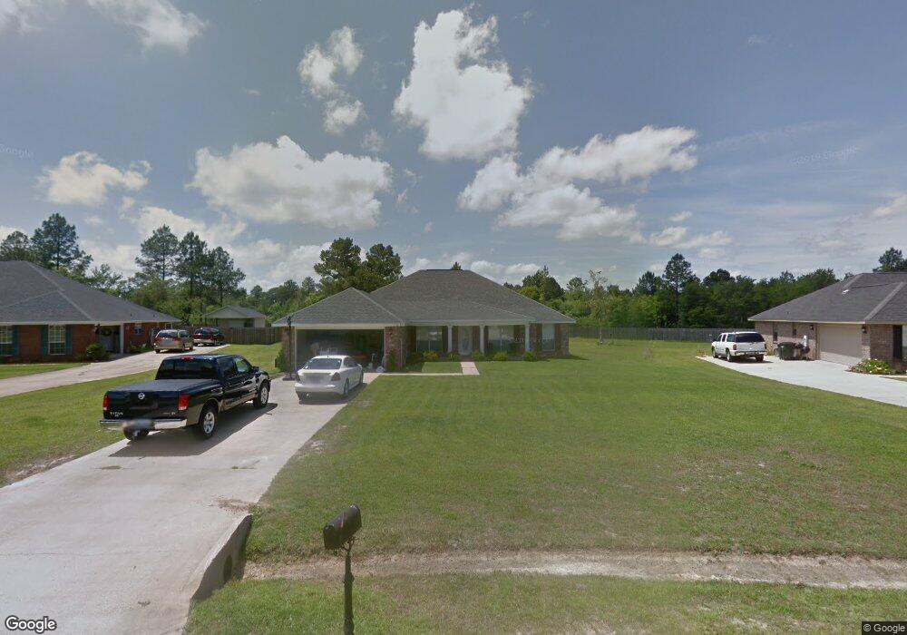
10197 Lake Forest Dr Vancleave, MS 39565
Estimated Value: $323,850 - $371,000
--
Bed
3
Baths
2,508
Sq Ft
$135/Sq Ft
Est. Value
About This Home
This home is located at 10197 Lake Forest Dr, Vancleave, MS 39565 and is currently estimated at $339,713, approximately $135 per square foot. 10197 Lake Forest Dr is a home located in Jackson County with nearby schools including St Martin East Elementary School, St Martin North Elementary School, and St Martin Upper Elementary School.
Ownership History
Date
Name
Owned For
Owner Type
Purchase Details
Closed on
Jul 28, 2017
Sold by
Green James L
Bought by
Green James L and Green Nancy
Current Estimated Value
Home Financials for this Owner
Home Financials are based on the most recent Mortgage that was taken out on this home.
Original Mortgage
$198,000
Interest Rate
3.88%
Mortgage Type
VA
Purchase Details
Closed on
Aug 29, 2015
Sold by
Green Katherine F
Bought by
Green James L
Create a Home Valuation Report for This Property
The Home Valuation Report is an in-depth analysis detailing your home's value as well as a comparison with similar homes in the area
Home Values in the Area
Average Home Value in this Area
Purchase History
| Date | Buyer | Sale Price | Title Company |
|---|---|---|---|
| Green James L | -- | None Available | |
| Green James L | -- | None Available |
Source: Public Records
Mortgage History
| Date | Status | Borrower | Loan Amount |
|---|---|---|---|
| Closed | Green James L | $198,000 |
Source: Public Records
Tax History Compared to Growth
Tax History
| Year | Tax Paid | Tax Assessment Tax Assessment Total Assessment is a certain percentage of the fair market value that is determined by local assessors to be the total taxable value of land and additions on the property. | Land | Improvement |
|---|---|---|---|---|
| 2024 | $1,998 | $19,145 | $2,927 | $16,218 |
| 2023 | $1,998 | $19,145 | $2,927 | $16,218 |
| 2022 | $1,933 | $19,145 | $2,927 | $16,218 |
| 2021 | $1,940 | $19,213 | $2,927 | $16,286 |
| 2020 | $1,981 | $18,881 | $3,018 | $15,863 |
| 2019 | $1,956 | $18,881 | $3,018 | $15,863 |
| 2018 | $2,000 | $18,881 | $3,018 | $15,863 |
| 2017 | $2,039 | $18,881 | $3,018 | $15,863 |
| 2016 | $1,946 | $18,881 | $3,018 | $15,863 |
| 2015 | $1,806 | $176,050 | $30,180 | $145,870 |
| 2014 | $1,825 | $18,089 | $3,018 | $15,071 |
| 2013 | $1,754 | $18,089 | $3,018 | $15,071 |
Source: Public Records
Map
Nearby Homes
- 0 Muszar Ln
- 13601 Virginia St
- 0 Maple Cove
- 13221 Sunview Cove
- 13809 Briarwood Dr
- 13505 Sarus Dr
- 13521 Sarus Dr
- 13509 Sarus Dr
- The Camden Plan at Crane Landing
- The Jasmine Plan at Crane Landing
- The Destin Plan at Crane Landing
- The Hawthorne Plan at Crane Landing
- The Holly Plan at Crane Landing
- 13517 Sarus Dr
- 13461 Crane Dr
- 13529 Sarus Dr
- 13465 Crane Dr
- 13533 Sarus Dr
- 13541 Sarus Dr
- 13412 Crane Dr
- 10193 Lake Forest Dr
- 10201 Lake Forest Dr
- 10205 Lake Forest Dr
- 10189 Lake Forest Dr
- 12120 Poplar Dr
- 10196 Lake Forest Dr
- 12116 Poplar Dr
- 10185 Lake Forest Dr
- 10208 Lake Forest Dr
- 10184 Lake Forest Dr
- 12112 Poplar Dr
- 10213 Lake Forest Dr
- 12125 Sargent Cherry Dr
- 10181 Lake Forest Dr
- 10180 Lake Forest Dr
- 12108 Poplar Dr
- 12121 Poplar Dr
- 12121 Sargent Cherry Dr
- 12117 Poplar Dr
- 12117 Poplar Dr