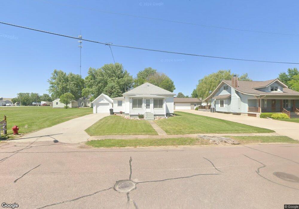
102 1st St Danbury, IA 51019
Estimated Value: $48,000 - $70,000
2
Beds
1
Bath
704
Sq Ft
$84/Sq Ft
Est. Value
About This Home
This home is located at 102 1st St, Danbury, IA 51019 and is currently estimated at $58,799, approximately $83 per square foot. 102 1st St is a home located in Woodbury County with nearby schools including Mapleton Elementary School, Mvao Middle School, and Maple Valley-Anthon Oto High School.
Ownership History
Date
Name
Owned For
Owner Type
Purchase Details
Closed on
Jun 1, 2023
Sold by
Hermsen Brittany Danielle
Bought by
Halbur Steven and Halbur Stacie
Current Estimated Value
Purchase Details
Closed on
Sep 18, 2015
Sold by
Barry Brian
Bought by
Hermsen Brittany Danielle
Home Financials for this Owner
Home Financials are based on the most recent Mortgage that was taken out on this home.
Original Mortgage
$20,400
Interest Rate
3.9%
Mortgage Type
Future Advance Clause Open End Mortgage
Create a Home Valuation Report for This Property
The Home Valuation Report is an in-depth analysis detailing your home's value as well as a comparison with similar homes in the area
Home Values in the Area
Average Home Value in this Area
Purchase History
| Date | Buyer | Sale Price | Title Company |
|---|---|---|---|
| Halbur Steven | $38,000 | None Listed On Document | |
| Hermsen Brittany Danielle | $25,000 | None Available |
Source: Public Records
Mortgage History
| Date | Status | Borrower | Loan Amount |
|---|---|---|---|
| Previous Owner | Hermsen Brittany Danielle | $20,400 |
Source: Public Records
Tax History Compared to Growth
Tax History
| Year | Tax Paid | Tax Assessment Tax Assessment Total Assessment is a certain percentage of the fair market value that is determined by local assessors to be the total taxable value of land and additions on the property. | Land | Improvement |
|---|---|---|---|---|
| 2025 | $452 | $39,370 | $8,810 | $30,560 |
| 2024 | $452 | $37,250 | $8,810 | $28,440 |
| 2023 | $486 | $33,170 | $8,810 | $24,360 |
| 2022 | $454 | $32,400 | $8,810 | $23,590 |
| 2021 | $454 | $32,400 | $8,810 | $23,590 |
| 2020 | $486 | $31,810 | $9,430 | $22,380 |
| 2019 | $490 | $31,810 | $9,430 | $22,380 |
| 2018 | $480 | $31,810 | $9,430 | $22,380 |
| 2017 | $492 | $31,810 | $9,430 | $22,380 |
| 2016 | $400 | $25,870 | $0 | $0 |
| 2015 | $373 | $24,170 | $8,810 | $15,360 |
| 2014 | $374 | $24,170 | $8,810 | $15,360 |
Source: Public Records
Map
Nearby Homes