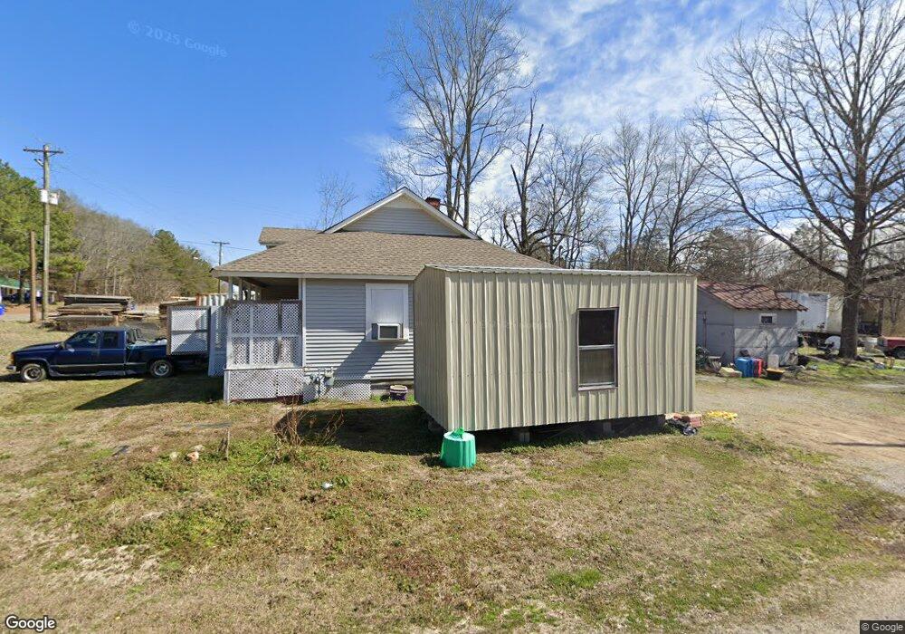
102 Barlow Rd Waynesboro, TN 38485
Estimated Value: $54,577 - $158,000
--
Bed
1
Bath
1,176
Sq Ft
$98/Sq Ft
Est. Value
About This Home
This home is located at 102 Barlow Rd, Waynesboro, TN 38485 and is currently estimated at $115,644, approximately $98 per square foot. 102 Barlow Rd is a home located in Wayne County with nearby schools including Wayne Academy.
Ownership History
Date
Name
Owned For
Owner Type
Purchase Details
Closed on
Jun 27, 2023
Sold by
Staggs Steven D
Bought by
Staggs Wanda
Current Estimated Value
Purchase Details
Closed on
Jan 3, 2022
Sold by
Kennedy Phil
Bought by
Staggs Wanda and Staggs Steven D
Purchase Details
Closed on
Nov 4, 2002
Bought by
Kennedy Phil Morgan Lbr Co
Purchase Details
Closed on
Apr 15, 2002
Bought by
Household Finance Corp
Purchase Details
Closed on
Jan 23, 2001
Sold by
William Parker Austin
Bought by
Faye Parker Deborah
Purchase Details
Closed on
Dec 10, 1998
Sold by
Kathym Anderson
Bought by
Parker Austin W and Parker Deborah
Purchase Details
Closed on
Jan 1, 1970
Bought by
Parker Austin
Purchase Details
Closed on
Jan 2, 1900
Create a Home Valuation Report for This Property
The Home Valuation Report is an in-depth analysis detailing your home's value as well as a comparison with similar homes in the area
Home Values in the Area
Average Home Value in this Area
Purchase History
| Date | Buyer | Sale Price | Title Company |
|---|---|---|---|
| Staggs Wanda | -- | None Listed On Document | |
| Staggs Wanda | $15,000 | None Available | |
| Kennedy Phil Morgan Lbr Co | $18,500 | -- | |
| Household Finance Corp | $39,800 | -- | |
| Faye Parker Deborah | -- | -- | |
| Parker Austin W | $6,000 | -- | |
| Parker Austin | -- | -- | |
| -- | -- | -- |
Source: Public Records
Tax History Compared to Growth
Tax History
| Year | Tax Paid | Tax Assessment Tax Assessment Total Assessment is a certain percentage of the fair market value that is determined by local assessors to be the total taxable value of land and additions on the property. | Land | Improvement |
|---|---|---|---|---|
| 2024 | $373 | $17,200 | $2,275 | $14,925 |
| 2023 | $536 | $17,200 | $2,275 | $14,925 |
| 2022 | $536 | $17,200 | $2,275 | $14,925 |
| 2021 | $394 | $17,200 | $2,275 | $14,925 |
| 2020 | $394 | $10,525 | $1,500 | $9,025 |
| 2019 | $305 | $10,525 | $1,500 | $9,025 |
| 2018 | $394 | $10,525 | $1,500 | $9,025 |
| 2017 | $332 | $10,525 | $1,500 | $9,025 |
| 2016 | $310 | $8,875 | $1,500 | $7,375 |
| 2014 | $269 | $7,631 | $0 | $0 |
Source: Public Records
Map
Nearby Homes
- 1027 Highway 99
- 131 Susan Ln
- 418 Moore St
- 120 Wallace Dr
- 711 Hurricane Hill Dr
- 910 Hassell Dr
- 1141 Lawrenceburg Hwy
- 123 Brewer Dr
- 0 Keeton Rd
- 117 Belew Cir
- 446 Kilburn Hollow Rd
- 0 Kilburn Hollow Rd Unit RTC3042008
- 108 Butler St
- 0 Waynesboro Hwy Unit RTC2991221
- 0 Waynesboro Hwy Unit RTC2806893
- 0 Waynesboro Hwy Unit RTC2821045
- 117 N High St
- 202 Morris St
- 107 W Songer St
- 308 S High St
- 1037 Highway 99
- 1049 Highway 99
- 1040 Highway 99
- 1026 State Highway 99
- 1025 Highway 99
- 1014 State Highway 99
- 1015 Highway 99
- 1015 Highway 99
- 1011 Highway 99
- 1081 Highway 99
- 1081 Highway 99
- 1081 Highway 99
- 1075 Highway 99
- 997 Highway 99 Unit 997
- 99 Highway 99
- 00 Old Highway 64 E
- 972 Highway 99
- 0 State Highway 99
- 936 State Highway 99