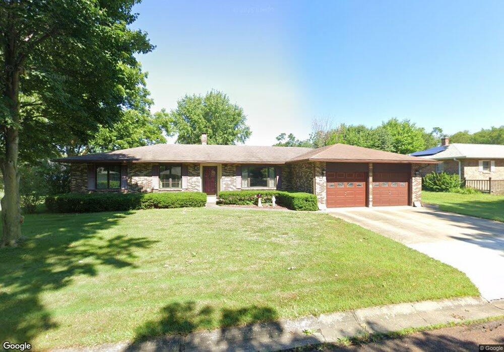
102 Barnes St Pilot Grove, MO 65276
Estimated Value: $189,000 - $266,000
3
Beds
--
Bath
2,650
Sq Ft
$89/Sq Ft
Est. Value
About This Home
This home is located at 102 Barnes St, Pilot Grove, MO 65276 and is currently estimated at $235,072, approximately $88 per square foot. 102 Barnes St is a home with nearby schools including Pilot Grove Elementary School, Pilot Grove High School, and St. Joseph Elementary School.
Create a Home Valuation Report for This Property
The Home Valuation Report is an in-depth analysis detailing your home's value as well as a comparison with similar homes in the area
Tax History
| Year | Tax Paid | Tax Assessment Tax Assessment Total Assessment is a certain percentage of the fair market value that is determined by local assessors to be the total taxable value of land and additions on the property. | Land | Improvement |
|---|---|---|---|---|
| 2025 | $1,767 | $26,030 | $0 | $0 |
| 2024 | $1,767 | $24,230 | $0 | $0 |
| 2023 | $1,746 | $24,230 | $0 | $0 |
| 2022 | $1,531 | $22,670 | $0 | $0 |
| 2021 | $1,363 | $20,200 | $0 | $0 |
| 2020 | $1,374 | $19,060 | $0 | $0 |
| 2019 | $1,361 | $19,060 | $0 | $19,060 |
| 2018 | $1,342 | $19,060 | $0 | $19,060 |
| 2017 | $1,383 | $18,770 | $0 | $18,770 |
| 2016 | -- | $17,960 | $0 | $0 |
| 2015 | -- | $17,960 | $0 | $0 |
| 2011 | -- | $17,960 | $0 | $0 |
Source: Public Records
Map
Nearby Homes
- 500 4th St
- 208 College St
- 110 3rd St
- 13985 N Hwy
- TBD Hwy Nn
- 0 M Hwy
- 14292 Missouri 5
- 250ac Tbd Z Hwy
- Tbd Hwy Z
- 13169 Destrehan Ct
- LOT 91 Madewood Rd
- 15685 Highway 5
- 0 Ferry Rd
- LOT 1 Ferry Rd
- LOT 2 Ferry Rd
- LOT 205 Mid-America Industrial Ct
- LOT 202 Mid-America Industrial Ct
- LOT 17A Mid-America Industrial Ct
- LOT 16 Mid-America Industrial Ct
- 303 Trigg Ave
Your Personal Tour Guide
Ask me questions while you tour the home.