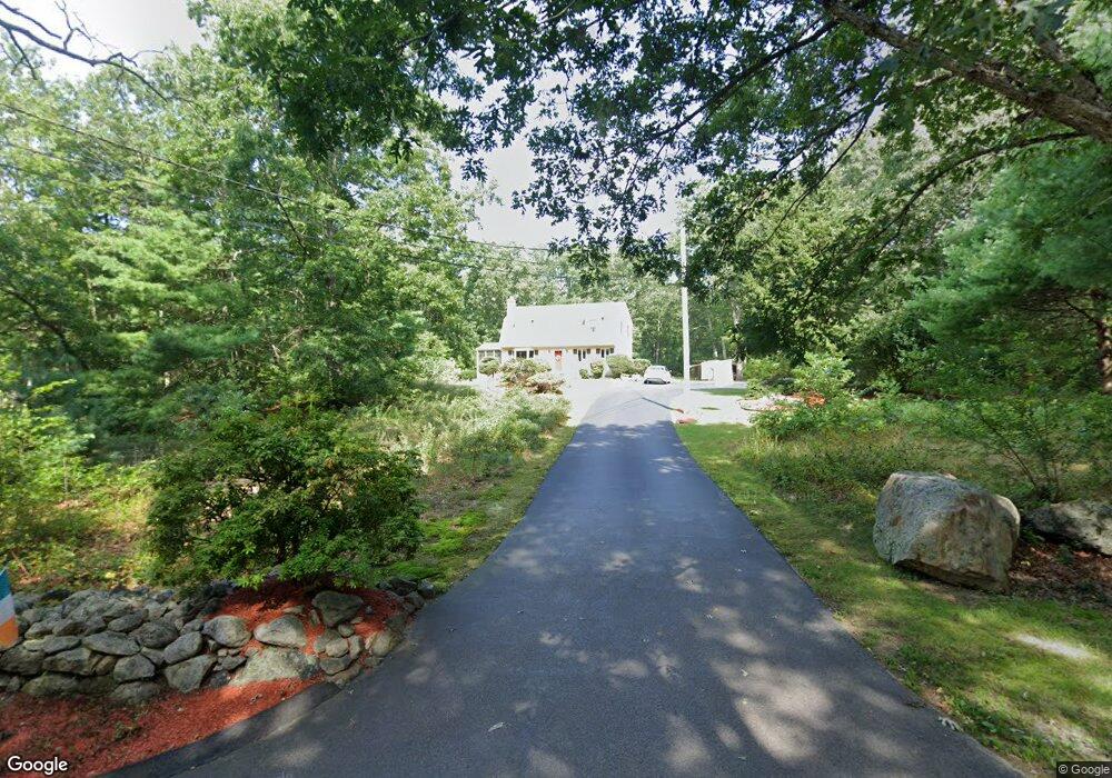
102 Bellingham Rd Blackstone, MA 01504
Estimated Value: $504,000 - $593,000
3
Beds
3
Baths
1,728
Sq Ft
$308/Sq Ft
Est. Value
About This Home
This home is located at 102 Bellingham Rd, Blackstone, MA 01504 and is currently estimated at $532,938, approximately $308 per square foot. 102 Bellingham Rd is a home located in Worcester County with nearby schools including Blackstone-Millville Regional High School.
Ownership History
Date
Name
Owned For
Owner Type
Purchase Details
Closed on
Apr 28, 2016
Sold by
White Kenneth B and White Sandra L
Bought by
White Ft and White
Current Estimated Value
Purchase Details
Closed on
Mar 27, 1986
Bought by
White Kenneth B
Create a Home Valuation Report for This Property
The Home Valuation Report is an in-depth analysis detailing your home's value as well as a comparison with similar homes in the area
Home Values in the Area
Average Home Value in this Area
Purchase History
| Date | Buyer | Sale Price | Title Company |
|---|---|---|---|
| White Ft | -- | -- | |
| White Kenneth B | -- | -- | |
| White Ft | -- | -- |
Source: Public Records
Mortgage History
| Date | Status | Borrower | Loan Amount |
|---|---|---|---|
| Previous Owner | White Kenneth B | $80,000 | |
| Previous Owner | White Kenneth B | $77,000 | |
| Previous Owner | White Kenneth B | $78,500 |
Source: Public Records
Tax History Compared to Growth
Tax History
| Year | Tax Paid | Tax Assessment Tax Assessment Total Assessment is a certain percentage of the fair market value that is determined by local assessors to be the total taxable value of land and additions on the property. | Land | Improvement |
|---|---|---|---|---|
| 2025 | $6,336 | $419,600 | $173,800 | $245,800 |
| 2024 | $6,912 | $423,300 | $182,200 | $241,100 |
| 2023 | $6,694 | $413,700 | $182,200 | $231,500 |
| 2022 | $5,968 | $333,400 | $162,900 | $170,500 |
| 2021 | $4,642 | $311,300 | $162,900 | $148,400 |
| 2020 | $4,581 | $319,400 | $163,200 | $156,200 |
| 2019 | $5,875 | $310,700 | $153,900 | $156,800 |
| 2018 | $6,858 | $288,600 | $150,700 | $137,900 |
| 2017 | $5,901 | $306,400 | $156,000 | $150,400 |
| 2016 | $5,398 | $279,100 | $130,400 | $148,700 |
| 2015 | $5,065 | $260,000 | $123,200 | $136,800 |
Source: Public Records
Map
Nearby Homes
- 17 Colonial Dr
- 20 Thayer Rd
- 36 Indian Run Rd
- 0 North St Unit 73440626
- 211 S Main St
- 17 Susan Ln
- 975 S Main St
- 26 Iris Ln
- 62 Laurel Ln
- 46 Douglas Dr
- 11 Silver Ave
- 6 Fleuette Dr
- 1 Clover Dr
- 4 Little Tree Ln
- 19 King Philip Path
- 19 Geordan Ave
- 125 Blackstone St
- 1099 S Main St
- 123-125 Mendon St
- 1136 S Main St
- 100 Bellingham Rd
- 96 Bellingham Rd
- 84 Bellingham Rd
- 83 Bellingham Rd
- 81 Bellingham Rd
- 3 Marszalkowski St
- 82 Bellingham Rd
- 79 Bellingham Rd
- 80 Bellingham Rd
- 176 Lakeshore Dr
- 178 Lakeshore Dr
- 174 Lakeshore Dr
- 77 Bellingham Rd
- 190 Lakeshore Dr
- 192 Lakeshore Dr
- 78 Bellingham Rd
- 172 Lakeshore Dr
- 194 Lakeshore Dr
- 1 Marszalkowski St
- 196 Lakeshore Dr