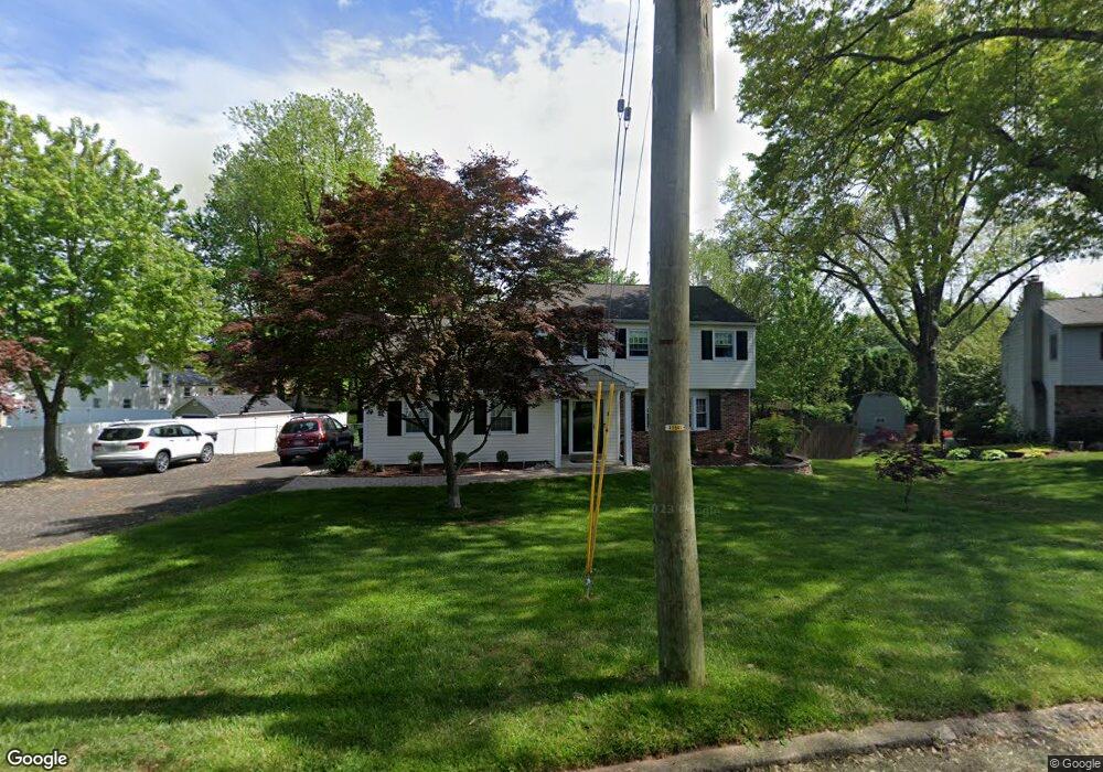
102 Bluebird Rd Southampton, PA 18966
Estimated Value: $551,000 - $655,000
4
Beds
3
Baths
2,083
Sq Ft
$294/Sq Ft
Est. Value
About This Home
This home is located at 102 Bluebird Rd, Southampton, PA 18966 and is currently estimated at $612,344, approximately $293 per square foot. 102 Bluebird Rd is a home located in Bucks County with nearby schools including Churchville Elementary School, Holland Middle School, and Council Rock High School - South.
Ownership History
Date
Name
Owned For
Owner Type
Purchase Details
Closed on
Apr 18, 2005
Sold by
Speiser Terri
Bought by
Speiser Paul and Speiser Terri
Current Estimated Value
Home Financials for this Owner
Home Financials are based on the most recent Mortgage that was taken out on this home.
Original Mortgage
$254,000
Interest Rate
5.47%
Mortgage Type
New Conventional
Create a Home Valuation Report for This Property
The Home Valuation Report is an in-depth analysis detailing your home's value as well as a comparison with similar homes in the area
Home Values in the Area
Average Home Value in this Area
Purchase History
| Date | Buyer | Sale Price | Title Company |
|---|---|---|---|
| Speiser Paul | -- | -- |
Source: Public Records
Mortgage History
| Date | Status | Borrower | Loan Amount |
|---|---|---|---|
| Closed | Speiser Paul | $254,000 |
Source: Public Records
Tax History Compared to Growth
Tax History
| Year | Tax Paid | Tax Assessment Tax Assessment Total Assessment is a certain percentage of the fair market value that is determined by local assessors to be the total taxable value of land and additions on the property. | Land | Improvement |
|---|---|---|---|---|
| 2025 | $5,547 | $28,800 | $5,560 | $23,240 |
| 2024 | $5,547 | $28,800 | $5,560 | $23,240 |
| 2023 | $5,228 | $28,800 | $5,560 | $23,240 |
| 2022 | $5,180 | $28,800 | $5,560 | $23,240 |
| 2021 | $5,016 | $28,800 | $5,560 | $23,240 |
| 2020 | $4,904 | $28,800 | $5,560 | $23,240 |
| 2019 | $4,693 | $28,800 | $5,560 | $23,240 |
| 2018 | $4,610 | $28,800 | $5,560 | $23,240 |
| 2017 | $4,432 | $28,800 | $5,560 | $23,240 |
| 2016 | $4,432 | $28,800 | $5,560 | $23,240 |
| 2015 | -- | $28,800 | $5,560 | $23,240 |
| 2014 | -- | $28,800 | $5,560 | $23,240 |
Source: Public Records
Map
Nearby Homes
- 100 E Holland Rd
- 6 Windy Knoll Dr
- 41 Grant Dr
- 15 Penn Cir
- 6 Rolling Hills Dr
- 4 Providence Dr
- 131 Rocksville Rd
- 120 Gleniffer Hill Rd
- 379 Glen Meadow Rd
- 7 Bennett Place
- 21019 Bennett Place Unit 7
- 302 Independence Dr
- 270 Rocksville Rd
- 327 Hale Dr Unit 801A
- 534 Holly Knoll Dr
- 151 Knox Ct
- 27 Rocking Horse Way
- 148 Laurel Rd
- 1502 Chinquapin Rd
- 3 Tanyard Rd