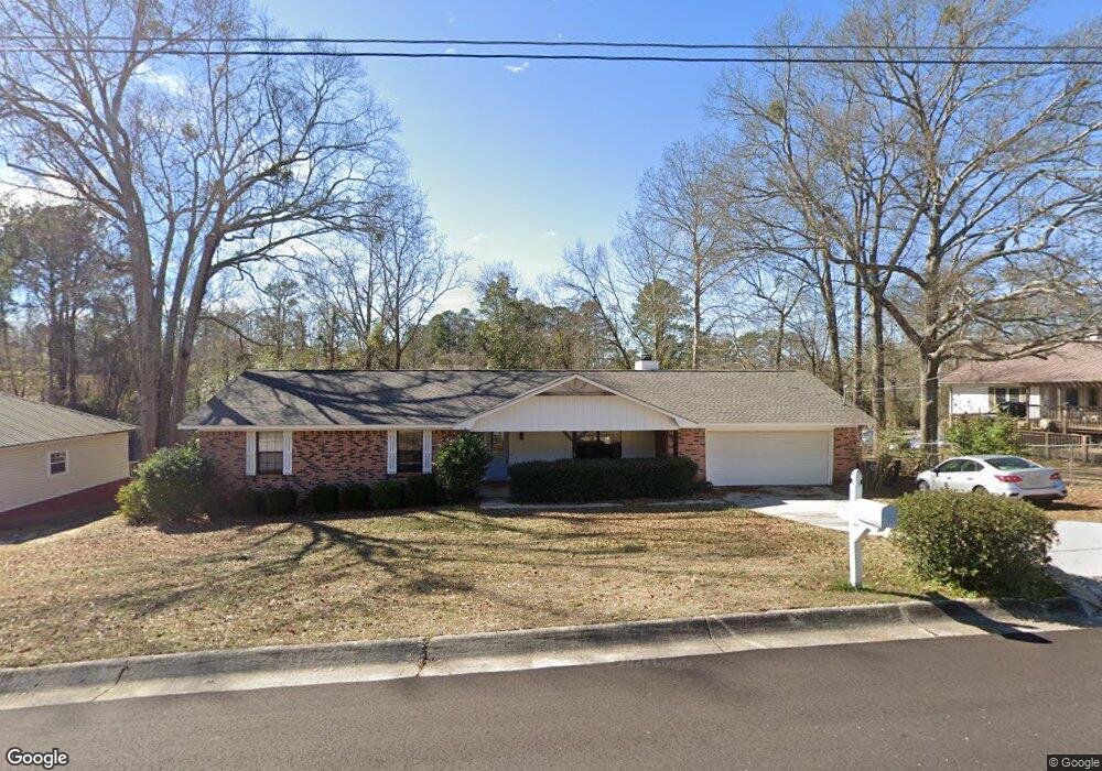
102 Comanche St Enterprise, AL 36330
Estimated Value: $196,000 - $219,000
4
Beds
2
Baths
1,740
Sq Ft
$119/Sq Ft
Est. Value
About This Home
This home is located at 102 Comanche St, Enterprise, AL 36330 and is currently estimated at $207,664, approximately $119 per square foot. 102 Comanche St is a home located in Coffee County with nearby schools including Harrand Creek Elementary School, Dauphin Junior High School, and Enterprise High School.
Ownership History
Date
Name
Owned For
Owner Type
Purchase Details
Closed on
Feb 17, 2023
Sold by
Ddd Land Company
Bought by
Pilgrims Pride Corporation
Current Estimated Value
Purchase Details
Closed on
Jun 13, 2022
Sold by
Reddee Llc
Bought by
Gunter Llc
Purchase Details
Closed on
Jun 2, 2020
Sold by
Mcdonald David W
Bought by
Reddee Llc
Home Financials for this Owner
Home Financials are based on the most recent Mortgage that was taken out on this home.
Original Mortgage
$105,000
Interest Rate
3.2%
Mortgage Type
Seller Take Back
Purchase Details
Closed on
Apr 15, 2014
Sold by
Spivey Donna G and Spivey Donna G
Bought by
Mcdonald David W
Create a Home Valuation Report for This Property
The Home Valuation Report is an in-depth analysis detailing your home's value as well as a comparison with similar homes in the area
Purchase History
| Date | Buyer | Sale Price | Title Company |
|---|---|---|---|
| Pilgrims Pride Corporation | $77,000 | None Listed On Document | |
| Gunter Llc | $119,120 | -- | |
| Reddee Llc | $110,000 | None Available | |
| Mcdonald David W | -- | -- |
Source: Public Records
Mortgage History
| Date | Status | Borrower | Loan Amount |
|---|---|---|---|
| Previous Owner | Reddee Llc | $105,000 |
Source: Public Records
Tax History
| Year | Tax Paid | Tax Assessment Tax Assessment Total Assessment is a certain percentage of the fair market value that is determined by local assessors to be the total taxable value of land and additions on the property. | Land | Improvement |
|---|---|---|---|---|
| 2024 | $1,671 | $34,520 | $0 | $0 |
| 2023 | $1,548 | $28,664 | $3,600 | $25,064 |
| 2022 | $1,278 | $28,680 | $0 | $0 |
| 2021 | $1,102 | $24,640 | $0 | $0 |
| 2020 | $1,067 | $23,840 | $0 | $0 |
| 2019 | $1,067 | $23,840 | $0 | $0 |
| 2018 | $1,125 | $25,180 | $0 | $0 |
| 2017 | $1,097 | $24,520 | $0 | $0 |
| 2016 | $1,114 | $24,920 | $0 | $0 |
| 2015 | $1,114 | $24,920 | $0 | $0 |
| 2014 | $525 | $12,460 | $0 | $0 |
| 2013 | $558 | $0 | $0 | $0 |
Source: Public Records
Map
Nearby Homes
- 105 Comanche St
- 114 Iroquois Rd
- 406 Iroquois Rd
- 200 Lake Oliver Dr
- 503 Navaho St
- 201 Lake Oliver Dr
- 302 Robin Ln
- 287 County Road 755
- 108 Anthony Cir Unit C
- 000 Springdale Dr
- 105 Bellevue Way
- 311 Antler Dr
- 604 Springdale Dr
- 322 Lakes Dr
- 216 Morgan Ln
- 410 Melbourne Dr
- 208 Deerfield Dr
- 103 Cleo Ct
- 0 E Lee St
- 413 Lake Oliver Dr
- 104 Comanche St
- 104 Comanche Ct
- 301 Iroquois Rd
- 301 Iroquois Dr
- 401 Iroquois Rd
- 101 Comanche St
- 103 Comanche Ct
- 106 Comanche Ct
- 101 Comanche Ct
- 105 Comanche Ct
- 403 Iroquois Rd
- 203 Iroquois Rd
- 107 Comanche Ct
- 108 Comanche Ct
- 403 Iroquois Dr
- 99 Mohawk St
- 101 Arapaho Ct
- 108 Comanche St
- 103 Mohegan Dr
- 101 Mohegan Dr
Your Personal Tour Guide
Ask me questions while you tour the home.