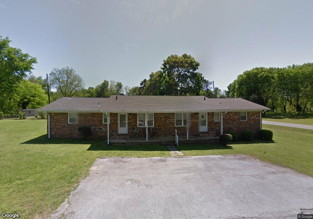
102 Doris Ln Florence, AL 35630
North Florence NeighborhoodEstimated Value: $166,809 - $616,000
--
Bed
3
Baths
2,100
Sq Ft
$181/Sq Ft
Est. Value
About This Home
This home is located at 102 Doris Ln, Florence, AL 35630 and is currently estimated at $379,702, approximately $180 per square foot. 102 Doris Ln is a home located in Lauderdale County with nearby schools including Florence Freshman Center, Florence High School, and St. Joseph Regional Catholic School.
Ownership History
Date
Name
Owned For
Owner Type
Purchase Details
Closed on
Jul 31, 2025
Sold by
Shoals Ohio Llc
Bought by
Doris Lane Apartments Llc
Current Estimated Value
Home Financials for this Owner
Home Financials are based on the most recent Mortgage that was taken out on this home.
Original Mortgage
$660,000
Outstanding Balance
$658,874
Interest Rate
6.81%
Mortgage Type
New Conventional
Estimated Equity
-$279,172
Create a Home Valuation Report for This Property
The Home Valuation Report is an in-depth analysis detailing your home's value as well as a comparison with similar homes in the area
Home Values in the Area
Average Home Value in this Area
Purchase History
| Date | Buyer | Sale Price | Title Company |
|---|---|---|---|
| Doris Lane Apartments Llc | $880,000 | Attorney Only |
Source: Public Records
Mortgage History
| Date | Status | Borrower | Loan Amount |
|---|---|---|---|
| Open | Doris Lane Apartments Llc | $660,000 |
Source: Public Records
Tax History Compared to Growth
Tax History
| Year | Tax Paid | Tax Assessment Tax Assessment Total Assessment is a certain percentage of the fair market value that is determined by local assessors to be the total taxable value of land and additions on the property. | Land | Improvement |
|---|---|---|---|---|
| 2024 | $1,704 | $31,920 | $2,200 | $29,720 |
| 2023 | $1,564 | $1,980 | $1,980 | $0 |
| 2022 | $1,203 | $24,560 | $0 | $0 |
| 2021 | $995 | $20,300 | $0 | $0 |
| 2020 | $875 | $17,860 | $0 | $0 |
| 2019 | $875 | $17,860 | $0 | $0 |
| 2018 | $844 | $17,220 | $0 | $0 |
| 2017 | $821 | $16,760 | $0 | $0 |
| 2016 | $777 | $15,860 | $0 | $0 |
| 2015 | $835 | $17,040 | $0 | $0 |
| 2014 | $792 | $16,160 | $0 | $0 |
Source: Public Records
Map
Nearby Homes
- 205 Baker Dr
- 0 Cypress Chase Dr
- 820 Cypress Mill Rd
- 209 Cypress Chase Dr
- 506 Cypress Mill Rd
- 514 Collier Ave
- 1626 Ridge Ave
- 00 Park Ridge Rd
- 614 Paxton St
- 1115 Wildwood Park Rd
- 614 Londondary Rd
- 32 & 33 Wildwood Trail
- 00 Wildwood Trail
- 117 Creekside Dr
- 112 Creekside Dr
- 260 Creekside Dr
- 114 Creekside Dr
- 0 Creekside Dr
- 520 W Woodland Rd
- 332 Garfield Ave
- 105 Doris Ln Unit DEER
- 101 Doris Ln
- 1321 Cypress Mill Rd
- 1407 Cypress Mill Rd
- 1317 Cypress Mill Rd
- 1415 Cypress Mill Rd
- 1400 Cypress Mill Rd
- 1315 Cypress Mill Rd
- 1350 Cypress Mill Rd
- 1309 Cypress Mill Rd
- 1313 Cypress Mill Rd
- 1340 Cypress Mill Rd
- 1308 Cypress Mill Rd
- 1307 Cypress Mill Rd
- 1305 Cypress Mill Rd
- 116 Cypress Mill Ct
- 1306 Cypress Mill Rd
- 114 Cypress Mill Ct
- 1300 Cypress Mill Rd
- 102 Butler Dr