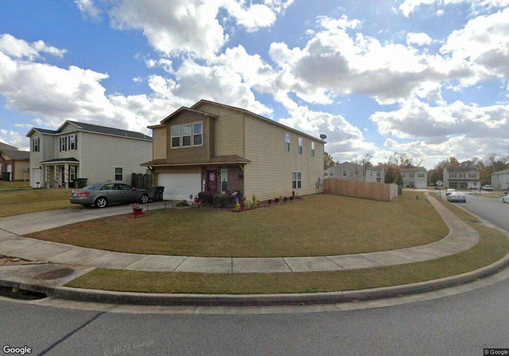
102 Dormont Dr NE Huntsville, AL 35810
Moores Mill NeighborhoodEstimated Value: $237,000 - $261,000
--
Bed
1
Bath
2,682
Sq Ft
$94/Sq Ft
Est. Value
About This Home
This home is located at 102 Dormont Dr NE, Huntsville, AL 35810 and is currently estimated at $253,049, approximately $94 per square foot. 102 Dormont Dr NE is a home with nearby schools including Martin Luther King Jr. Elementary School, Chapman Middle School, and Lee High School.
Ownership History
Date
Name
Owned For
Owner Type
Purchase Details
Closed on
Nov 30, 2021
Sold by
New Castle Development Enterprises Llc
Bought by
Valor Communities Llc
Current Estimated Value
Purchase Details
Closed on
Sep 18, 2009
Sold by
Hunter Communities Inc
Bought by
Hampton Joyce M and Hampton Earl
Home Financials for this Owner
Home Financials are based on the most recent Mortgage that was taken out on this home.
Original Mortgage
$143,083
Interest Rate
5.15%
Mortgage Type
FHA
Purchase Details
Closed on
Jul 15, 2009
Sold by
Concord Development Co Inc
Bought by
Hunter Communities Inc
Create a Home Valuation Report for This Property
The Home Valuation Report is an in-depth analysis detailing your home's value as well as a comparison with similar homes in the area
Home Values in the Area
Average Home Value in this Area
Purchase History
| Date | Buyer | Sale Price | Title Company |
|---|---|---|---|
| Valor Communities Llc | -- | -- | |
| Hampton Joyce M | -- | -- | |
| Hunter Communities Inc | -- | -- |
Source: Public Records
Mortgage History
| Date | Status | Borrower | Loan Amount |
|---|---|---|---|
| Previous Owner | Hampton Joyce M | $143,083 |
Source: Public Records
Tax History Compared to Growth
Tax History
| Year | Tax Paid | Tax Assessment Tax Assessment Total Assessment is a certain percentage of the fair market value that is determined by local assessors to be the total taxable value of land and additions on the property. | Land | Improvement |
|---|---|---|---|---|
| 2024 | $1,617 | $26,300 | $3,500 | $22,800 |
| 2023 | $1,477 | $19,660 | $3,500 | $16,160 |
| 2022 | $829 | $15,120 | $3,000 | $12,120 |
| 2021 | $672 | $12,420 | $2,000 | $10,420 |
| 2020 | $672 | $12,410 | $2,000 | $10,410 |
| 2019 | $618 | $11,480 | $2,000 | $9,480 |
| 2018 | $429 | $8,220 | $0 | $0 |
| 2017 | $378 | $7,340 | $0 | $0 |
| 2016 | $378 | $7,340 | $0 | $0 |
| 2015 | $378 | $7,340 | $0 | $0 |
| 2014 | $417 | $8,020 | $0 | $0 |
Source: Public Records
Map
Nearby Homes
- 127 Whitestone Dr NE
- 102 Whitestone Dr NE
- 223 Dormont Dr NE
- 235 Dormont Dr NE
- 220 Valleyside Dr NE
- 340 Ruby Elm Ave NE
- 6028 Normal Heights Cir NW
- 341 Ruby Elm Ave NE
- 2102 Southline Dr NW
- Lakeside-4 sides Brick Plan at Highland Hills
- Freeport-4 sides Brick Plan at Highland Hills
- Cali-4 sides Brick Plan at Highland Hills
- Kerry-4 sides Brick Plan at Highland Hills
- 336 Ruby Elm Ave NE
- 334 Ruby Elm Ave NE
- 2236 NW Swaim Cir NW
- 339 Ruby Elm Ave NE
- 338 Ruby Elm Ave NE
- 335 Ruby Elm Ave NE
- 2106 Apache Rd NW
- 104 Dormont Dr NE
- 106 Dormont Dr NE
- 121 Dormont Dr NE
- 115 Whitestone Dr NE
- 109 Dormont Dr NE
- 108 Dormont Dr NE
- 107 Dormont Dr NE
- 117 Whitestone Dr NE
- 105 Dormont Dr NE
- 123 Dormont Dr NE
- 119 Dormont Dr NE
- 111 Dormont Dr NE
- 117 Dormont Dr NE
- 103 Dormont Dr NE
- 110 Dormont Dr NE
- 113 Dormont Dr NE
- 119 Whitestone Dr NE
- 121 Whitestone Dr NE
- 115 Dormont Dr NE
- 125 Dormont Dr NE