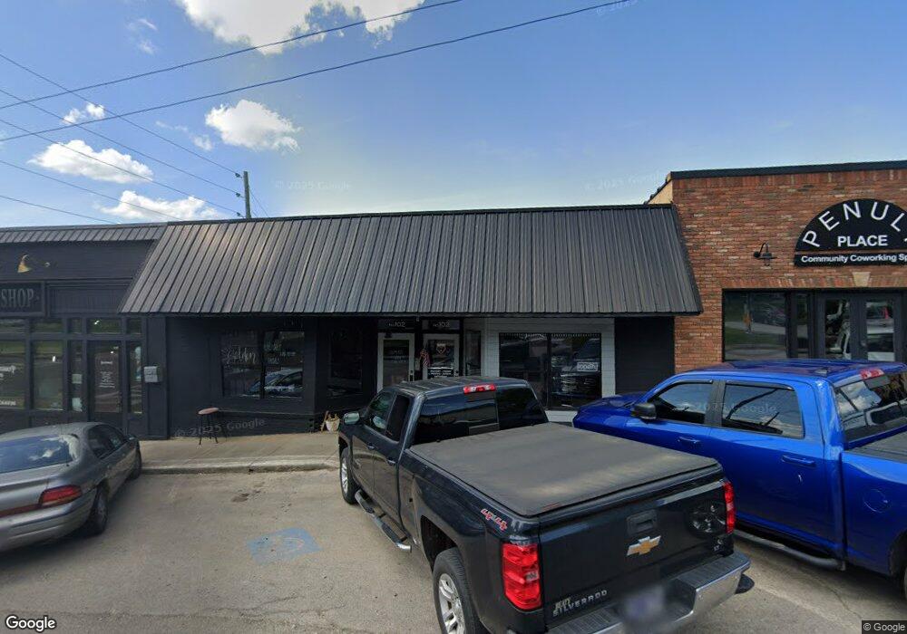
102 E Old Andrew Johnson Hwy Jefferson City, TN 37760
Estimated Value: $94,810
--
Bed
1
Bath
1,872
Sq Ft
$51/Sq Ft
Est. Value
About This Home
This home is located at 102 E Old Andrew Johnson Hwy, Jefferson City, TN 37760 and is currently estimated at $94,810, approximately $50 per square foot. 102 E Old Andrew Johnson Hwy is a home located in Jefferson County with nearby schools including Jefferson Montessori School and Heritage Christian Academy.
Ownership History
Date
Name
Owned For
Owner Type
Purchase Details
Closed on
Aug 27, 2020
Sold by
Quarles Teresa Tullock and Sands Angela Michelle
Bought by
Massengill Terri
Current Estimated Value
Home Financials for this Owner
Home Financials are based on the most recent Mortgage that was taken out on this home.
Original Mortgage
$55,000
Outstanding Balance
$48,809
Interest Rate
2.9%
Mortgage Type
New Conventional
Estimated Equity
$46,001
Purchase Details
Closed on
Jan 10, 1992
Bought by
Tullock Bill F
Purchase Details
Closed on
Feb 13, 1989
Bought by
Breeden Breeden J and Breeden Ruth
Purchase Details
Closed on
Apr 4, 1979
Bought by
Breeden Robert and Breeden Jeanette
Purchase Details
Closed on
May 16, 1975
Create a Home Valuation Report for This Property
The Home Valuation Report is an in-depth analysis detailing your home's value as well as a comparison with similar homes in the area
Home Values in the Area
Average Home Value in this Area
Purchase History
| Date | Buyer | Sale Price | Title Company |
|---|---|---|---|
| Massengill Terri | $55,000 | Jefferson Title Inc | |
| Tullock Bill F | $5,100 | -- | |
| Breeden Breeden J | $74,500 | -- | |
| Breeden Robert | -- | -- | |
| -- | -- | -- |
Source: Public Records
Mortgage History
| Date | Status | Borrower | Loan Amount |
|---|---|---|---|
| Open | Massengill Terri | $55,000 |
Source: Public Records
Tax History Compared to Growth
Tax History
| Year | Tax Paid | Tax Assessment Tax Assessment Total Assessment is a certain percentage of the fair market value that is determined by local assessors to be the total taxable value of land and additions on the property. | Land | Improvement |
|---|---|---|---|---|
| 2025 | $749 | $28,600 | $4,520 | $24,080 |
| 2023 | $749 | $21,400 | $0 | $0 |
| 2022 | $726 | $21,400 | $3,080 | $18,320 |
| 2021 | $726 | $21,400 | $3,080 | $18,320 |
| 2020 | $0 | $21,400 | $3,080 | $18,320 |
| 2019 | $726 | $21,400 | $3,080 | $18,320 |
| 2018 | $606 | $17,080 | $3,040 | $14,040 |
| 2017 | $606 | $17,080 | $3,040 | $14,040 |
| 2016 | $606 | $17,080 | $3,040 | $14,040 |
| 2015 | $598 | $17,080 | $3,040 | $14,040 |
| 2014 | $589 | $17,080 | $3,040 | $14,040 |
Source: Public Records
Map
Nearby Homes
- 1905 Walnut Ave
- 902 N College St
- 1916 N Sizer Ave
- 903 Julianne Dr
- 807 E Ellis St
- 1819 Brookline Ct
- 724 E Jefferson St
- 409 Clearbrook Dr
- 1825 Burnette Ave
- 819 Navajo Dr
- 431 Clearbrook Dr
- 848 Navajo Dr
- 1405 Odell Ave
- 720 Carson St
- 1015 Battle Ridge
- 1215 George Ave
- Macon Plan at Battle Ridge
- Cabral Plan at Battle Ridge
- Cali Plan at Battle Ridge
- Glendale Plan at Battle Ridge
- 104 E Old Andrew Johnson Hwy
- 104 E Old Andrew Johnson Hwy Unit 703/3
- 9 E Old A J Hwy
- 106 E Old Andrew Johnson Hwy
- 11-E W Old Aj Hwy
- Lot 15 Old Andrew Johnson Hwy
- Lot 7 Old Andrew Johnson Hwy
- 110 E Old Andrew Johnson Hwy
- 7 E Old Andrew Johnson Hwy
- 15 E Old Andrew Johnson Hwy
- 102 Old Aj Hwy
- 112 E Old A J Hwy
- 104 W Old Andrew Johnson Hwy
- 104 W Old A J Hwy
- 711 E Main St
- 114 E Old Andrew Johnson Hwy
- 114 E Old A J Hwy
- 1917 Manning Ave
- 707 E Cherokee Dr Unit Parcel 028.00 Map 01
- 707 E Cherokee Dr