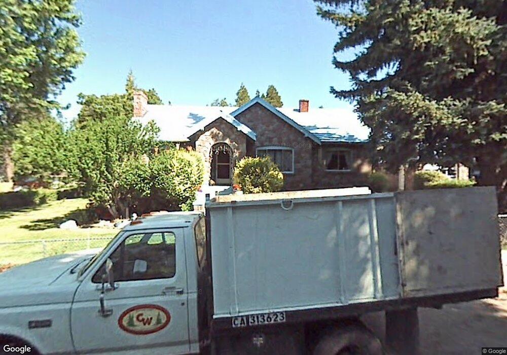
102 Holly St Mount Shasta, CA 96067
Estimated Value: $320,184 - $432,000
3
Beds
2
Baths
1,539
Sq Ft
$245/Sq Ft
Est. Value
About This Home
This home is located at 102 Holly St, Mount Shasta, CA 96067 and is currently estimated at $376,296, approximately $244 per square foot. 102 Holly St is a home located in Siskiyou County with nearby schools including Mt. Shasta Elementary School, Mt. Shasta High School, and Golden Eagle Charter School.
Ownership History
Date
Name
Owned For
Owner Type
Purchase Details
Closed on
Sep 24, 2004
Sold by
Wright Todd D
Bought by
Wright Todd D and Wright Cynthia L
Current Estimated Value
Home Financials for this Owner
Home Financials are based on the most recent Mortgage that was taken out on this home.
Original Mortgage
$111,800
Interest Rate
5.76%
Mortgage Type
New Conventional
Purchase Details
Closed on
Apr 18, 2002
Sold by
Wright Cynthia L
Bought by
Wright Todd D
Home Financials for this Owner
Home Financials are based on the most recent Mortgage that was taken out on this home.
Original Mortgage
$110,000
Interest Rate
7.08%
Create a Home Valuation Report for This Property
The Home Valuation Report is an in-depth analysis detailing your home's value as well as a comparison with similar homes in the area
Home Values in the Area
Average Home Value in this Area
Purchase History
| Date | Buyer | Sale Price | Title Company |
|---|---|---|---|
| Wright Todd D | -- | Siskiyou County Title Co | |
| Wright Todd D | -- | Siskiyou County Title Co |
Source: Public Records
Mortgage History
| Date | Status | Borrower | Loan Amount |
|---|---|---|---|
| Closed | Wright Todd D | $111,800 | |
| Closed | Wright Todd D | $110,000 | |
| Closed | Wright Todd D | $75,000 |
Source: Public Records
Tax History Compared to Growth
Tax History
| Year | Tax Paid | Tax Assessment Tax Assessment Total Assessment is a certain percentage of the fair market value that is determined by local assessors to be the total taxable value of land and additions on the property. | Land | Improvement |
|---|---|---|---|---|
| 2025 | $802 | $75,935 | $13,450 | $62,485 |
| 2023 | $802 | $72,988 | $12,929 | $60,059 |
| 2022 | $772 | $71,558 | $12,676 | $58,882 |
| 2021 | $759 | $70,156 | $12,428 | $57,728 |
| 2020 | $758 | $69,438 | $12,301 | $57,137 |
| 2019 | $744 | $68,077 | $12,060 | $56,017 |
| 2018 | $730 | $66,743 | $11,824 | $54,919 |
| 2017 | $722 | $65,436 | $11,593 | $53,843 |
| 2016 | $708 | $64,154 | $11,366 | $52,788 |
| 2015 | -- | $63,192 | $11,196 | $51,996 |
| 2014 | -- | $61,955 | $10,977 | $50,978 |
Source: Public Records
Map
Nearby Homes
- 00 S Mount Shasta Blvd
- 0 S Mount Shasta Blvd
- 0 Berry St
- 706 Glen Mar Dr
- 114 Smith St
- 1501 Village Way
- Lot 1 S Old Stage Rd
- 506 Eiler Rd
- 208 Mccloud Ave
- 614 Michele Dr
- 509 Mccloud Ave
- 109 N Washington Dr
- 1395 Northridge Dr
- 1227 Eddy Dr
- 0 Alma St Apn #057-203-040
- Parcel 1,2,3 Pine Field St
- lot 7 Ream Ave
- 1007 Mccloud Ave
- 527 Paul's Place
- 1539 Eddy Dr
- 1018 Oak St
- 1013 S Mount Shasta Blvd
- 103 Holly St
- 1011 S Mount Shasta Blvd
- 1019 Oak St
- 1005 S Mount Shasta Blvd
- 1017 Oak St
- 1005 Oak St
- 1002 Ream Ave
- 1101 Oak St
- 1109 S Mount Shasta Blvd
- 1024 Court St
- 1002 Oak St
- 1023 1023A Ream
- 36 Siskiyou Ave
- 1032 Court St
- 205 Old McCloud Rd
- 1105 Oak St
- 909 S Mount Shasta Blvd
- Parcel 2 / 36 Court St