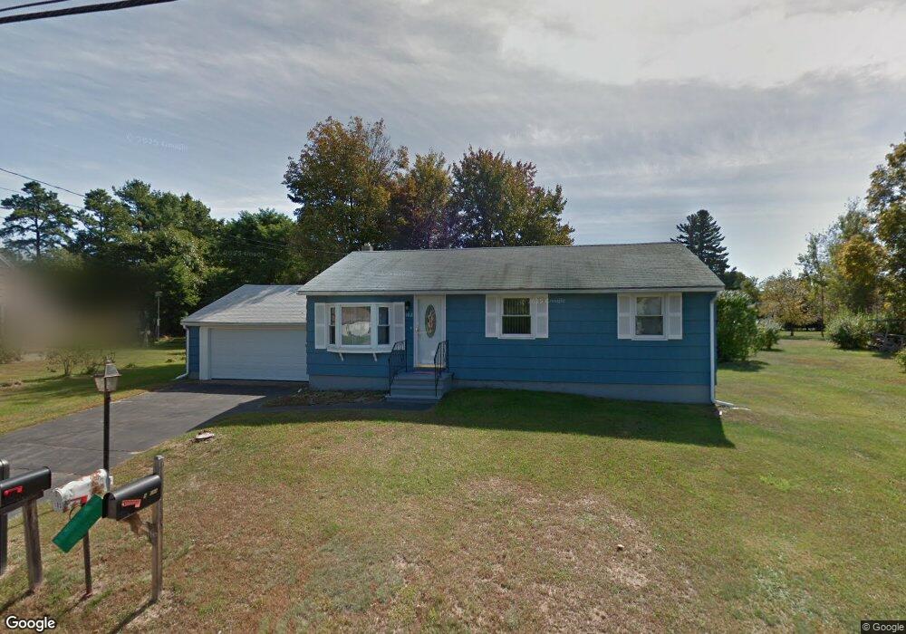
102 Maple St Somersworth, NH 03878
Estimated Value: $317,000 - $392,000
2
Beds
1
Bath
1,440
Sq Ft
$254/Sq Ft
Est. Value
About This Home
This home is located at 102 Maple St, Somersworth, NH 03878 and is currently estimated at $366,302, approximately $254 per square foot. 102 Maple St is a home with nearby schools including Maple Wood Elementary School, Somersworth High School, and Tri-City Christian Academy.
Ownership History
Date
Name
Owned For
Owner Type
Purchase Details
Closed on
Feb 21, 2024
Sold by
Somersworth City Of
Bought by
Somersworth City Of
Current Estimated Value
Purchase Details
Closed on
Feb 20, 2008
Sold by
Descosiers Paul E Est and Bowley
Bought by
Mcdonnell Carolyn A and Mcdonnell Joseph M
Home Financials for this Owner
Home Financials are based on the most recent Mortgage that was taken out on this home.
Original Mortgage
$60,900
Interest Rate
5.9%
Mortgage Type
Purchase Money Mortgage
Create a Home Valuation Report for This Property
The Home Valuation Report is an in-depth analysis detailing your home's value as well as a comparison with similar homes in the area
Home Values in the Area
Average Home Value in this Area
Purchase History
| Date | Buyer | Sale Price | Title Company |
|---|---|---|---|
| Somersworth City Of | -- | None Available | |
| Somersworth City Of | -- | None Available | |
| Mcdonnell Carolyn A | $155,000 | -- | |
| Desrosiers Paul E Est | $66,700 | -- | |
| Mcdonnell Carolyn A | $155,000 | -- |
Source: Public Records
Mortgage History
| Date | Status | Borrower | Loan Amount |
|---|---|---|---|
| Previous Owner | Mcdonnell Carolyn A | $60,900 |
Source: Public Records
Tax History Compared to Growth
Tax History
| Year | Tax Paid | Tax Assessment Tax Assessment Total Assessment is a certain percentage of the fair market value that is determined by local assessors to be the total taxable value of land and additions on the property. | Land | Improvement |
|---|---|---|---|---|
| 2024 | $6,076 | $324,900 | $99,400 | $225,500 |
| 2023 | $6,311 | $215,400 | $49,900 | $165,500 |
| 2022 | $6,051 | $215,400 | $49,900 | $165,500 |
| 2021 | $5,933 | $215,500 | $49,900 | $165,600 |
| 2020 | $6,002 | $215,500 | $49,900 | $165,600 |
| 2019 | $5,879 | $215,500 | $49,900 | $165,600 |
| 2018 | $5,068 | $151,700 | $58,800 | $92,900 |
| 2017 | $5,016 | $151,600 | $58,800 | $92,800 |
| 2016 | $4,863 | $151,400 | $58,800 | $92,600 |
| 2015 | $4,883 | $151,400 | $58,800 | $92,600 |
| 2014 | $4,715 | $151,400 | $58,800 | $92,600 |
Source: Public Records
Map
Nearby Homes
- 94 Maple St Unit A
- 23 Mount Vernon St
- 18 Grand St
- 178 High St
- 24-26 Highland St
- 29 Chadwick Ln
- 19B Birch Hill Ln Unit 19B
- 23A Birch Hill Ln Unit 23A
- 23B Birch Hill Ln Unit 23B
- 22A Birch Hill Ln Unit 22A
- 18 Lenox Dr Unit C
- 22B Birch Hill Ln Unit 22B
- 19A Birch Hill Ln Unit 19A
- 27B Birch Hill Ln Unit 27B
- 11 Linden St
- 25 High St
- 37 Franklin St
- 1 Bridge St
- 43 Otis Rd
- 105-107 Main St