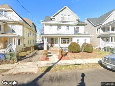
102 Merchant St Unit 104 Bridgeport, CT 06604
Brooklawn-Saint Vincent NeighborhoodEstimated Value: $478,512 - $669,000
6
Beds
3
Baths
3,942
Sq Ft
$146/Sq Ft
Est. Value
About This Home
This home is located at 102 Merchant St Unit 104, Bridgeport, CT 06604 and is currently estimated at $575,378, approximately $145 per square foot. 102 Merchant St Unit 104 is a home located in Fairfield County with nearby schools including Geraldine Johnson School, Bassick High School, and Catholic Academy of Bridgeport-St. Raphael Academy.
Ownership History
Date
Name
Owned For
Owner Type
Purchase Details
Closed on
Mar 31, 1994
Sold by
Santos Joaquim and Santos Maria
Bought by
Lanzo Luis and Lanzo Elia
Current Estimated Value
Home Financials for this Owner
Home Financials are based on the most recent Mortgage that was taken out on this home.
Original Mortgage
$117,214
Interest Rate
7.07%
Mortgage Type
Unknown
Create a Home Valuation Report for This Property
The Home Valuation Report is an in-depth analysis detailing your home's value as well as a comparison with similar homes in the area
Home Values in the Area
Average Home Value in this Area
Purchase History
| Date | Buyer | Sale Price | Title Company |
|---|---|---|---|
| Lanzo Luis | $118,000 | -- | |
| Lanzo Luis | $118,000 | -- |
Source: Public Records
Mortgage History
| Date | Status | Borrower | Loan Amount |
|---|---|---|---|
| Open | Lanzo Luis | $145,000 | |
| Closed | Lanzo Luis | $117,214 |
Source: Public Records
Tax History Compared to Growth
Tax History
| Year | Tax Paid | Tax Assessment Tax Assessment Total Assessment is a certain percentage of the fair market value that is determined by local assessors to be the total taxable value of land and additions on the property. | Land | Improvement |
|---|---|---|---|---|
| 2024 | $10,318 | $237,470 | $78,480 | $158,990 |
| 2023 | $10,318 | $237,470 | $78,480 | $158,990 |
| 2022 | $10,318 | $237,470 | $78,480 | $158,990 |
| 2021 | $10,318 | $237,470 | $78,480 | $158,990 |
| 2020 | $9,838 | $182,220 | $47,560 | $134,660 |
| 2019 | $9,838 | $182,220 | $47,560 | $134,660 |
| 2018 | $9,907 | $182,220 | $47,560 | $134,660 |
| 2017 | $9,907 | $182,220 | $47,560 | $134,660 |
| 2016 | $9,907 | $182,220 | $47,560 | $134,660 |
| 2015 | $9,629 | $228,180 | $50,360 | $177,820 |
| 2014 | $9,629 | $228,180 | $50,360 | $177,820 |
Source: Public Records
Map
Nearby Homes
- 128 Bancroft Ave
- 501 Pequonnock St
- 64-66 Maplewood Ave
- 88 Pierce Ave
- 1391 North Ave Unit 1393
- 191 Oak St
- 141 Arcadia Ave
- 1057 Briarwood Ave
- 127 Jones Ave
- 265 Olive St
- 2370 North Ave Unit 12G
- 2370 North Ave Unit 6A
- 2370 North Ave Unit 10A
- 2370 North Ave Unit 9D
- 2370 North Ave Unit 5A
- 2370 North Ave Unit 9G
- 599 Laurel Ave
- 276 Pequonnock St
- 1356 Wood Ave
- 84 Hillside Ave
- 102 Merchant St Unit 104
- 94 Merchant St
- 114 Merchant St Unit 116
- 92 Merchant St Unit 94
- 84 Merchant St
- 82 Merchant St Unit 84
- 82-84 Merchant St Unit 3
- 83 Merchant St
- 115 Merchant St Unit 117
- 101 Merchant St Unit 103
- 95 Eaton St
- 103 Eaton St Unit 105
- 91 Merchant St Unit 93
- 72 Merchant St Unit 74
- 72 Merchant St Unit 3
- 72-74 Merchant St Unit 3
- 115 Eaton St
- 93 Eaton St Unit 95
- 1231 Norman St Unit 1235
- 81 Merchant St Unit 83