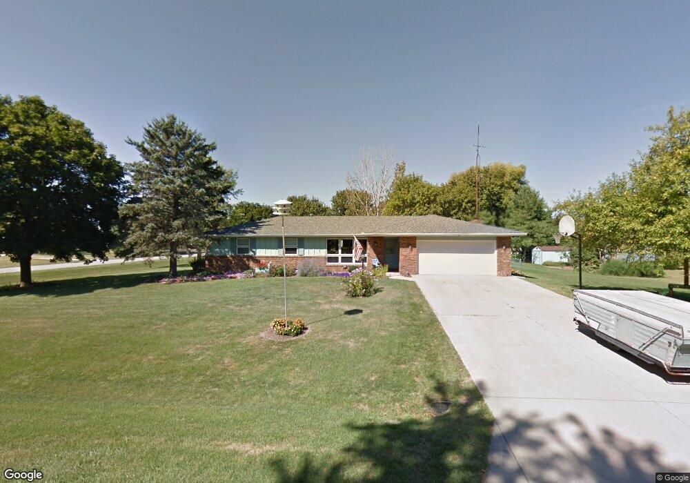
102 Miriam Way Towanda, IL 61776
Estimated Value: $247,844 - $313,000
Studio
2
Baths
1,592
Sq Ft
$184/Sq Ft
Est. Value
About This Home
This home is located at 102 Miriam Way, Towanda, IL 61776 and is currently estimated at $293,211, approximately $184 per square foot. 102 Miriam Way is a home located in McLean County with nearby schools including Towanda Elementary School, Evans Junior High School, and Normal Community High School.
Ownership History
Date
Name
Owned For
Owner Type
Purchase Details
Closed on
Jul 19, 2022
Sold by
Lang Michael R and Lang Beverly A
Bought by
Michael R Lang And Beverly A Lang Revocable L and Lang
Current Estimated Value
Purchase Details
Closed on
Apr 9, 2009
Sold by
Lang Michael R
Bought by
Lang Michael R and Lang Beverly A
Create a Home Valuation Report for This Property
The Home Valuation Report is an in-depth analysis detailing your home's value as well as a comparison with similar homes in the area
Purchase History
| Date | Buyer | Sale Price | Title Company |
|---|---|---|---|
| Michael R Lang And Beverly A Lang Revocable L | -- | Galloway Brian L | |
| Lang Michael R | -- | None Available |
Source: Public Records
Tax History
| Year | Tax Paid | Tax Assessment Tax Assessment Total Assessment is a certain percentage of the fair market value that is determined by local assessors to be the total taxable value of land and additions on the property. | Land | Improvement |
|---|---|---|---|---|
| 2024 | $4,246 | $72,836 | $16,612 | $56,224 |
| 2022 | $4,246 | $58,536 | $13,351 | $45,185 |
| 2021 | $3,971 | $54,321 | $12,390 | $41,931 |
| 2020 | $3,925 | $53,629 | $12,232 | $41,397 |
| 2019 | $3,839 | $54,435 | $12,416 | $42,019 |
| 2018 | $4,360 | $54,435 | $12,416 | $42,019 |
| 2017 | $4,165 | $54,435 | $12,416 | $42,019 |
| 2016 | $4,152 | $54,435 | $12,416 | $42,019 |
| 2015 | $4,079 | $53,546 | $12,213 | $41,333 |
| 2014 | $3,985 | $52,827 | $12,049 | $40,778 |
| 2013 | -- | $51,634 | $11,777 | $39,857 |
Source: Public Records
Map
Nearby Homes
- 1260 Silver Oak Cir
- 1236 Blue Bill Way
- 752 Kristin Dr
- 775 Kristin Dr
- 3618 Cabernet Ct
- Lot 47 Serenity Blvd
- Lot 38 Serenity Blvd
- Lot 48 Serenity Blvd
- Lot 46 Serenity Blvd
- Lot 34 Serenity Blvd
- Lot 42 Serenity Blvd
- Lot 37 Serenity Blvd
- Lot 39 Serenity Blvd
- Lot 45 Serenity Blvd
- Lot 40 Serenity Blvd
- Lot 35 Serenity Blvd
- Lot 36 Serenity Blvd
- 3617 Cabernet Ct
- 3613 Cabernet Ct
- Lot 23 Celebration Dr
- 104 Miriam Way
- 405 Delane Ave
- 103 Miriam Way
- 101 Miriam Way
- 501 Delane Ave
- 106 Miriam Way
- 105 Miriam Way
- 403 Delane Ave
- 139 Fincham Way
- 500 Delane Ave
- 107 Miriam Way
- 503 Delane Ave
- 502 Delane Ave
- 138 Fincham Way
- 108 Miriam Way
- 137 Fincham Way
- 109 Miriam Way
- 400 Delane Ave
- 109 Eugene St
- 113 Miriam Way
Your Personal Tour Guide
Ask me questions while you tour the home.