Estimated Value: $112,000 - $137,000
3
Beds
1
Bath
1,176
Sq Ft
$105/Sq Ft
Est. Value
About This Home
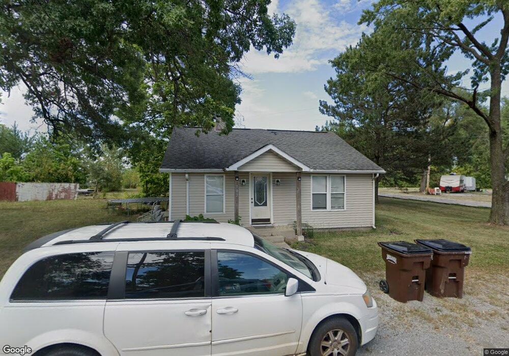
This home is located at 102 N Watt Ave, Lima, OH 45801 and is currently estimated at $123,239, approximately $104 per square foot. 102 N Watt Ave is a home located in Allen County with nearby schools including Bath Elementary School, Bath Middle School, and Bath High School.
Ownership History
Date
Name
Owned For
Owner Type
Purchase Details
Closed on
May 22, 2023
Sold by
Equity Trust Co
Bought by
Heffernan Nathan
Current Estimated Value
Home Financials for this Owner
Home Financials are based on the most recent Mortgage that was taken out on this home.
Original Mortgage
$112,917
Outstanding Balance
$109,584
Interest Rate
6.27%
Mortgage Type
FHA
Estimated Equity
$13,655
Purchase Details
Closed on
Feb 23, 2005
Sold by
Bankers Trust Of California Na
Bought by
Equity Trust Co
Purchase Details
Closed on
Dec 29, 2004
Sold by
Lemaster Jerry W and Lemaster Catherine N
Bought by
Bankers Trust Of California Na
Purchase Details
Closed on
Dec 12, 1997
Sold by
Taylor Alvin
Bought by
Taylor Catherine
Purchase Details
Closed on
Jan 1, 1990
Bought by
Taylor Alvin J
Create a Home Valuation Report for This Property
The Home Valuation Report is an in-depth analysis detailing your home's value as well as a comparison with similar homes in the area
Purchase History
| Date | Buyer | Sale Price | Title Company |
|---|---|---|---|
| Heffernan Nathan | $115,000 | None Listed On Document | |
| Equity Trust Co | $10,000 | Sovereign Title Agency Llc | |
| Bankers Trust Of California Na | $10,000 | None Available | |
| Taylor Catherine | $5,000 | -- | |
| Taylor Alvin J | -- | -- |
Source: Public Records
Mortgage History
| Date | Status | Borrower | Loan Amount |
|---|---|---|---|
| Open | Heffernan Nathan | $112,917 |
Source: Public Records
Tax History
| Year | Tax Paid | Tax Assessment Tax Assessment Total Assessment is a certain percentage of the fair market value that is determined by local assessors to be the total taxable value of land and additions on the property. | Land | Improvement |
|---|---|---|---|---|
| 2024 | $1,935 | $29,020 | $2,770 | $26,250 |
| 2023 | $1,291 | $24,190 | $2,310 | $21,880 |
| 2022 | $1,130 | $24,190 | $2,310 | $21,880 |
| 2021 | $1,136 | $24,190 | $2,310 | $21,880 |
| 2020 | $1,179 | $22,960 | $2,170 | $20,790 |
| 2019 | $1,179 | $22,960 | $2,170 | $20,790 |
| 2018 | $1,155 | $22,960 | $2,170 | $20,790 |
| 2017 | $1,156 | $22,960 | $2,170 | $20,790 |
| 2016 | $1,143 | $22,960 | $2,170 | $20,790 |
| 2015 | $708 | $22,960 | $2,170 | $20,790 |
| 2014 | $708 | $13,720 | $2,170 | $11,550 |
| 2013 | $498 | $9,630 | $2,170 | $7,460 |
Source: Public Records
Map
Nearby Homes
- 105 Watt Ave
- 1705 Karen St
- 128 E Lane Ave
- 400 W Northern Ave
- 207 W Lane Ave
- 1924 Burch Ave
- 1435 N Central Ave
- 1200 N Main St
- 1317 Virginia Ave
- 500 W Robb Ave
- 711 Taylor Ave
- 475 Kenmore St
- 1720 Brookwood Dr
- 520 Kenmore St
- 608 W O'Connor Ave
- 812 Christopher Dr
- 645 W O'Connor Ave
- 2300 Mandolin Dr
- 1021 N McDonel St
- 557 W Ashton Ave