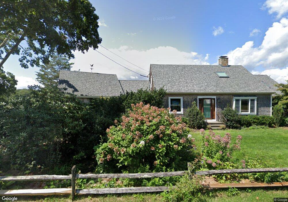
102 Pratt Rd Clinton, CT 06413
Estimated Value: $827,814 - $1,296,000
4
Beds
3
Baths
2,957
Sq Ft
$372/Sq Ft
Est. Value
About This Home
This home is located at 102 Pratt Rd, Clinton, CT 06413 and is currently estimated at $1,100,704, approximately $372 per square foot. 102 Pratt Rd is a home located in Middlesex County with nearby schools including Lewin G. Joel Jr. School and The Morgan School.
Ownership History
Date
Name
Owned For
Owner Type
Purchase Details
Closed on
Jun 15, 1999
Sold by
Ellsworth Lee E
Bought by
Staunton James R and Staunton Catherine A
Current Estimated Value
Create a Home Valuation Report for This Property
The Home Valuation Report is an in-depth analysis detailing your home's value as well as a comparison with similar homes in the area
Home Values in the Area
Average Home Value in this Area
Purchase History
| Date | Buyer | Sale Price | Title Company |
|---|---|---|---|
| Staunton James R | $62,000 | -- | |
| Staunton James R | $62,000 | -- |
Source: Public Records
Mortgage History
| Date | Status | Borrower | Loan Amount |
|---|---|---|---|
| Open | Staunton James R | $250,000 | |
| Closed | Staunton James R | $30,000 | |
| Open | Staunton James R | $405,000 |
Source: Public Records
Tax History
| Year | Tax Paid | Tax Assessment Tax Assessment Total Assessment is a certain percentage of the fair market value that is determined by local assessors to be the total taxable value of land and additions on the property. | Land | Improvement |
|---|---|---|---|---|
| 2025 | $11,149 | $358,013 | $108,013 | $250,000 |
| 2024 | $10,833 | $358,013 | $108,013 | $250,000 |
| 2023 | $10,680 | $358,013 | $108,013 | $250,000 |
| 2022 | $10,471 | $351,013 | $108,013 | $243,000 |
| 2021 | $9,915 | $332,400 | $108,000 | $224,400 |
| 2020 | $10,388 | $332,400 | $108,000 | $224,400 |
| 2019 | $10,388 | $332,400 | $108,000 | $224,400 |
| 2018 | $10,151 | $332,400 | $108,000 | $224,400 |
| 2017 | $9,942 | $332,400 | $108,000 | $224,400 |
| 2016 | $9,021 | $332,400 | $108,000 | $224,400 |
| 2015 | $8,807 | $329,000 | $107,000 | $222,000 |
| 2014 | $8,643 | $329,000 | $107,000 | $222,000 |
Source: Public Records
Map
Nearby Homes
- 178 W Main St
- 4 North St
- 3 Sandgate Cir
- 63GG Dudley Ln
- 133 W Main St Unit MV1
- 133 W Main St Unit TRLR A9
- 4 Currycross Rd Unit 4
- 64 W Main St
- 0 Cow Hill Rd
- 116 Commerce St Unit F-9
- 13 Waterside Ln
- 27 College St Unit 4
- 11 Longview Terrace
- 49 + 51 Uncas Rd
- 151 E Main St Unit 12
- 153 E Main St Unit 10
- 153 E Main St Unit 13
- 153 E Main St Unit 31
- 153 E Main St Unit 8
- 153 E Main St Unit 9