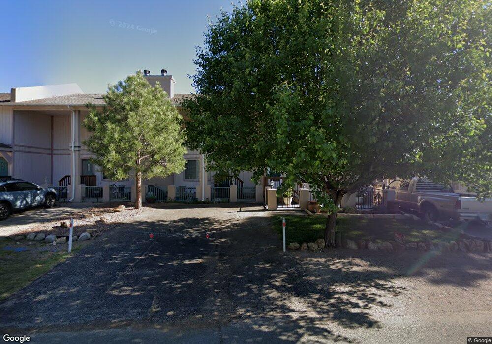
102 Rowan Rd Ruidoso, NM 88345
Estimated Value: $296,357 - $362,000
3
Beds
3
Baths
1,308
Sq Ft
$251/Sq Ft
Est. Value
About This Home
This home is located at 102 Rowan Rd, Ruidoso, NM 88345 and is currently estimated at $328,786, approximately $251 per square foot. 102 Rowan Rd is a home located in Lincoln County with nearby schools including Sierra Vista Primary School, White Mountain Elementary School, and Ruidoso Middle School.
Ownership History
Date
Name
Owned For
Owner Type
Purchase Details
Closed on
Jun 4, 2024
Sold by
Harmon Bobbie
Bought by
Sherlock Timothy Martin and Sherlock Jana Jo
Current Estimated Value
Home Financials for this Owner
Home Financials are based on the most recent Mortgage that was taken out on this home.
Original Mortgage
$199,500
Outstanding Balance
$197,026
Interest Rate
7.17%
Mortgage Type
New Conventional
Estimated Equity
$131,760
Purchase Details
Closed on
Mar 18, 2019
Sold by
Bowden Craig A and Bowden Bonnie Y
Bought by
Harmon Bobbie
Home Financials for this Owner
Home Financials are based on the most recent Mortgage that was taken out on this home.
Original Mortgage
$101,349
Interest Rate
4.4%
Mortgage Type
New Conventional
Create a Home Valuation Report for This Property
The Home Valuation Report is an in-depth analysis detailing your home's value as well as a comparison with similar homes in the area
Home Values in the Area
Average Home Value in this Area
Purchase History
| Date | Buyer | Sale Price | Title Company |
|---|---|---|---|
| Sherlock Timothy Martin | -- | None Listed On Document | |
| Harmon Bobbie | -- | Lincoln Cnty Abstract & Ttl |
Source: Public Records
Mortgage History
| Date | Status | Borrower | Loan Amount |
|---|---|---|---|
| Open | Sherlock Timothy Martin | $199,500 | |
| Previous Owner | Harmon Bobbie | $101,349 |
Source: Public Records
Tax History Compared to Growth
Tax History
| Year | Tax Paid | Tax Assessment Tax Assessment Total Assessment is a certain percentage of the fair market value that is determined by local assessors to be the total taxable value of land and additions on the property. | Land | Improvement |
|---|---|---|---|---|
| 2025 | $1,662 | $88,504 | $567 | $87,937 |
| 2024 | $1,662 | $88,504 | $567 | $87,937 |
| 2023 | $1,662 | $55,082 | $550 | $54,532 |
| 2022 | $1,723 | $53,478 | $534 | $52,944 |
| 2021 | $1,722 | $51,915 | $518 | $51,397 |
| 2020 | $1,657 | $50,403 | $503 | $49,900 |
| 2019 | $1,386 | $44,017 | $493 | $43,524 |
| 2018 | $1,376 | $44,017 | $493 | $43,524 |
| 2017 | $1,401 | $44,017 | $493 | $43,524 |
| 2015 | $1,321 | $42,739 | $479 | $42,260 |
| 2014 | $1,255 | $41,494 | $465 | $41,029 |
Source: Public Records
Map
Nearby Homes
- 103 Niblic Ct
- 116 D Rowan Rd
- 150 North St
- 208 North St Unit 10
- 208 North St Unit 12
- 124 North St
- 111 Bogie Ln Unit 12
- 104 Bogie Ln
- 101 North St
- 113 Bogie Ln Unit 21
- 157 Fern Trail
- 121 Rio St
- 110 Bogie Ln Unit 4A
- 409 Barcus Rd
- 419 Barcus Rd
- 405 Barcus Rd
- 97 Rio St
- 425 Barcus Rd
- 2606 Sudderth Dr
- 120 Lower Terrace Dr Unit 20
- 104 Rowan Rd
- 108 Rowan Rd Unit O
- 108 Rowan Rd
- 106 Rowan Rd Unit O
- 106 Rowan Rd
- 106 A 106 A Rowan Rd
- 106 A 106 A Rowan Rd
- 105 Rowan Rd
- 107 Eagle Dr
- 116 Rowan Rd Unit G
- 116 Rowan Rd
- 116 Rowan Rd
- 116 Rowan Rd Unit 14
- 116 Rowan Rd
- 103 Rowan Rd
- 108 B 108 B Rowan Rd
- 105 Niblic Ct
- 105 Niblic Ct
- 105 Niblic Ct Unit x
- 107 Niblic Ct