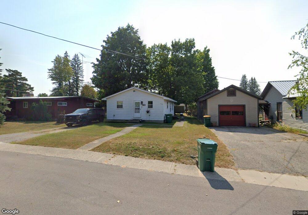
102 S 7th St Roscommon, MI 48653
Estimated Value: $62,459 - $145,000
Studio
--
Bath
912
Sq Ft
$104/Sq Ft
Est. Value
About This Home
This home is located at 102 S 7th St, Roscommon, MI 48653 and is currently estimated at $95,115, approximately $104 per square foot. 102 S 7th St is a home with nearby schools including Roscommon Elementary School, Roscommon Middle School, and Roscommon High School.
Ownership History
Date
Name
Owned For
Owner Type
Purchase Details
Closed on
Oct 21, 2021
Sold by
Dodge Matthew N
Bought by
Milnes Matthew J
Current Estimated Value
Purchase Details
Closed on
Nov 30, 2018
Sold by
Dodge Alexander C
Bought by
Dodge Matthew N
Purchase Details
Closed on
Mar 3, 2006
Sold by
Pittnger Charles K and Pittnger Kathryn A
Bought by
Burniac Margaret R
Home Financials for this Owner
Home Financials are based on the most recent Mortgage that was taken out on this home.
Original Mortgage
$43,200
Interest Rate
6.33%
Mortgage Type
New Conventional
Create a Home Valuation Report for This Property
The Home Valuation Report is an in-depth analysis detailing your home's value as well as a comparison with similar homes in the area
Home Values in the Area
Average Home Value in this Area
Purchase History
| Date | Buyer | Sale Price | Title Company |
|---|---|---|---|
| Milnes Matthew J | $42,500 | None Available | |
| Dodge Matthew N | -- | -- | |
| Burniac Margaret R | $54,000 | None Available |
Source: Public Records
Mortgage History
| Date | Status | Borrower | Loan Amount |
|---|---|---|---|
| Previous Owner | Burniac Margaret R | $43,200 |
Source: Public Records
Tax History
| Year | Tax Paid | Tax Assessment Tax Assessment Total Assessment is a certain percentage of the fair market value that is determined by local assessors to be the total taxable value of land and additions on the property. | Land | Improvement |
|---|---|---|---|---|
| 2025 | $457 | $22,300 | $0 | $0 |
| 2024 | $4 | $23,000 | $0 | $0 |
| 2023 | $424 | $23,000 | $0 | $0 |
| 2022 | $928 | $18,500 | $0 | $0 |
| 2021 | $778 | $17,700 | $0 | $0 |
| 2020 | $1,029 | $18,100 | $0 | $0 |
| 2019 | $834 | $17,800 | $0 | $0 |
| 2018 | $959 | $15,100 | $0 | $0 |
| 2016 | $686 | $15,200 | $0 | $0 |
| 2015 | -- | $14,100 | $0 | $0 |
| 2014 | -- | $14,400 | $0 | $0 |
| 2013 | -- | $15,300 | $0 | $0 |
Source: Public Records
Map
Nearby Homes
- 206 N Main St
- Parcel 13 N M-18
- Parcel 14 N M-18
- 0 N Main St Unit 20251028047
- 211 N 4th St
- 11536 N Central Dr
- 38 S Eugene Dr
- 11491 Pines Trail
- Lot 22 S Stephan Bridge Rd
- 11269 Tanglewood Dr
- 111 Anna Ave
- 0 Pocahontas Trail Unit 6
- Lot 26 & Lot 27 Roberta Dr
- Lots 26-27 W Roberta Dr
- LOT #42 E Roberta Dr
- 2948 E Michigan Hwy
- Lot 10 Fairway Dr
- Lot 9 Fairway Dr
- 10775 Pocahontas Trail
- 1050 W Burdell Rd
Your Personal Tour Guide
Ask me questions while you tour the home.