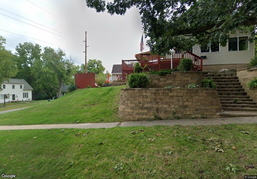
102 S Starr Ave Burlington, IA 52601
Estimated Value: $98,000 - $152,000
2
Beds
2
Baths
1,349
Sq Ft
$90/Sq Ft
Est. Value
About This Home
This home is located at 102 S Starr Ave, Burlington, IA 52601 and is currently estimated at $120,818, approximately $89 per square foot. 102 S Starr Ave is a home located in Des Moines County with nearby schools including Burlington Community High School, Burlington Notre Dame Catholic Elementary School, and Burlington Christian School.
Ownership History
Date
Name
Owned For
Owner Type
Purchase Details
Closed on
Aug 2, 2021
Sold by
Leave Lee Qiekie
Bought by
Lee Carl Oreqoay and Lee Qickie Leone
Current Estimated Value
Purchase Details
Closed on
Oct 24, 2007
Sold by
Cheney Kenneth W and Cheney Patricia
Bought by
Kongable Vickie L
Home Financials for this Owner
Home Financials are based on the most recent Mortgage that was taken out on this home.
Original Mortgage
$50,000
Interest Rate
6.44%
Mortgage Type
New Conventional
Create a Home Valuation Report for This Property
The Home Valuation Report is an in-depth analysis detailing your home's value as well as a comparison with similar homes in the area
Home Values in the Area
Average Home Value in this Area
Purchase History
| Date | Buyer | Sale Price | Title Company |
|---|---|---|---|
| Lee Carl Oreqoay | -- | None Listed On Document | |
| Kongable Vickie L | $50,000 | None Available | |
| Kongble Vickie L | -- | None Available |
Source: Public Records
Mortgage History
| Date | Status | Borrower | Loan Amount |
|---|---|---|---|
| Previous Owner | Kongble Vickie L | $50,000 |
Source: Public Records
Tax History Compared to Growth
Tax History
| Year | Tax Paid | Tax Assessment Tax Assessment Total Assessment is a certain percentage of the fair market value that is determined by local assessors to be the total taxable value of land and additions on the property. | Land | Improvement |
|---|---|---|---|---|
| 2025 | $1,412 | $86,900 | $8,500 | $78,400 |
| 2024 | $1,412 | $82,900 | $8,500 | $74,400 |
| 2023 | $1,326 | $82,900 | $8,500 | $74,400 |
| 2022 | $1,344 | $75,000 | $8,500 | $66,500 |
| 2021 | $1,344 | $75,000 | $8,500 | $66,500 |
| 2020 | $1,436 | $75,000 | $8,500 | $66,500 |
| 2019 | $1,298 | $75,000 | $8,500 | $66,500 |
| 2018 | $1,296 | $64,900 | $9,800 | $55,100 |
| 2017 | $1,296 | $62,800 | $0 | $0 |
| 2016 | $1,182 | $60,600 | $0 | $0 |
| 2015 | $1,182 | $60,600 | $0 | $0 |
| 2014 | $1,196 | $44,800 | $0 | $0 |
Source: Public Records
Map
Nearby Homes
- 1615 Smith St
- 410 S Starr Ave
- 420 S Plane St
- 320 N Plane St
- 218 S Gunnison St
- 418 S Leebrick St
- 415 S Garfield Ave
- 100 S Marshall St
- 310 Curran St
- 526 S Plane St
- 410 S Marshall St
- 513 Hagemann Ave
- 123 Shields St
- 613 N Garfield Ave
- 1308 Plank St
- 1432 Cleveland Ave
- 2204 Williams St
- 2600 Amelia St
- 2503 Clearview Dr
- 1127 Washington St
- 106 S Starr Ave
- 112 S Starr Ave
- 114 S Starr Ave
- 116 S Starr Ave
- 101 S Starr Ave
- 107 S Starr Ave
- 103 S Adams St
- 103 S Adams St
- 107 S Adams St
- 1814 Market St
- 1814 Market St
- 120 S Starr Ave
- 111 S Starr Ave
- 1816 Market St
- 111 S Adams St
- 1902 Market St
- 117 S Starr Ave
- 122 S Starr Ave
- 1806 Market St
- 115 S Adams St