102 S Talbot St Saint Michaels, MD 21663
Estimated Value: $1,446,516
Studio
--
Bath
3,344
Sq Ft
$433/Sq Ft
Est. Value
About This Home
This home is located at 102 S Talbot St, Saint Michaels, MD 21663 and is currently estimated at $1,446,516, approximately $432 per square foot. 102 S Talbot St is a home located in Talbot County with nearby schools including St. Michaels Elementary School, St. Michaels Middle/High School, and Easton High School.
Ownership History
Date
Name
Owned For
Owner Type
Purchase Details
Closed on
Apr 5, 1995
Sold by
Barry Courtney E and Barry Joyce M
Bought by
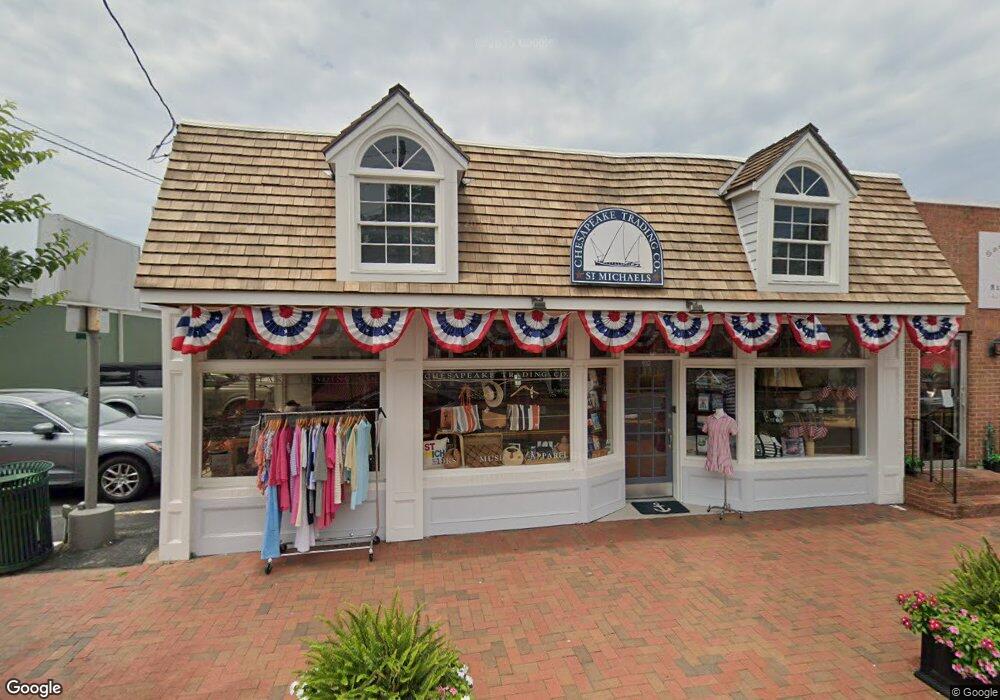
Chesapeake Trading Co Properties
Current Estimated Value
Purchase Details
Closed on
Jan 30, 1984
Sold by
Al Stein Incorporated
Bought by
Barry Courtney E and Barry Joyce M
Home Financials for this Owner
Home Financials are based on the most recent Mortgage that was taken out on this home.
Original Mortgage
$113,000
Interest Rate
13.29%
Purchase Details
Closed on
Dec 30, 1982
Sold by
Hubbard Martin M and Hubbard Ruth E
Bought by
Al Stein Incorporated
Home Financials for this Owner
Home Financials are based on the most recent Mortgage that was taken out on this home.
Original Mortgage
$120,000
Interest Rate
13.6%
Create a Home Valuation Report for This Property
The Home Valuation Report is an in-depth analysis detailing your home's value as well as a comparison with similar homes in the area
Home Values in the Area
Average Home Value in this Area
Purchase History
| Date | Buyer | Sale Price | Title Company |
|---|---|---|---|
| Chesapeake Trading Co Properties | $360,000 | -- | |
| Barry Courtney E | $185,000 | -- | |
| Al Stein Incorporated | $160,000 | -- |
Source: Public Records
Mortgage History
| Date | Status | Borrower | Loan Amount |
|---|---|---|---|
| Previous Owner | Barry Courtney E | $113,000 | |
| Previous Owner | Al Stein Incorporated | $120,000 |
Source: Public Records
Tax History
| Year | Tax Paid | Tax Assessment Tax Assessment Total Assessment is a certain percentage of the fair market value that is determined by local assessors to be the total taxable value of land and additions on the property. | Land | Improvement |
|---|---|---|---|---|
| 2025 | $7,009 | $562,200 | $316,800 | $245,400 |
| 2024 | $6,727 | $544,833 | $0 | $0 |
| 2023 | $6,322 | $527,467 | $0 | $0 |
| 2022 | $5,849 | $510,100 | $316,800 | $193,300 |
| 2021 | $5,794 | $510,100 | $316,800 | $193,300 |
| 2020 | $5,794 | $510,100 | $316,800 | $193,300 |
| 2019 | $5,860 | $515,900 | $316,800 | $199,100 |
| 2018 | $5,724 | $513,333 | $0 | $0 |
| 2017 | $5,515 | $510,767 | $0 | $0 |
| 2016 | $4,891 | $508,200 | $0 | $0 |
| 2015 | $5,397 | $508,200 | $0 | $0 |
| 2014 | $5,397 | $508,200 | $0 | $0 |
Source: Public Records
Map
Nearby Homes
- 205 Cherry St
- 101 Mulberry St
- 111 Gloria Ave
- 113 Gloria Ave
- 117 Chesapeake Ave
- 408 Spinnaker Ln
- 101 Brooks Ln
- 209 Webb Ln
- 107 W Chestnut St
- 106 E Chestnut St
- 222 E Chestnut St
- 114 W Chestnut St
- 216 Brooks Ln
- 114 E Chew Ave
- 216 E Chew Ave
- 228 Perry Cabin Dr Unit 228 / 226
- Lot 16A Meadow St
- 105 Seymour Ave
- 938 Marea Terrace
- 912 Calvert Ave
- 104 Railroad Ave
- 107 S Talbot St Unit FIRST FLOOR
- 107 S Talbot St
- 106 Railroad Ave
- 103 S Talbot St
- 108 Railroad Ave
- 101 S Talbot St
- 205 S Talbot St
- 100 Cherry St
- 101 N Talbot St
- 105 S Talbot St
- 104 N Talbot St
- 114 S Talbot St
- 109 S Talbot St
- 122 Fremont Street Fremont St
- 119 Fremont St
- 106 N Talbot St
- 103 Railroad Ave
- 103 Railroad Ave Unit 1
- 103 Cherry St
Your Personal Tour Guide
Ask me questions while you tour the home.